1980s Maps of Suffolk County, New York
Explore 8 historic maps of Suffolk County from the 1980s. These maps offer a rare glimpse into what life looked like during the 1980s — showing old roads, neighborhoods, homes, and landmarks that have changed or disappeared over time.
Whether you're researching your family's past, planning a metal detecting trip, or studying how Suffolk County's landscape evolved across the 1980s, these high-resolution maps are a powerful tool for exploring the history of this region.
- Focus on a specific era: All maps on this page are from the 1980s, giving you a focused view of this time period.
- See what’s changed: Compare century-old streets, trails, and buildings to today's modern landscape using overlays and satellite layers.
- Research with precision: Use these maps for genealogy, historical research, land use analysis, or educational projects.
- View, download, or print: Maps are fully viewable online in high resolution, and can be downloaded or printed for your own records.
Start exploring Suffolk County's history through authentic maps from the 1980s. This is your window into the past.
Suffolk County, NY maps
(8)- 1983 Map of Niantic
 1983 Niantic1983 Print · USGSCoastal Connecticut in the early eighties shows a landscape of beach colonies and strategic infrastructure. Researchers can trace the development of Niantic and Flanders while locating local landmarks like Stone Church, Jordan Cem, and the New London-Waterford Airport.3 unique versions available
 - 1983 Map of New Haven, 1985 Print
 1983 New Haven1985 Print · USGSThe Connecticut shoreline and eastern Long Island are documented here in the early eighties, from the streets of New Haven to the piers of New London. Genealogists and historians can trace the geography of maritime heritage and academia at Yale University and the U.S. Coast Guard Academy.2 unique versions available
 - 1984 Map of Block Island
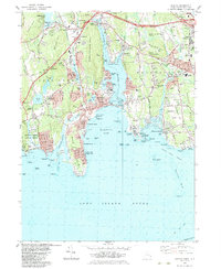
 1984 Block Island1984 Print · USGSThe coastal borderlands of Rhode Island, Connecticut, and New York are captured here in the mid-eighties, from the rail hubs of Westerly to the shores of Block Island. Genealogists and historians can trace the shoreline's evolution through landmarks like the Pequot Indian Res, New Shoreham, and Narragansett Pier.
 - 1984 Map of New London
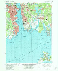 1984 New London1984 Print · USGSThe Thames River waterfront in the mid-1980s reveals a dense network of naval history and maritime industry. Researchers can trace the grounds of the US Coast Guard Academy or locate local landmarks like Cedar Grove Cemetery and the New London Harbor Lighthouse.2 unique versions available
 - 1984 Map of Mystic
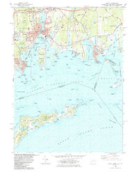 1984 Mystic1984 Print · USGSCoastal Connecticut and the New York borderlands meet in the mid-eighties as maritime traditions and modern development converge. Genealogists and historians can trace family plots at Elm Grove Cemetery or explore the harbor layout near Mystic Seaport and the abandoned lighthouse.2 unique versions available
 - 1984 Map of Long Island East, 1985 Print
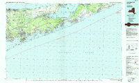 1984 Long Island East1985 Print · USGSEastern Long Island in the 1980s reveals a landscape of suburban growth and coastal preservation. Trace the mid-century development of Hampton Bays alongside Calverton National Cemetery and the Long Island Rail Road.3 unique versions available
 - 1984 Map of Long Island West, 1986 Print
 1984 Long Island West1986 Print · USGSWestern Long Island in the mid-eighties shows a mature suburban landscape defined by its famous expressways and historic rail lines. Researchers can trace the development of planned communities like Levittown or locate landmarks such as Fort Totten Mil Res and Stony Brook.2 unique versions available
 - 1986 Map of Bridgeport
 1986 Bridgeport1986 Print · USGSSpanning the New York and Connecticut border in the mid-eighties, this survey shows the dense rail and parkway network connecting the Hudson to the Sound. Researchers can trace the massive New Croton Reservoir system or locate landmarks like the West Point U.S. Military Academy.3 unique versions available
End of results
Showing maps 1-8 of 8
Top cities of Suffolk County
- Brookhaven historical maps
- Islip historical maps
- Babylon historical maps
- Huntington historical maps
- Smithtown historical maps
- Southampton historical maps
See more
Frequently asked questions
- What are the different types of historical maps available for Suffolk County?
- What is the oldest map of Suffolk County?
- Where can I purchase historical maps of Suffolk County for my home or office?
- Where can I download high-res historical maps of Suffolk County?
- Are there historical topographic maps available for Suffolk County?
- Is there historical aerial imagery available for Suffolk County?
- Where are historical maps of Suffolk County sourced from?