1960s Maps of Suffolk County, New York
Explore 27 historic maps of Suffolk County from the 1960s. These maps offer a rare glimpse into what life looked like during the 1960s — showing old roads, neighborhoods, homes, and landmarks that have changed or disappeared over time.
Whether you're researching your family's past, planning a metal detecting trip, or studying how Suffolk County's landscape evolved across the 1960s, these high-resolution maps are a powerful tool for exploring the history of this region.
- Focus on a specific era: All maps on this page are from the 1960s, giving you a focused view of this time period.
- See what’s changed: Compare century-old streets, trails, and buildings to today's modern landscape using overlays and satellite layers.
- Research with precision: Use these maps for genealogy, historical research, land use analysis, or educational projects.
- View, download, or print: Maps are fully viewable online in high resolution, and can be downloaded or printed for your own records.
Start exploring Suffolk County's history through authentic maps from the 1960s. This is your window into the past.
Suffolk County, NY maps
(27)- 1960 Map of Sherwood Point, 1962 Print
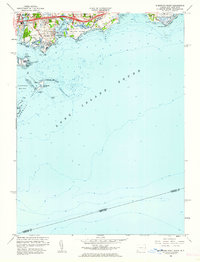 1960 Sherwood Point1962 Print · USGSThe Fairfield County coast at the start of the sixties shows a landscape of tidal inlets and growing shoreline communities. Genealogists and local historians can trace the foundations of Saugatuck, identify plots near St Marys Cem, and explore the layout of Sherwood Island State Park.2 unique versions available
 - 1960 Map of Norwalk South, 1963 Print
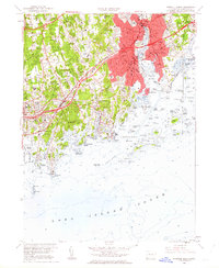 1960 Norwalk South1963 Print · USGSThe Fairfield County coast in the early sixties showcases a period of rapid infrastructure growth alongside its maritime roots. Genealogists and historians can trace local landmarks from Talmadge Hill Chapel to the many family plots like Hoyt Cem and Waterbury Cem.3 unique versions available
 - 1960 Map of New York, 1979 Print
 1960 New York1979 Print · USGSLong Island and the five boroughs are shown at a transformative moment mid-century as suburban expansion reshaped the landscape. Researchers can trace family roots through evolving neighborhoods from Rockville Centre to Sayville, or locate historic maritime landmarks like Eatons Neck and Montauk Point.2 unique versions available
 - 1961 Map of Hartford
 1961 Hartford1961 Print · USGSSouthern New England and the Hudson Valley are shown here in the mid-fifties, capturing a landscape of booming coastal cities and interior hill towns. Researchers can trace the legacy of the New York New Haven and Hartford rail corridor and find strategic sites like Camp Shanks and Fort Michie.
 - 1962 Map of Hartford, 1971 Print
 1962 Hartford1971 Print · USGSSouthern New England and the Hudson Valley are shown in the early sixties, as suburban growth reached into the foothills. Trace the path of the New York New Haven & Hartford RR and find landmarks like Camp Nathan Hale and Gillette Castle State Park.3 unique versions available
 - 1963 Map of Providence
 1963 Providence1963 Print · USGSSouthern New England's coastal and industrial heartland is captured here in the early sixties, from the Rhode Island mainland to the far reaches of the Cape. Researchers can trace mid-century growth in Providence or locate landmarks on Marthas Vineyard and Nantucket Island.
 - 1965 Map of Hartford
 1965 Hartford1965 Print · USGSSouthern New England and the Hudson Valley are shown here during the mid-sixties expansion of the Interstate era. Trace the path of the New York New Haven & Hartford RR or locate historic landmarks like West Point Military Reservation and the Merritt Parkway.2 unique versions available
 - 1967 Map of Lloyd Harbor, 1968 Print
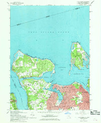 1967 Lloyd Harbor1968 Print · USGSThe North Shore of Long Island is captured in the late sixties, showing the suburban maturation of Huntington and Halesite. Trace family landmarks and community roots at Saint Patricks Cem, Sagamore Hill Nat Hist Site, and Flower Hill Sch.2 unique versions available
 - 1967 Map of Howells Point, 1968 Print
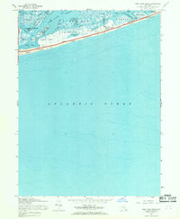
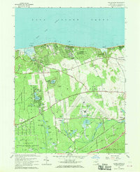
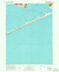 1967 Howells Point1968 Print · USGSThe South Shore of Long Island is captured in the late sixties, showcasing the newly established Fire Island National Seashore. Researchers can trace the development of Bellport and Shirley or locate small beach outposts like Davis Park.3 unique versions available
 - 1967 Map of West Gilgo Beach, 1968 Print
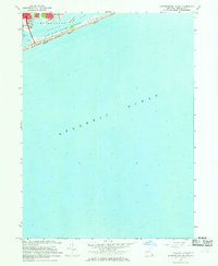
 1967 West Gilgo Beach1968 Print · USGSLong Island's south shore barrier islands are shown in the late sixties as a carefully managed landscape of public parks and wildlife refuges. Researchers can trace the layout of West Gilgo Beach, locate the U S Coast Guard Station, and explore the marshes of the Tobay Beach Bird and Game Sanctuary.
 - 1967 Map of Northport, 1968 Print
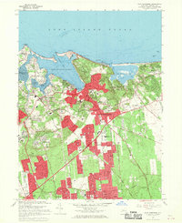
 1967 Northport1968 Print · USGSThe North Shore of Long Island is captured here in the late sixties, showcasing the coastal villages and deep harbors of Suffolk County. Trace family roots and local landmarks through sites like the Vanderbilt Museum, Old Northport Cem, and the Long Island Rail Road corridor.2 unique versions available
 - 1967 Map of Sayville, 1968 Print
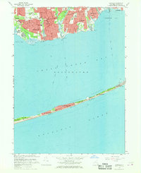 1967 Sayville1968 Print · USGSThe South Shore of Long Island and the barrier beaches of Fire Island are captured here during the late sixties. Genealogists and local historians can trace the streets of Sayville, locate landmarks like the La Salle Military Academy, and explore the early layout of Davis Park and Cherry Grove.2 unique versions available
 - 1967 Map of Bay Shore East, 1969 Print
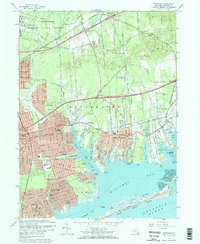
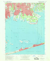 1967 Bay Shore East1969 Print · USGSThe South Shore of Long Island is captured here in the late sixties, showing the suburban expansion of Bay Shore and Islip alongside the preserved reaches of Heckscher State Park. Genealogists and historians can trace local landmarks like Oakwood Cemetery, St Marys Ch, and the iconic Fire Island Lighthouse.2 unique versions available
 - 1967 Map of Port Jefferson, 1969 Print
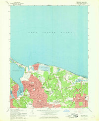
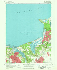
 1967 Port Jefferson1969 Print · USGSPort Jefferson and the surrounding North Shore villages appear here during a period of rapid suburban and institutional growth in the late sixties. Genealogists and local historians can trace family-named sites like the Thompson House or locate the historic St James Cem and Monastery of the Little Portion.
 - 1967 Map of Middle Island, 1969 Print
 1967 Middle Island1969 Print · USGSCoastal Suffolk County is caught in a moment of rapid suburban expansion during the late sixties, as new neighborhoods rise along the Long Island Sound. Researchers can trace the development of Gordon Heights and Middle Island alongside landmarks like Artist Lake and the Middle Island State Game Farm.
 - 1967 Map of Saint James, 1969 Print
 1967 Saint James1969 Print · USGSThe North Shore of Long Island is captured here in the late sixties, showcasing a landscape of established villages and major institutions. Researchers can trace the grounds of Kings Park State Hospital, the Stony Brook Sch, and the winding Nissequogue River.2 unique versions available
 - 1967 Map of Bellport, 1969 Print
 1967 Bellport1969 Print · USGSCoastal Suffolk County is captured here in the late sixties as suburban expansion meets traditional south-shore life. Trace family roots and local landmarks from Squassux Landing to the sprawling Brookhaven National Laboratory.3 unique versions available
 - 1967 Map of Pattersquash Island, 1969 Print
 1967 Pattersquash Island1969 Print · USGSCoastal Suffolk County comes into focus in the late sixties as the barrier beach and mainland settlements reached a new era of connectivity. Trace local landmarks like the Smith Point Bridge and the Tollgate leading to Smith Pt.2 unique versions available
 - 1967 Map of Huntington, 1969 Print
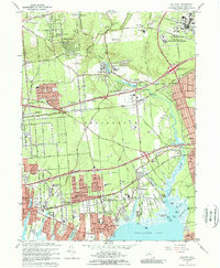
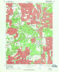
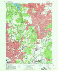 1967 Huntington1969 Print · USGSNorth Shore harbors and suburban expansion define this Long Island landscape in the late sixties. Genealogists and historians can locate the Walt Whitman Birthplace, Old Burial Hill Cem, and the massive Long Island National Cemetery.2 unique versions available
 - 1967 Map of Moriches, 1970 Print
 1967 Moriches1970 Print · USGSCoastal Suffolk County emerges as a suburban and scientific hub during the late sixties, where the sprawling Brookhaven National Laboratory meets the burgeoning South Shore. Trace family roots at the Floyd Cem or locate lost landmarks like the Drive-in Theater and the New York National Speedway.2 unique versions available
 - 1967 Map of Patchogue, 1970 Print
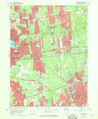 1967 Patchogue1970 Print · USGSMid-century Long Island growth is on full display here as suburban neighborhoods expand around established village centers. Researchers can trace local development through sites like Long Island Mac Arthur Airport, the Cenacle Convent, and the Coram Drive-in Theater.2 unique versions available
 - 1967 Map of Wading River, 1970 Print
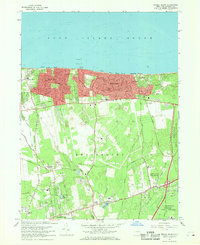
 1967 Wading River1970 Print · USGSThe North Shore of Long Island meets high-tech industry in the late sixties, just as the region began its modern transformation. Genealogists and local historians can trace the Wading River community, explore the Wading River Cemetery, or locate the Orphanage and various early camps along the Sound.
 - 1967 Map of Central Islip, 1970 Print
 1967 Central Islip1970 Print · USGSCentral Islip and Smithtown are captured during a period of rapid suburbanization in the late sixties. Genealogists and historians can trace the sprawling Central Islip State Hospital, the grounds of St Patricks Cem, and the edges of Lake Ronkonkoma.4 unique versions available
 - 1967 Map of Greenlawn, 1971 Print
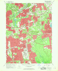
 1967 Greenlawn1971 Print · USGSMid-century Suffolk County is captured here during its height of suburban growth, as residential grids began to fill the gaps between historic hamlets. Genealogists and local historians can trace the development of neighborhood schools like Madonna Heights Sch and landmarks such as the expansive Pilgrim State Hospital and Deer Park Airport.3 unique versions available
 - 1969 Map of New York
 1969 New York1969 Print · USGSLong Island and the New York harbor area are shown here during a peak era of suburban expansion and Cold War defense. Trace the growth of Levittown, the infrastructure of Idlewild NY International Airport, and the reach of the Long Island RR.
Showing maps 1-25 of 27
Top cities of Suffolk County
- Brookhaven historical maps
- Islip historical maps
- Babylon historical maps
- Huntington historical maps
- Smithtown historical maps
- Southampton historical maps
See more
Frequently asked questions
- What are the different types of historical maps available for Suffolk County?
- What is the oldest map of Suffolk County?
- Where can I purchase historical maps of Suffolk County for my home or office?
- Where can I download high-res historical maps of Suffolk County?
- Are there historical topographic maps available for Suffolk County?
- Is there historical aerial imagery available for Suffolk County?
- Where are historical maps of Suffolk County sourced from?