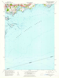
1960 Map of Sherwood Point
USGS Topo · Published 1962About this map
Sherwood Island State Park dominates the coastline of this 1960 survey, illustrating the managed recreation and preservation efforts along the Long Island Sound. The map reveals the intricate shoreline of Westport and Saugatuck, where tidal marshes and inlets like Sherwood Millpond and Compo Cove meet residential development. Notable landmarks such as the Westport-Longshore Club Park and Hale Court provide a look at mid-century community life and land use. The presence of the New York New Haven and Hartford railroad tracks cutting through the settlements of Greens Farms and Saugatuck underscores the enduring importance of this rail corridor to the region's connectivity. Offshore, depth soundings and hazards like Cockenoe Reef and Peck Ledge highlight the navigational complexity of the harbor areas near Goose Island.
Find a feature on this map
47 named features on this map. Tap any name to fly to it.
Don’t see what you’re looking for? This feature index may not catch every label — zoom into the map to look around manually.
Map Details
Editions of this 1960 Sherwood Point Map
2 editions found
Other maps of this area

1891 · Bridgeport
USGS Topo · 1:62,500

1892 · Norwalk
USGS Topo · 1:62,500

1893 · Bridgeport
USGS Topo · 1:62,500

1893 · Norwalk
USGS Topo · 1:62,500

1901 · Northport
USGS Topo · 1:62,500

1902 · Setauket
USGS Topo · 1:62,500

1903 · Northport
USGS Topo · 1:62,500

1904 · Setauket
USGS Topo · 1:62,500

1904 · Islip
USGS Topo · 1:125,000

1919 · Setauket
USGS Topo · 1:62,500