Old Maps of High Falls, New York for Hiking & Exploration
Hike through history with 24 historic maps of High Falls. Explore old trails, ghost towns, and forgotten backroads — perfect for outdoor adventurers and local explorers.
- Rediscover forgotten places: Map out old mining camps, roads, and footpaths that no longer exist on modern maps.
- Layer with modern tools: Combine with LiDAR or satellite views to plan hikes through historical terrain.
- Made for exploration: Popular among hikers, overlanders, and local history lovers.
Use these maps to find adventure and explore the hidden past of High Falls.
High Falls, NY maps
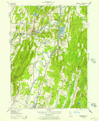
(24)- 1901 Map of Rosendale, 1961 Print
 1901 Rosendale1961 Print · USGSUlster County at the dawn of the century shows a landscape in transition as the Ashokan Reservoir reshaped the valley. Genealogists and historians can trace defunct rail stops and early hamlets from Kripplebush and Whiteport to the busy docks at Wilbur.
 - 1903 Map of Rosendale
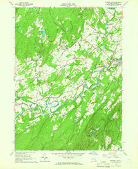
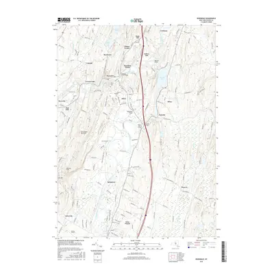
 1903 Rosendale1903 Print · USGSUlster County was a hub of canal and rail transport at the turn of the century, centered on the Delaware and Hudson Canal. Genealogists can trace family footprints through historic settlements like Browns Station, Kripplebush, and Lomontville.11 unique versions available
 - 1942 Map of Rosendale, 1957 Print
 1942 Rosendale1957 Print · USGSUlster County's industrial and agricultural corridors are mapped here during the early 1940s, highlighting the transition between the old canal era and modern development. Genealogists and historians can trace family properties like Bergemanns Farm or find local landmarks such as Century Cement Co and All Saints Church.2 unique versions available
 - 1942 Map of Mohonk Lake, 1959 Print
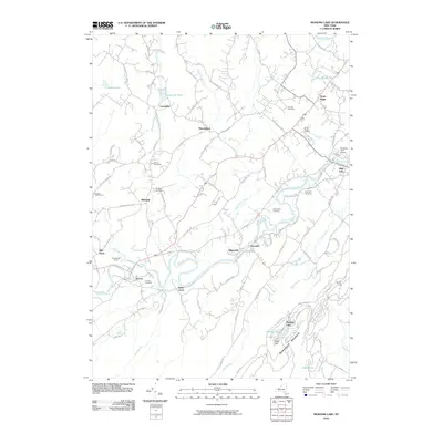
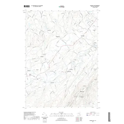
 1942 Mohonk Lake1959 Print · USGSUlster County's river valleys and mountain ridges are captured here during the early 1940s as rail transit still defined local travel. Genealogists can locate family-named landmarks and rural hubs like Kyserike Sta, Stone Ridge, and the Rock Hill Sch.
 - 1943 Map of Rosendale
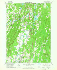
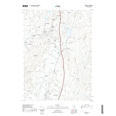
 1943 Rosendale1943 Print · USGSCentral Ulster County is seen here during the mid-forties, capturing the industrial corridor between the Shawangunk Mountains and the Hudson. Researchers can trace the Delaware and Hudson Canal or locate family sites like the Mollenhauer Farm and Century Cement Co.
 - 1943 Map of Mohonk Lake
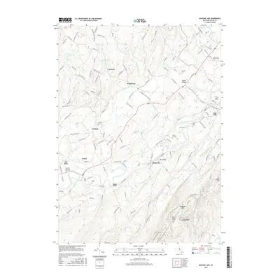
 1943 Mohonk Lake1943 Print · USGSThe Shawangunk Mountains and Rondout Creek valley are captured here in the early 1940s. Trace the New York Ontario and Western rail line and find family sites like P Schmidke or local landmarks like Mohonk House.
 - 1950 Map of Scranton, 1952 Print
 1950 Scranton1952 Print · USGSMid-century Northeast Pennsylvania and the Hudson Valley come alive in this survey of the tri-state region. Genealogists and historians can trace the dense rail networks of the Erie RR and DL&W RR between industrial hubs like Scranton and Wilkes-Barre.
 - 1953 Map of Scranton
 1953 Scranton1953 Print · USGSNortheastern Pennsylvania and the Catskills are shown in great detail during the early fifties, a time when rail lines and river valleys dictated the region's growth. Genealogists and historians can trace the industrial hearts of Scranton and Wilkes-Barre or locate remote landmarks like High Point and Lake Wallenpaupack.
 - 1959 Map of Scranton
 1959 Scranton1959 Print · USGSThe northern coalfields and the Hudson Valley meet in this mid-century survey of the Pennsylvania and New York borderlands. Genealogists and historians can trace the intricate rail networks of the Erie Railroad and the vast waters of Lake Wallenpaupack.2 unique versions available
 - 1962 Map of Scranton, 1977 Print
 1962 Scranton1977 Print · USGSThe industrial heart of eastern Pennsylvania and the New York Catskills are captured here in the early sixties. Genealogists and historians can trace the dense valley settlements from Scranton to Wilkes-Barre and the rail lines of the Erie Lackawanna Railroad.2 unique versions available
 - 1964 Map of Mohonk Lake, 1966 Print
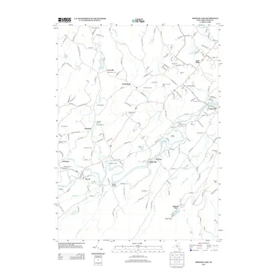
 1964 Mohonk Lake1966 Print · USGSUlster County's Rondout Valley is captured in the mid-1960s, a time when the New York Ontario and Western Railroad and old quarries still defined the local landscape. Genealogists and historians can locate family landmarks such as Marbletown School, Fairview Cemetery, and the St Marys Convent.3 unique versions available
 - 1964 Map of Rosendale, 1966 Print
 1964 Rosendale1966 Print · USGSMid-century Ulster County is captured here at the junction of the Rondout Creek and Wallkill River. Researchers can trace old industrial sites like the Binnewater quarries, find the historic Covered Bridge, or locate family sites at St Peters Cem.3 unique versions available
 - 1965 Map of Scranton
 1965 Scranton1965 Print · USGSThe tri-state highlands of Pennsylvania, New York, and New Jersey come alive in the mid-sixties as industry and recreation converge. Trace the intricate rail lines of the Erie Lackawanna RR or locate landmarks like the U S Military Academy.2 unique versions available
 - 1986 Map of Monticello
 1986 Monticello1986 Print · USGSThe Catskills and Shawangunk Ridge meet in the mid-eighties, showing a landscape defined by massive reservoirs and valley towns. Genealogists and researchers can trace the growth of Monticello, Ellenville, and New Paltz alongside landmarks like Mohonk Preserve and Stewart Airport.2 unique versions available
 - 2010 Map of Rosendale, 2010 Print
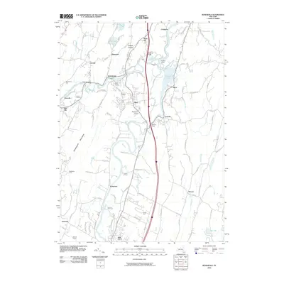 2010 Rosendale2010 Print · USGSCovers High Falls, including New Paltz, Ulster, and other nearby areas
 - 2010 Map of Mohonk Lake, 2010 Print
 2010 Mohonk Lake2010 Print · USGSCovers High Falls, including New Paltz, Rochester, and other nearby areas
 - 2013 Map of Rosendale, 2013 Print
 2013 Rosendale2013 Print · USGSCovers High Falls, including New Paltz, Ulster, and other nearby areas
 - 2013 Map of Mohonk Lake, 2013 Print
 2013 Mohonk Lake2013 Print · USGSCovers High Falls, including New Paltz, Rochester, and other nearby areas
 - 2016 Map of Mohonk Lake, 2016 Print
 2016 Mohonk Lake2016 Print · USGSCovers High Falls, including New Paltz, Rochester, and other nearby areas
 - 2016 Map of Rosendale, 2016 Print
 2016 Rosendale2016 Print · USGSCovers High Falls, including New Paltz, Ulster, and other nearby areas
 - 2019 Map of Mohonk Lake, 2019 Print
 2019 Mohonk Lake2019 Print · USGSCovers High Falls, including New Paltz, Rochester, and other nearby areas
 - 2019 Map of Rosendale, 2019 Print
 2019 Rosendale2019 Print · USGSCovers High Falls, including New Paltz, Ulster, and other nearby areas
 - 2023 Map of Mohonk Lake, 2023 Print
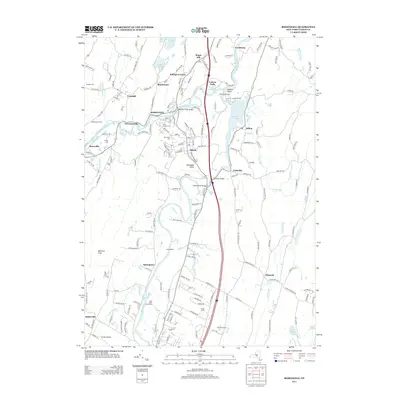
 2023 Mohonk Lake2023 Print · USGSThe Shawangunk Mountains and the Rondout Creek valley are captured here in a period of modern preservation and growth. Researchers can trace historic burial sites like Benton-Bar Cem or explore the landscape around High Falls and the Catskill Aqueduct.
 - 2023 Map of Rosendale, 2023 Print
 2023 Rosendale2023 Print · USGSThe northern Wallkill Valley and its surrounding ridges come into focus in this contemporary survey of central Ulster County. Genealogists and hikers can locate historic burial sites like Coxing Cem or trace the rugged trails leading toward Bonticou Crag.
End of results
Showing maps 1-24 of 24
Top cities near High Falls
- Poughkeepsie historical maps
- Newburgh historical maps
- Poughkeepsie historical maps
- Wappinger historical maps
- Kingston historical maps
- Montgomery historical maps
See more
Top neighborhoods of High Falls
Frequently asked questions
- What are the different types of historical maps available for High Falls?
- What is the oldest map of High Falls?
- Where can I purchase historical maps of High Falls for my home or office?
- Where can I download high-res historical maps of High Falls?
- Are there historical topographic maps available for High Falls?
- Is there historical aerial imagery available for High Falls?
- Where are historical maps of High Falls sourced from?