1990s Maps of Westchester County, New York
Explore 5 historic maps of Westchester County from the 1990s. These maps offer a rare glimpse into what life looked like during the 1990s — showing old roads, neighborhoods, homes, and landmarks that have changed or disappeared over time.
Whether you're researching your family's past, planning a metal detecting trip, or studying how Westchester County's landscape evolved across the 1990s, these high-resolution maps are a powerful tool for exploring the history of this region.
- Focus on a specific era: All maps on this page are from the 1990s, giving you a focused view of this time period.
- See what’s changed: Compare century-old streets, trails, and buildings to today's modern landscape using overlays and satellite layers.
- Research with precision: Use these maps for genealogy, historical research, land use analysis, or educational projects.
- View, download, or print: Maps are fully viewable online in high resolution, and can be downloaded or printed for your own records.
Start exploring Westchester County's history through authentic maps from the 1990s. This is your window into the past.
Westchester County, NY maps
(5)- 1995 Map of Flushing, 1999 Print
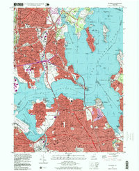 1995 Flushing1999 Print · USGSThe coastal stretches of the Bronx and Queens are captured here in the mid-nineties, showing the dense residential growth and massive bridge infrastructure of the era. Researchers can trace historic institutions and local landmarks like Shea Stadium, Fort Totten Mil Reservation, and St Raymonds Cemetery.
 - 1995 Map of Mount Vernon, 1999 Print
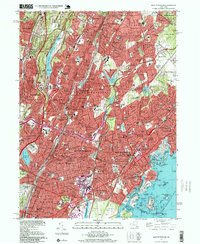 1995 Mount Vernon1999 Print · USGSSouthern Westchester County and the northern Bronx appear here at a moment of late-century suburban maturity. Genealogists and local researchers can locate numerous parish schools and resting places like Mount Hope Cem and the Wartburg Orphanage.
 - 1998 Map of Yonkers, 2000 Print
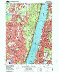 1998 Yonkers2000 Print · USGSThe Hudson River divides the urban landscape of Westchester and the Bronx from the suburban boroughs of Bergen County at the close of the century. Trace historic sites like the Van Cortlandt Mansion House and the grounds of Woodlawn Cemetery.
 - 1998 Map of Peach Lake, 2001 Print
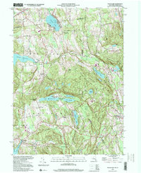 1998 Peach Lake2001 Print · USGSThe New York and Connecticut borderlands appear here in the late 1990s as a landscape of ridges and reservoir-fed valleys. Genealogists can locate family sites near St Johns Ch, North Salem, and the Peach Lake Meetinghouse.
 - 1998 Map of Mount Kisco, 2001 Print
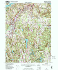 1998 Mount Kisco2001 Print · USGSWestchester County at the close of the twentieth century shows a landscape of established villages and vital reservoirs. Genealogists and local historians can trace residential growth around Mount Kisco or locate family sites near St Matthews Ch and Oakwood Cem.
End of results
Showing maps 1-5 of 5
Top cities of Westchester County
- Yonkers historical maps
- Greenburgh historical maps
- New Rochelle historical maps
- Mount Vernon historical maps
- White Plains historical maps
- Rye historical maps
See more
Frequently asked questions
- What are the different types of historical maps available for Westchester County?
- What is the oldest map of Westchester County?
- Where can I purchase historical maps of Westchester County for my home or office?
- Where can I download high-res historical maps of Westchester County?
- Are there historical topographic maps available for Westchester County?
- Is there historical aerial imagery available for Westchester County?
- Where are historical maps of Westchester County sourced from?