
Historical Maps of Harrington Park
Journey back in time with 42 historical maps of Harrington Park, dating from 1891 to present day. Explore and discover the history of Harrington Park through detailed topographic maps, featuring cities, landmarks, and geographical changes. Dive deeper into each map with our interactive high-resolution viewer and extensive library data. Every map in our collection is also available for purchase as a framed or unframed museum-quality print for those interested interested in bringing a part of history into their home. Begin your historical adventure now!
Harrington Park maps (42)
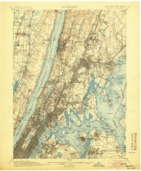
- 1891 Map of Harlem
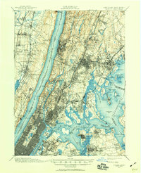
 1891 Harlem1891 Print · USGSCovers portions of Harrington Park, including Bergen County, New York, and others.
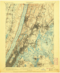
 - 1897 Map of Harlem, 1956 Print
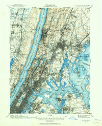
 1897 Harlem1956 Print · USGSCovers portions of Harrington Park, including Westchester County, New Jersey, and others.
 - 1897 Map of Harlem, 1960 Print
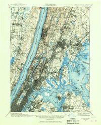
 1897 Harlem1960 Print · USGSCovers portions of Harrington Park, including Westchester County, New Jersey, and others.
 - 1897 Map of Harlem, 1964 Print
 1897 Harlem1964 Print · USGSCovers portions of Harrington Park, including Westchester County, New Jersey, and others.
 - 1897 Map of Harlem, 1967 Print
 1897 Harlem1967 Print · USGSCovers portions of Harrington Park, including Westchester County, New Jersey, and others.
 - 1898 Map of Harlem
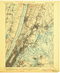
 1898 Harlem1898 Print · USGSCovers portions of Harrington Park, including Westchester County, New Jersey, and others.
 - 1900 Map of Harlem
 1900 Harlem1900 Print · USGSCovers portions of Harrington Park, including Westchester County, New Jersey, and others.
 - 1900 Map of Harlem, 1901 Print
 1900 Harlem1901 Print · USGSCovers portions of Harrington Park, including Westchester County, New Jersey, and others.
 - 1900 Map of Harlem, 1905 Print
 1900 Harlem1905 Print · USGSCovers portions of Harrington Park, including Westchester County, New Jersey, and others.
 - 1900 Map of Harlem, 1907 Print
 1900 Harlem1907 Print · USGSCovers portions of Harrington Park, including Westchester County, New Jersey, and others.
Showing maps 1-10 of 42
Explore maps of related cities
See more
Explore maps of related counties
- Atlantic County, NJ
- Bergen County, NJ
- Burlington County, NJ
- Camden County, NJ
- Cape May County, NJ
- Cumberland County, NJ
See more
Frequently asked questions
Can I purchase a physical print of a historical map of Harrington Park?
Why are historical maps of Harrington Park important for research and professional purposes?
What types of historical maps are available for Harrington Park?
What advanced features do you offer for professional use?
How can I find a specific historical map of Harrington Park?
How can I contribute a historical map of Harrington Park that's not in your collection?
What is the oldest map of Harrington Park in your collection?
How can I download a map of Harrington Park?