
Historical Maps of Ocean County, New Jersey
What stories do these 320 old maps tell about Ocean County's past? From 1884 to present day, these maps reveal the evolution of streets, neighborhoods, iconic landmarks, and natural features in stunning high-res detail. Whether you're a history enthusiast, genealogist, or professional in education, environmental work, or architecture, these maps are perfect for exploration, research, and discovery.
Discover Ocean County's history through maps:
- Trace Ocean County's growth: Explore earlier and latest maps and editions to uncover how the region changed over time.
- Examine technical details: Each map includes its creators, publishers, scale, dimensions, and full source information.
- Layer maps with modern tools & imagery: Compare historical maps to modern-day with high-resolution satellite imagery and detailed LiDAR layers.
- Sourced from trusted archives: Carefully preserved and digitized by institutions like the United Stated Geological Survey and the US Library of Congress.
- Access in any format: View and explore in high resolution, download for offline use, or order a museum-quality print for yourself or a loved one.
Begin your journey into Ocean County's history with these remarkable must-see maps.
Ocean County, NJ maps
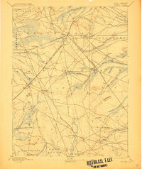
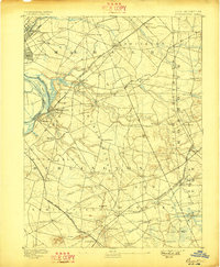
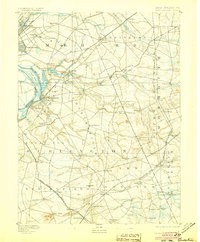
(320)- 1884 Map of Whitings
 1884 Whitings1884 Print · USGSCovers Ocean County, including Toms River, Jackson Township, and other nearby areas
 - 1887 Map of Atlantic City
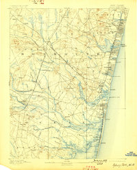
 1887 Atlantic City1887 Print · USGSCovers Ocean County, including Egg Harbor Township, Atlantic City, and other nearby areas
 - 1888 Map of Bordentown
 1888 Bordentown1888 Print · USGSCovers Ocean County, including Hamilton Township, Trenton, and other nearby areas
 - 1888 Map of Pemberton
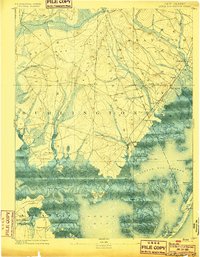
 1888 Pemberton1888 Print · USGSCovers Ocean County, including Southampton Township, Plumsted Township, and other nearby areas
 - 1888 Map of Barnegat
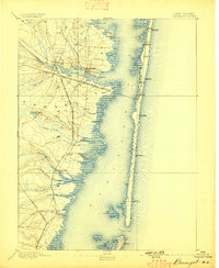
 1888 Barnegat1888 Print · USGSCovers Ocean County, including Toms River, Manchester Township, and other nearby areas
 - 1888 Map of Little Egg Harbor
 1888 Little Egg Harbor1888 Print · USGSCovers Ocean County, including Galloway Township, Stafford Township, and other nearby areas
 - 1888 Map of Asbury Park
 1888 Asbury Park1888 Print · USGSCovers Ocean County, including Toms River, Lakewood Township, and other nearby areas
 - 1888 Map of Cassville
 1888 Cassville1888 Print · USGSCovers Ocean County, including Toms River, Lakewood Township, and other nearby areas
 - 1888 Map of Long Beach
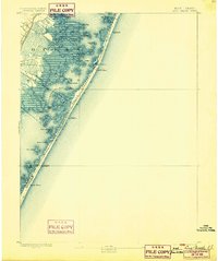
 1888 Long Beach1888 Print · USGSCovers Ocean County, including Stafford Township, Barnegat Township, and other nearby areas
 - 1888 Map of Little Egg Harbor, 1899 Print
 1888 Little Egg Harbor1899 Print · USGSCovers Ocean County, including Galloway Township, Stafford Township, and other nearby areas
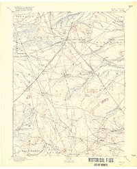
 - 1888 Map of Whitings, 1900 Print
 1888 Whitings1900 Print · USGSCovers Ocean County, including Toms River, Jackson Township, and other nearby areas
 - 1888 Map of Whiting, 1907 Print
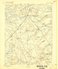
 1888 Whiting1907 Print · USGSCovers Ocean County, including Toms River, Jackson Township, and other nearby areas
 - 1888 Map of Whiting, 1916 Print
 1888 Whiting1916 Print · USGSCovers Ocean County, including Toms River, Jackson Township, and other nearby areas
 - 1888 Map of Whiting, 1916 Print
 1888 Whiting1916 Print · USGSCovers Ocean County, including Toms River, Jackson Township, and other nearby areas
 - 1893 Map of Bordentown
 1893 Bordentown1893 Print · USGSCovers Ocean County, including Hamilton Township, Trenton, and other nearby areas
 - 1893 Map of Little Egg Harbor
 1893 Little Egg Harbor1893 Print · USGSCovers Ocean County, including Galloway Township, Stafford Township, and other nearby areas
 - 1893 Map of Asbury Park
 1893 Asbury Park1893 Print · USGSCovers Ocean County, including Toms River, Lakewood Township, and other nearby areas
 - 1893 Map of Long Beach
 1893 Long Beach1893 Print · USGSCovers Ocean County, including Stafford Township, Barnegat Township, and other nearby areas
 - 1893 Map of Barnegat
 1893 Barnegat1893 Print · USGSCovers Ocean County, including Toms River, Manchester Township, and other nearby areas
 - 1893 Map of Barnegat, 1898 Print
 1893 Barnegat1898 Print · USGSCovers Ocean County, including Toms River, Manchester Township, and other nearby areas
 - 1893 Map of Bordentown, 1898 Print
 1893 Bordentown1898 Print · USGSCovers Ocean County, including Hamilton Township, Trenton, and other nearby areas
 - 1893 Map of Asbury Park, 1898 Print
 1893 Asbury Park1898 Print · USGSCovers Ocean County, including Toms River, Lakewood Township, and other nearby areas
 - 1893 Map of Long Beach, 1899 Print
 1893 Long Beach1899 Print · USGSCovers Ocean County, including Stafford Township, Barnegat Township, and other nearby areas
 - 1893 Map of Little Egg Harbor, 1899 Print
 1893 Little Egg Harbor1899 Print · USGSCovers Ocean County, including Galloway Township, Stafford Township, and other nearby areas
 - 1893 Map of Bordentown, 1905 Print
 1893 Bordentown1905 Print · USGSCovers Ocean County, including Hamilton Township, Trenton, and other nearby areas
Showing maps 1-25 of 320
Top cities in Ocean County
- Toms River historical maps
- Lakewood Township historical maps
- Brick Township historical maps
- Jackson Township historical maps
- Manchester Township historical maps
- Berkeley Township historical maps
See more
Frequently asked questions
- What are the different types of historical maps available for Ocean County?
- What is the oldest map of Ocean County?
- Where can I purchase historical maps of Ocean County for my home or office?
- Where can I download high-res historical maps of Ocean County?
- Are there historical topographic maps available for Ocean County?
- Is there historical aerial imagery available for Ocean County?
- Where are historical maps of Ocean County sourced from?