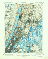
1897 Map of Harlem
USGS Topo · Published 1964About this map
Woodlawn Cemetery and the sprawling expanse of Pelham Bay Park anchor this late 19th-century landscape of upper Manhattan, the Bronx, and lower Westchester County. The topography reveals a region in transition, where the dense grid of the city meets the intricate water systems of the Old Croton Aqueduct and the Jerome Reservoir. Along the Hudson River, the Palisades rise sharply opposite Grants Tomb, while the complex waterways of the East River and Long Island Sound are dotted with landmarks like Fort Schuyler and Steppingstone Light.
Find a feature on this map
162 named features on this map. Tap any name to fly to it.
Don’t see what you’re looking for? This feature index may not catch every label — zoom into the map to look around manually.
Map Details
Editions of this 1897 Harlem Map
4 editions found

Other maps of this area

1888 · Paterson
USGS Topo · 1:62,500

1889 · Brooklyn
USGS Topo · 1:62,500

1891 · Ramapo
USGS Topo · 1:62,500

1891 · Brooklyn
USGS Topo · 1:62,500

1891 · Harlem
USGS Topo · 1:62,500

1892 · Stamford
USGS Topo · 1:62,500

1892 · Paterson
USGS Topo · 1:62,500

1892 · Tarrytown
USGS Topo · 1:62,500

1893 · Stamford
USGS Topo · 1:62,500

1893 · Tarrytown
USGS Topo · 1:62,500