1960s Maps of Alexander County, North Carolina
Explore 6 historic maps of Alexander County from the 1960s. These maps offer a rare glimpse into what life looked like during the 1960s — showing old roads, neighborhoods, homes, and landmarks that have changed or disappeared over time.
Whether you're researching your family's past, planning a metal detecting trip, or studying how Alexander County's landscape evolved across the 1960s, these high-resolution maps are a powerful tool for exploring the history of this region.
- Focus on a specific era: All maps on this page are from the 1960s, giving you a focused view of this time period.
- See what’s changed: Compare century-old streets, trails, and buildings to today's modern landscape using overlays and satellite layers.
- Research with precision: Use these maps for genealogy, historical research, land use analysis, or educational projects.
- View, download, or print: Maps are fully viewable online in high resolution, and can be downloaded or printed for your own records.
Start exploring Alexander County's history through authentic maps from the 1960s. This is your window into the past.
Alexander County, NC maps
(6)- 1960 Map of Charlotte
 1960 Charlotte1960 Print · USGSMid-century North Carolina and South Carolina meet in this 1960 survey of the Piedmont's industrial and textile heartland. Trace the growth of Charlotte alongside historic landmarks like Kings Mountain National Military Park and the Charlotte Naval Ammunition Depot.2 unique versions available
 - 1962 Map of Winston-Salem
 1962 Winston-Salem1962 Print · USGSThe North Carolina Piedmont meets the Virginia highlands in the early sixties, showing the rail corridors and mountain gaps of the southern Appalachians. Researchers can trace the Blue Ridge Parkway or locate family sites near Winston-Salem, Mount Airy, and Hanging Rock Mountain.
 - 1962 Map of Charlotte
 1962 Charlotte1962 Print · USGSThe North Carolina Piedmont in the early sixties showcases a landscape transformed by massive reservoirs and industrial growth. Researchers can trace the development of Lake Norman, locate the Charlotte Naval Ammunition Depot, or find family landmarks like Wesley Chapel and Brown & Norcott Mills.
 - 1966 Map of Gilreath, 1968 Print
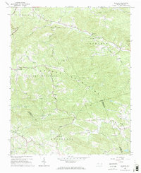 1966 Gilreath1968 Print · USGSThe foothills of the Blue Ridge come alive in this mid-century portrait of Wilkes and Alexander Counties. Genealogists and historians can trace family roots through numerous country landmarks like New Hope Ch, Old Gilreath, and Hunting Creek Cem.2 unique versions available
 - 1966 Map of Boomer, 1968 Print
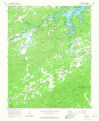 1966 Boomer1968 Print · USGSWilkes County life in the mid-sixties centered on the newly formed W Kerr Scott Reservoir and the surrounding peaks. Researchers can trace family roots at Ferguson and Boomer, or locate landmarks like the Boomer-Ferguson Sch and Zion Hill Ch.
 - 1966 Map of Moravian Falls, 1968 Print
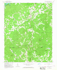 1966 Moravian Falls1968 Print · USGSThe foothills of Wilkes and Alexander counties are captured in the mid-1960s, just as the W Kerr Scott Reservoir was reshaping the local landscape. Genealogists and historians can trace community roots through numerous landmarks like Walnut Grove Ch, Pores Knob Lookout Tower, and the settlement of Boomer.
End of results
Showing maps 1-6 of 6
Top cities of Alexander County
Frequently asked questions
- What are the different types of historical maps available for Alexander County?
- What is the oldest map of Alexander County?
- Where can I purchase historical maps of Alexander County for my home or office?
- Where can I download high-res historical maps of Alexander County?
- Are there historical topographic maps available for Alexander County?
- Is there historical aerial imagery available for Alexander County?
- Where are historical maps of Alexander County sourced from?