Old Maps of Havelock, North Carolina for Metal Detecting
Plan your next treasure hunt with 36 historic maps of Havelock. Find old homesites, ghost towns, trails, and gathering spots that may be lost to time — perfect for identifying promising metal detecting locations.
- Locate forgotten sites: Uncover places like long-lost settlements, abandoned rail lines, or gathering spots.
- Plan better hunts: Use map overlays combined with LiDAR or satellite views to narrow in on historically rich areas.
- Made for detectorists: Thousands of hobbyists use these maps to discover relics, coins, and hidden history.
Use these historic maps to boost your research and find new opportunities beneath the surface of Havelock.
Havelock, NC maps
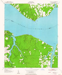
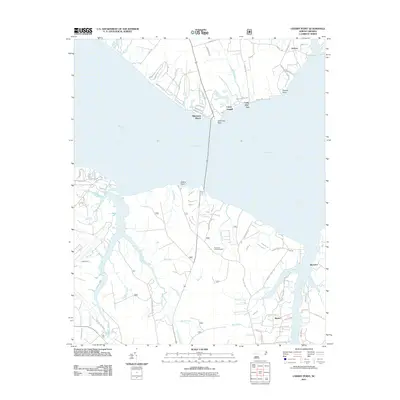
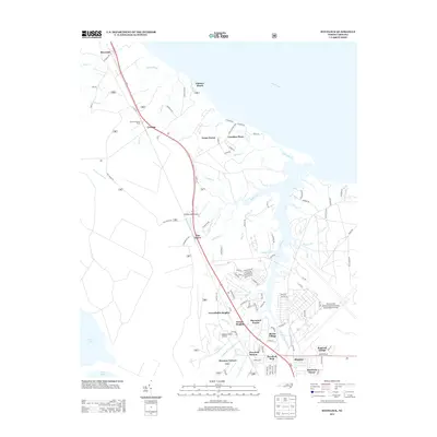
(36)- 1949 Map of Havelock, 1952 Print
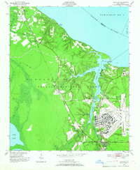 1949 Havelock1952 Print · USGSCoastal North Carolina at the dawn of the fifties shows a landscape of deep pine forests and growing military infrastructure. Researchers can trace the early layout of the Cherry Point Air Station and locate local landmarks like Brice Creek Ch and the Croatan Lookout Tower.4 unique versions available
 - 1949 Map of Newport, 1983 Print
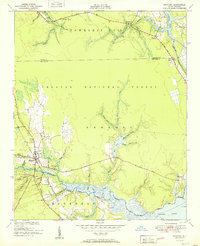
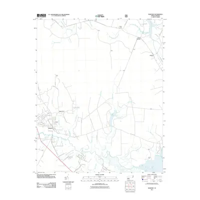
 1949 Newport1983 Print · USGSCoastal Carteret County in the late 1940s is captured here at the edge of the great coastal forests and tidal rivers. Genealogists can trace the environs of Newport, finding specific local landmarks like Hymans Chapel, the Newport Cem, and the Prison Camp.
 - 1949 Map of Cherry Point, 1984 Print
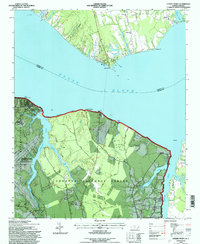
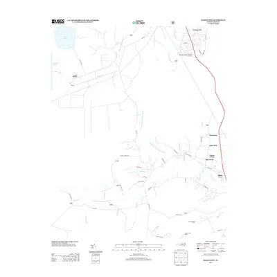
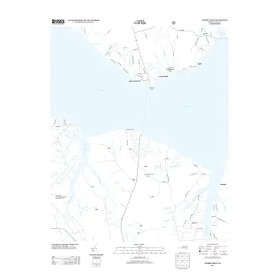
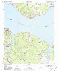 1949 Cherry Point1984 Print · USGSThe Neuse River shoreline just after World War II shows a landscape defined by the arrival of the Cherry Point Marine Base and the depth of the Croatan National Forest. Genealogists and local historians can trace rural landmarks like Weeping Mary Ch, Cahoogue Creek Sch, and the riverside Minnesott Beach.
 - 1949 Map of Masontown, 1984 Print
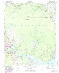
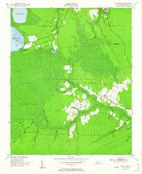
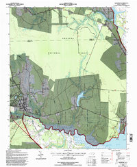
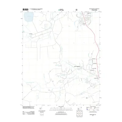
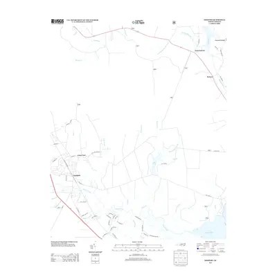
 1949 Masontown1984 Print · USGSCoastal North Carolina's pocosin wilderness and expanding rail-side settlements are captured here in the late 1940s. Genealogists and historians can trace the development of Havelock, Masontown, and Camp Bryan along the Atlantic and East Carolina railroad.
 - 1951 Map of Newport
 1951 Newport1951 Print · USGSCoastal North Carolina during the early fifties reveals a landscape of tidal rivers and timberlands within the Croatan National Forest. Researchers can trace old family sites and local landmarks like Hymans Chapel, the Prison Camp, and the historic rail line at Newport.3 unique versions available
 - 1951 Map of Cherry Point
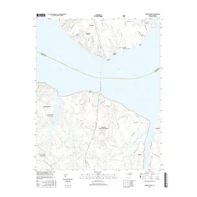
 1951 Cherry Point1951 Print · USGSCoastal Craven County comes alive in the early fifties as military installations and riverfront camps began to define the Neuse River shoreline. Genealogists and historians can trace the footprint of the US Marine Corps Air Station Cherry Point or locate local landmarks like Weeping Mary Ch and Minnesott Beach.2 unique versions available
 - 1951 Map of Masontown
 1951 Masontown1951 Print · USGSCoastal North Carolina during the early 1950s reveals a landscape of managed wetlands and isolated settlements within the Croatan National Forest. Local historians can trace old transit routes like the Nine Foot Road and locate rural communities at Masontown and Holly Springs.3 unique versions available
 - 1953 Map of Beaufort, 1965 Print
 1953 Beaufort1965 Print · USGSThe North Carolina coastline in the mid-fifties reveals an era of massive military expansion alongside traditional maritime life. Genealogists can trace family names and small settlements from Sealevel to Sneads Ferry or locate landmarks like Fort Macon.3 unique versions available
 - 1954 Map of Beaufort
 1954 Beaufort1954 Print · USGSCoastal North Carolina in the mid-fifties reveals a landscape of strategic military installations, sprawling wetlands, and thriving rail towns. Genealogists and historians can trace the foundations of Wilmington, the rural reaches of Duplin County, and shoreline landmarks like Cape Lookout and Carolina Beach.
 - 1972 Map of Beaufort, 1975 Print
 1972 Beaufort1975 Print · USGSThe North Carolina coast in the early seventies shows a landscape defined by massive military bases and coastal sounds. Trace rural family roots at Sarecta and Catherine Lake or explore the barrier islands of the Cape Lookout National Seashore.
 - 1985 Map of Morehead City
 1985 Morehead City1985 Print · USGSCoastal Carteret County in the 1980s reveals a transition from military installations and industrial hubs to protected wilderness along the Outer Banks. Researchers can trace the development of Morehead City and Beaufort or explore the remote stretches of Shackleford Banks and Harkers Island.
 - 1990 Map of Morehead City
 1990 Morehead City1990 Print · USGSCoastal Carteret County at the start of the nineties reveals a landscape balanced between military installations and expansive national seashores. Trace the shoreline from Cherry Point down to the Lighthouse at Cape Lookout and the historic streets of Beaufort.
 - 1994 Map of Masontown, 1997 Print
 1994 Masontown1997 Print · USGSCoastal North Carolina at the end of the twentieth century shows a landscape of deep swamps and managed forests. Genealogists and historians can locate residential pockets like Masontown and Holly Springs or trace the early paths of Nine Foot Road and the Atlantic and East Carolina rail line.2 unique versions available
 - 1994 Map of Newport, 1997 Print
 1994 Newport1997 Print · USGSThe coastal forest and river lowlands of eastern North Carolina are captured here in the mid-1990s. Researchers can trace the East Carolina Railroad through Newport and locate historical landmarks like Hymans Chapel and the Prison Camp near the river.
 - 1994 Map of Havelock, 1997 Print
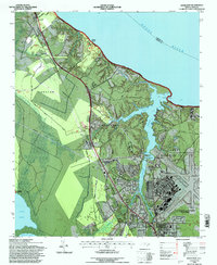 1994 Havelock1997 Print · USGSCoastal North Carolina's military and forest lands meet in the mid-nineties, where the sprawling U.S. Marine Corps Air Station Cherry Point sits alongside the Croatan National Forest. Researchers can trace the Atlantic and East Carolina rail line through Riverdale or locate historic sites like the Brice Creek Ch.
 - 1994 Map of Cherry Point, 1997 Print
 1994 Cherry Point1997 Print · USGSThe Neuse River shoreline in the mid-1990s showcases the sprawling US Marine Corps Air Station Cherry Point and the Croatan National Forest. Researchers can locate riverside landmarks like Minnesott Beach, Camp Seagull, and rural sites like Mt Zion Ch.
 - 2011 Map of Havelock, 2011 Print
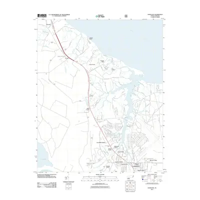 2011 Havelock2011 Print · USGSCovers Havelock, including New Bern, Carolina Pines, and other nearby areas
 - 2011 Map of Cherry Point, 2011 Print
 2011 Cherry Point2011 Print · USGSCovers Havelock, including Minnesott Beach, Arapahoe, and other nearby areas
 - 2011 Map of Masontown, 2011 Print
 2011 Masontown2011 Print · USGSCovers Havelock, including Newport, Bay Woods, and other nearby areas
 - 2011 Map of Newport, 2011 Print
 2011 Newport2011 Print · USGSCovers Havelock, including Newport, Union Point, and other nearby areas
 - 2013 Map of Masontown, 2013 Print
 2013 Masontown2013 Print · USGSCovers Havelock, including Newport, Bay Woods, and other nearby areas
 - 2013 Map of Havelock, 2013 Print
 2013 Havelock2013 Print · USGSCovers Havelock, including New Bern, Carolina Pines, and other nearby areas
 - 2013 Map of Newport, 2013 Print
 2013 Newport2013 Print · USGSCovers Havelock, including Newport, Union Point, and other nearby areas
 - 2013 Map of Cherry Point, 2013 Print
 2013 Cherry Point2013 Print · USGSCovers Havelock, including Minnesott Beach, Arapahoe, and other nearby areas
 - 2016 Map of Cherry Point, 2016 Print
 2016 Cherry Point2016 Print · USGSCovers Havelock, including Minnesott Beach, Arapahoe, and other nearby areas
Showing maps 1-25 of 36
Top cities near Havelock
- New Bern historical maps
- Morehead City historical maps
- James City historical maps
- Newport historical maps
- Trent Woods historical maps
- Emerald Isle historical maps
See more
Top neighborhoods of Havelock
- Slocum Village historical maps
- Wolf Creek historical maps
- College Park historical maps
- Manteo historical maps
- Jerrett Estates historical maps
- Havelock Station historical maps
See more
Frequently asked questions
- What are the different types of historical maps available for Havelock?
- What is the oldest map of Havelock?
- Where can I purchase historical maps of Havelock for my home or office?
- Where can I download high-res historical maps of Havelock?
- Are there historical topographic maps available for Havelock?
- Is there historical aerial imagery available for Havelock?
- Where are historical maps of Havelock sourced from?