1960s Maps of Haywood County, North Carolina
Explore 11 historic maps of Haywood County from the 1960s. These maps offer a rare glimpse into what life looked like during the 1960s — showing old roads, neighborhoods, homes, and landmarks that have changed or disappeared over time.
Whether you're researching your family's past, planning a metal detecting trip, or studying how Haywood County's landscape evolved across the 1960s, these high-resolution maps are a powerful tool for exploring the history of this region.
- Focus on a specific era: All maps on this page are from the 1960s, giving you a focused view of this time period.
- See what’s changed: Compare century-old streets, trails, and buildings to today's modern landscape using overlays and satellite layers.
- Research with precision: Use these maps for genealogy, historical research, land use analysis, or educational projects.
- View, download, or print: Maps are fully viewable online in high resolution, and can be downloaded or printed for your own records.
Start exploring Haywood County's history through authentic maps from the 1960s. This is your window into the past.
Haywood County, NC maps
(11)- 1960 Map of Knoxville
 1960 Knoxville1960 Print · USGSThe Southern Appalachians come alive in the 1950s, showing the intersection of new national park tourism and deep-rooted mountain industry. Trace old rail lines like the Clinchfield RR and find high-altitude landmarks from Mt Le Conte to the Cherokee Indian Reservation.2 unique versions available
 - 1964 Map of Knoxville
 1964 Knoxville1964 Print · USGSThe Southern Appalachians and Great Smokies are captured here during the mid-sixties, showing the rugged borderlands of Tennessee and North Carolina. Researchers can trace historic mountain routes like U S 441, the expanse of Pisgah National Forest, and the growing footprints of Asheville and Knoxville.
 - 1964 Map of Mount Guyot, 1966 Print
 1964 Mount Guyot1966 Print · USGSThe high peaks of the Great Smoky Mountains are captured here in the mid-1960s, tracing the state line from Tennessee into North Carolina. Hikers and historians can follow the Appalachian Trail past legendary landmarks like Charles Bunion, Mount Guyot, and the Lookout Tower near the Pinnacle.2 unique versions available
 - 1964 Map of Bunches Bald, 1967 Print
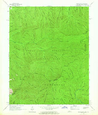
 1964 Bunches Bald1967 Print · USGSSwain and Haywood counties are captured here in the mid-1960s, showing where the national park and tribal lands converge. Genealogists and hikers can trace the Masonic Monument, old peaks like Chiltoskie Mtn, and the winding Blue Ridge Parkway.3 unique versions available
 - 1964 Map of Luftee Knob, 1967 Print
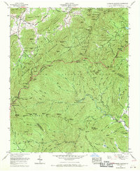
 1964 Luftee Knob1967 Print · USGSThe high ridges of the Great Smoky Mountains are captured in the mid-1960s, showing the intersection of wilderness trails and industrial history. Researchers can trace the Appalachian Trail across Camel Hump Knob or locate industrial remnants like the Old Railroad Grade and Brakeshoe Spring.4 unique versions available
 - 1967 Map of Clyde
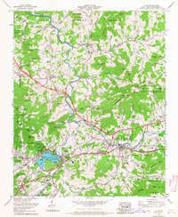 1967 Clyde1967 Print · USGSThe mountain valleys of Haywood County come alive in this late 1960s study, showcasing the development around Lake Junaluska and the PIGEON RIVER. Researchers can trace local genealogy through numerous sites like Ratcliffe Cove Cem and the Crabtree Iron Duff High Sch.3 unique versions available
 - 1967 Map of Fines Creek, 1970 Print
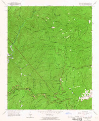
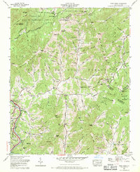 1967 Fines Creek1970 Print · USGSThe mountain coves of Haywood and Madison counties are captured here in the late sixties, showcasing the deeply rooted communities of the Blue Ridge. Researchers can locate numerous family burial sites and country churches, including Belmont Ch Cem, James Chapel, and Fines Cem.3 unique versions available
 - 1967 Map of Sylva North, 1970 Print
 1967 Sylva North1970 Print · USGSJackson County and the Cherokee Indian Reservation are shown during a period of mid-century growth and mountain travel. Genealogists can trace family names at Keener Cem and Sutton Cem or locate community hubs like Addie and Scotts Creek School.3 unique versions available
 - 1967 Map of Dunsmore Mountain, 1970 Print
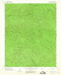
 1967 Dunsmore Mountain1970 Print · USGSThe high ridges of the Pisgah mountains appear in the late 1960s as a complex network of forest experimental grounds and wildlife management areas. Genealogists and hikers can trace the Blue Ridge Parkway past Mt Pisgah Church and the Kelley Cem.3 unique versions available
 - 1967 Map of Canton, 1970 Print
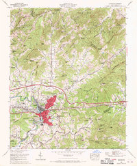 1967 Canton1970 Print · USGSCanton and the surrounding Haywood County highlands are shown here in the late sixties as modern interstate travel began to reshape the valley. Genealogists can trace family names and local landmarks through sites like Henderson Cemetery, Fibreville, and Pisgah High School.4 unique versions available
 - 1967 Map of Cove Creek Gap, 1970 Print
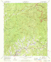
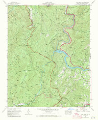 1967 Cove Creek Gap1970 Print · USGSThe high ridges of Haywood County meet at the edge of the Smokies in the late sixties, where old mountain settlements gave way to forest management. Genealogists can trace family heritage at Sutton Cem and Hannah Cem or locate the Abandoned mine near the Pigeon River.4 unique versions available
End of results
Showing maps 1-11 of 11
Top cities of Haywood County
Frequently asked questions
- What are the different types of historical maps available for Haywood County?
- What is the oldest map of Haywood County?
- Where can I purchase historical maps of Haywood County for my home or office?
- Where can I download high-res historical maps of Haywood County?
- Are there historical topographic maps available for Haywood County?
- Is there historical aerial imagery available for Haywood County?
- Where are historical maps of Haywood County sourced from?