Old Maps of Highlands, North Carolina for Hiking & Exploration
Hike through history with 16 historic maps of Highlands. Explore old trails, ghost towns, and forgotten backroads — perfect for outdoor adventurers and local explorers.
- Rediscover forgotten places: Map out old mining camps, roads, and footpaths that no longer exist on modern maps.
- Layer with modern tools: Combine with LiDAR or satellite views to plan hikes through historical terrain.
- Made for exploration: Popular among hikers, overlanders, and local history lovers.
Use these maps to find adventure and explore the hidden past of Highlands.
Highlands, NC maps
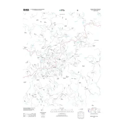
(16)- 1891 Map of Cowee
 1891 Cowee1891 Print · USGSWestern North Carolina's high mountain reaches are captured here in the late nineteenth century as the railroad began to transform the region. Trace early transport routes like the Western North Carolina Railroad and Cowee Tunnel alongside old settlements at Franklin and Quallatown.
 - 1897 Map of Cowee
 1897 Cowee1897 Print · USGSThe Great Smoky Mountains and Blue Ridge foothills appear here in the 1890s, when the railroad first began to penetrate the high gaps. Trace family roots and mountain industry through old settlements like Quallatown, Sylva, and the Cowee Tunnel engineering site.4 unique versions available
 - 1907 Map of Cowee
 1907 Cowee1907 Print · USGSWestern North Carolina at the turn of the century shows a landscape of rail-connected river towns and high mountain gaps. Genealogists can trace early homesteads and industry through landmarks like West Mill, Roanes Mill, and the many settlements along the Southern Railway.5 unique versions available
 - 1935 Map of Highlands
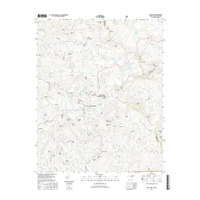
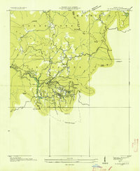 1935 Highlands1935 Print · USGSHighlands was already established as a prominent mountain destination in the mid-1930s, surrounded by the high peaks of the Blue Ridge. Genealogists and historians can trace old landmarks like Calloway Mill, the Highlands Country Club, and early hydroelectric sites like the Municipal Power Dam.
 - 1946 Map of Highlands, 1954 Print
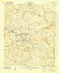
 1946 Highlands1954 Print · USGSHighlands and the surrounding Nantahala heights are captured here just after the war, showing the mountain town alongside its developing reservoirs and backcountry roads. Genealogists and hikers can trace old landmarks like Clear Creek School, Horse Cove Cemetery, and the cascades of Dry Falls.5 unique versions available
 - 1947 Map of Highlands
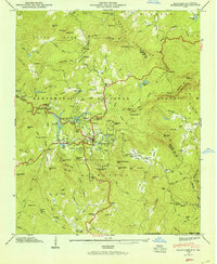
 1947 Highlands1947 Print · USGSThe mountain town of Highlands is shown here just after the war, surrounded by the peaks and waterfalls of the Nantahala National Forest. Genealogists and hikers can trace the paths of the Ellicott Rock Trail and locate sites like Clear Creek Ch or the Horse Cove Cem.2 unique versions available
 - 1955 Map of Knoxville
 1955 Knoxville1955 Print · USGSThe Southern Appalachians and the Smoky Mountains are shown here at a peak of mid-century development and conservation. Genealogists and historians can trace the early road networks connecting Gatlinburg, Waynesville, and the Cherokee Indian Reservation across the high ridges.
 - 1957 Map of Knoxville, 1966 Print
 1957 Knoxville1966 Print · USGSThe Southern Appalachians of Tennessee and North Carolina are mapped here during the mid-twentieth century as new highways reached the high country. Genealogists and historians can trace the topography between Knoxville and Asheville, locating family landmarks near Fontana Lake or along the Blue Ridge Parkway.4 unique versions available
 - 1960 Map of Knoxville
 1960 Knoxville1960 Print · USGSThe Southern Appalachians come alive in the 1950s, showing the intersection of new national park tourism and deep-rooted mountain industry. Trace old rail lines like the Clinchfield RR and find high-altitude landmarks from Mt Le Conte to the Cherokee Indian Reservation.2 unique versions available
 - 1964 Map of Knoxville
 1964 Knoxville1964 Print · USGSThe Southern Appalachians and Great Smokies are captured here during the mid-sixties, showing the rugged borderlands of Tennessee and North Carolina. Researchers can trace historic mountain routes like U S 441, the expanse of Pisgah National Forest, and the growing footprints of Asheville and Knoxville.
 - 1983 Map of Fontana Lake
 1983 Fontana Lake1983 Print · USGSWestern North Carolina's high peaks and reservoir-carved valleys are documented here during the early eighties. Genealogists and local historians can trace the mountain communities of Bryson City and Franklin or explore the boundaries of the Qualla Boundary.2 unique versions available
 - 2011 Map of Highlands, 2011 Print
 2011 Highlands2011 Print · USGSCovers Highlands, including Jackson County, Macon County, and other nearby areas
 - 2013 Map of Highlands, 2013 Print
 2013 Highlands2013 Print · USGSCovers Highlands, including Jackson County, Macon County, and other nearby areas
 - 2016 Map of Highlands, 2016 Print
 2016 Highlands2016 Print · USGSCovers Highlands, including Jackson County, Macon County, and other nearby areas
 - 2019 Map of Highlands, 2019 Print
 2019 Highlands2019 Print · USGSCovers Highlands, including Jackson County, Macon County, and other nearby areas
 - 2022 Map of Highlands, 2022 Print
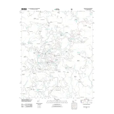
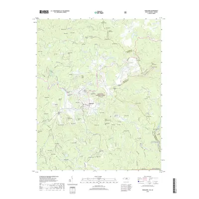
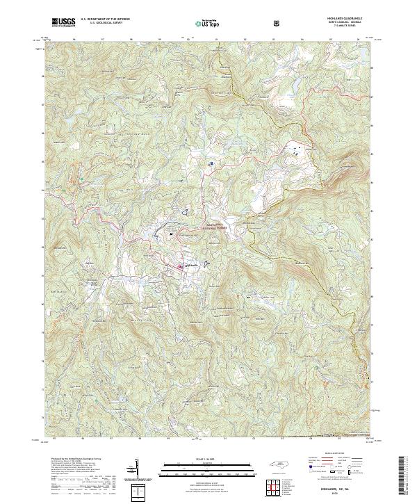 2022 Highlands2022 Print · USGSHighlands sits atop the crest of the Blue Ridge in the early 2020s, where the eastern continental divide meets the Georgia border. Trace local lineages at the Highlands Memorial Park Cem and explore the rugged landscape around Whiteside Mtn and Bridal Veil Falls.
End of results
Showing maps 1-16 of 16
Top cities near Highlands
- Franklin historical maps
- Clayton historical maps
- Mountain City historical maps
- Dillard historical maps
- Sky Valley historical maps
- Cashiers historical maps
See more
Frequently asked questions
- What are the different types of historical maps available for Highlands?
- What is the oldest map of Highlands?
- Where can I purchase historical maps of Highlands for my home or office?
- Where can I download high-res historical maps of Highlands?
- Are there historical topographic maps available for Highlands?
- Is there historical aerial imagery available for Highlands?
- Where are historical maps of Highlands sourced from?