1970s Maps of Moore County, North Carolina
Explore 18 historic maps of Moore County from the 1970s. These maps offer a rare glimpse into what life looked like during the 1970s — showing old roads, neighborhoods, homes, and landmarks that have changed or disappeared over time.
Whether you're researching your family's past, planning a metal detecting trip, or studying how Moore County's landscape evolved across the 1970s, these high-resolution maps are a powerful tool for exploring the history of this region.
- Focus on a specific era: All maps on this page are from the 1970s, giving you a focused view of this time period.
- See what’s changed: Compare century-old streets, trails, and buildings to today's modern landscape using overlays and satellite layers.
- Research with precision: Use these maps for genealogy, historical research, land use analysis, or educational projects.
- View, download, or print: Maps are fully viewable online in high resolution, and can be downloaded or printed for your own records.
Start exploring Moore County's history through authentic maps from the 1970s. This is your window into the past.
Moore County, NC maps
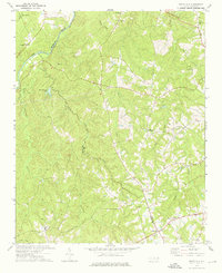
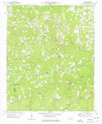
(18)- 1970 Map of Goldston, 1972 Print
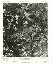
 1970 Goldston1972 Print · USGSChatham and Moore counties meet along the Deep River in the early seventies, where rail lines and river bends shaped local life. Genealogists can trace family footprints at Walters Sch, Mt Herman Ch, and the rural community of Goldston.3 unique versions available
 - 1970 Map of Bear Creek, 1973 Print
 1970 Bear Creek1973 Print · USGSChatham and Moore counties were predominantly rural in the early 1970s, defined by a network of Baptist and Methodist congregations and quiet railway crossings. Researchers can trace the path of the SOUTHERN line through Bear Creek or find the Old Railroad Grade near Harpers Crossroads.2 unique versions available
 - 1973 Map of Seagrove, 1977 Print
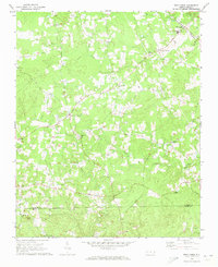
 1973 Seagrove1977 Print · USGSThe rural communities of Randolph and Montgomery counties are captured here in the early 1970s as the local economy transitioned from traditional farming. Genealogists can locate family landmarks such as Center Cross Ch, Fairview Ch, and the crossroads at Whynot.
 - 1974 Map of Carthage, 1976 Print
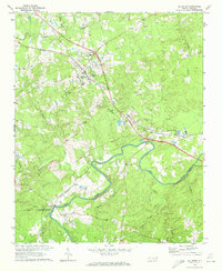
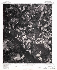
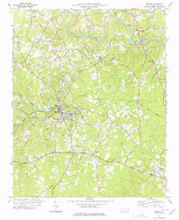
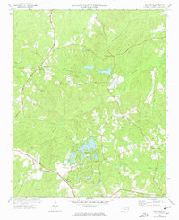
 1974 Carthage1976 Print · USGSCarthage and the surrounding Moore County countryside are shown here in the mid-seventies during a period of residential and recreational growth. Researchers can find numerous rural landmarks, from Goodwin State Forest to historic sites like Doubs Chapel and the Farm Life Sch.2 unique versions available
 - 1974 Map of White Hill, 1976 Print
 1974 White Hill1976 Print · USGSThe rural countryside near the Moore and Lee County line is captured here in the mid-1970s. Genealogists can locate family landmarks like White Hill and several country churches, including Euphronia Ch and Poplar Springs Ch.
 - 1974 Map of Vass, 1976 Print
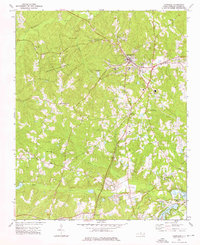
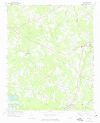 1974 Vass1976 Print · USGSMoore County in the mid-seventies shows a landscape of established rail towns and emerging residential developments near the Lee County line. Genealogists and local historians can trace family-named sites like Henderson Cem, Stones Chapel, and the Seaboard Coast Line through Vass.
 - 1974 Map of Putnam, 1977 Print
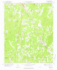
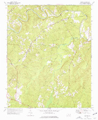 1974 Putnam1977 Print · USGSMoore County in the mid-seventies remained a landscape of quiet rural settlements and winding river valleys. You can trace the path of the Norfolk Southern railroad as it serves Glendon and Putnam, or locate local landmarks like Fair Promise Ch and Prosperity Ch Cem.
 - 1974 Map of Candor, 1977 Print
 1974 Candor1977 Print · USGSThe Norfolk Southern line crosses the Sandhills in the mid-1970s, linking the communities of Candor and Eagle Springs. Genealogists and historians can trace local landmarks like Big Oak Academy, Antioch Ch, and the Candor Cem.2 unique versions available
 - 1976 Map of West End
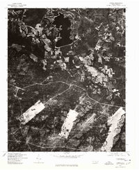
 1976 West End1976 Print · USGSMoore County's sandhills region is seen here in the mid-seventies, showing the intersection of agricultural clearings and dense woodland. Researchers can trace the exact layout of settlements like West End and Jackson Springs or the path of Drowning Creek.
 - 1976 Map of Southern Pines, 1978 Print
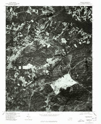
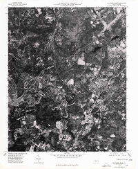 1976 Southern Pines1978 Print · USGSMid-seventies Moore County is revealed through detailed aerial imagery, showing the rapid evolution of the Sandhills region. Trace the development patterns between Southern Pines, Pinehurst, and Aberdeen to see how these communities were beginning to merge.
 - 1976 Map of Pinebluff, 1978 Print
 1976 Pinebluff1978 Print · USGSThe Moore County landscape near Aberdeen is captured in sharp detail in the mid-1970s through this aerial survey. Researchers and local historians can trace the exact footprint of early neighborhoods, road networks, and agricultural boundaries surrounding the town.
 - 1976 Map of Lobelia, 1978 Print
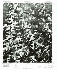
 1976 Lobelia1978 Print · USGSNorth Carolina's rural landscape is captured here in the mid-1970s through detailed aerial imagery of Hoke County. Researchers can trace the layout of the Mt Pleasant settlement and examine the precise field patterns and wooded tracts of the era.
 - 1976 Map of Norman, 1978 Print
 1976 Norman1978 Print · USGSRichmond County in the mid-seventies is documented here through high-resolution aerial imagery rather than traditional line work. You can precisely trace the rural layout of Norman and Plain View or follow the path of Drowning Creek.
 - 1976 Map of Hoffman, 1978 Print
 1976 Hoffman1978 Print · USGSHoffman and the surrounding Richmond County timberlands are captured here in the mid-1970s through high-altitude aerial photography. Trace the path of the Seaboard Coast Line railroad as it passes through Hoffman or locate the dense woodlands flanking Drowning Creek.
 - 1976 Map of Niagara, 1978 Print
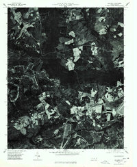
 1976 Niagara1978 Print · USGSMoore County as it appeared in the mid-seventies is captured in this detailed orthophotoquad, showing the rural landscape just as suburban expansion began. Local historians can trace the footprint of early development near Lake Niagara and study the 1976 patterns of forestry and farmland.
 - 1977 Map of Robbins
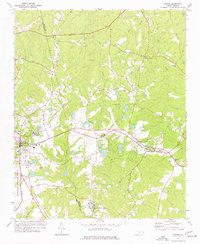
 1977 Robbins1977 Print · USGSMoore County in the late seventies reveals a landscape of rural congregations and small-town industry centered on the town of Robbins. Genealogists can trace family roots through numerous sites like Garners Store, Collins Chapel, and North Moore School.
 - 1977 Map of Spies, 1978 Print
 1977 Spies1978 Print · USGSIn the Piedmont countryside of the late 1970s, this area shows a landscape of family-named landmarks and winding creek branches. Trace local history along the NORFOLK SOUTHERN line through Spies or locate ancestors at Shamburger Cem and Mt Zion Ch.
 - 1977 Map of Zion Grove, 1978 Print
 1977 Zion Grove1978 Print · USGSMoore County in the late 1970s shows a landscape of traditional rail-side settlements and emerging lakefront developments. Trace family roots and local landmarks from Zion Grove and Eagle Springs to the Mt Carmel Ch and the West End Sch.2 unique versions available
End of results
Showing maps 1-18 of 18
Top cities of Moore County
- Pinehurst historical maps
- Southern Pines historical maps
- Aberdeen historical maps
- Seven Lakes historical maps
- Whispering Pines historical maps
- Carthage historical maps
See more
Frequently asked questions
- What are the different types of historical maps available for Moore County?
- What is the oldest map of Moore County?
- Where can I purchase historical maps of Moore County for my home or office?
- Where can I download high-res historical maps of Moore County?
- Are there historical topographic maps available for Moore County?
- Is there historical aerial imagery available for Moore County?
- Where are historical maps of Moore County sourced from?