2020s Maps of Nash County, North Carolina
Explore 19 historic maps of Nash County from the 2020s. These maps offer a rare glimpse into what life looked like during the 2020s — showing old roads, neighborhoods, homes, and landmarks that have changed or disappeared over time.
Whether you're researching your family's past, planning a metal detecting trip, or studying how Nash County's landscape evolved across the 2020s, these high-resolution maps are a powerful tool for exploring the history of this region.
- Focus on a specific era: All maps on this page are from the 2020s, giving you a focused view of this time period.
- See what’s changed: Compare century-old streets, trails, and buildings to today's modern landscape using overlays and satellite layers.
- Research with precision: Use these maps for genealogy, historical research, land use analysis, or educational projects.
- View, download, or print: Maps are fully viewable online in high resolution, and can be downloaded or printed for your own records.
Start exploring Nash County's history through authentic maps from the 2020s. This is your window into the past.
Nash County, NC maps
(19)- 2022 Map of Red Oak, 2022 Print
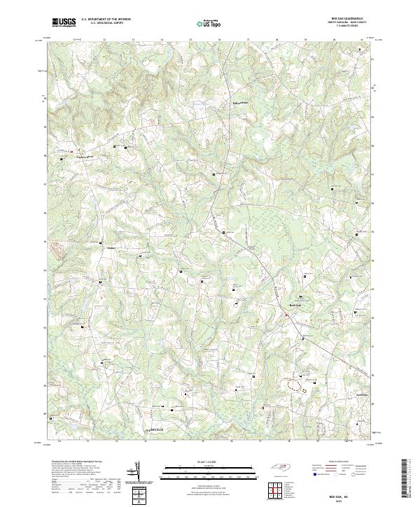 2022 Red Oak2022 Print · USGSNash County at the turn of the 2020s remains a landscape of historic crossroads and family homesteads. Researchers can trace ancestral locations through dozens of family-named sites like Boseman Cem, Arrington Cem, and the community of Taylors Store.
 - 2022 Map of Bailey, 2022 Print
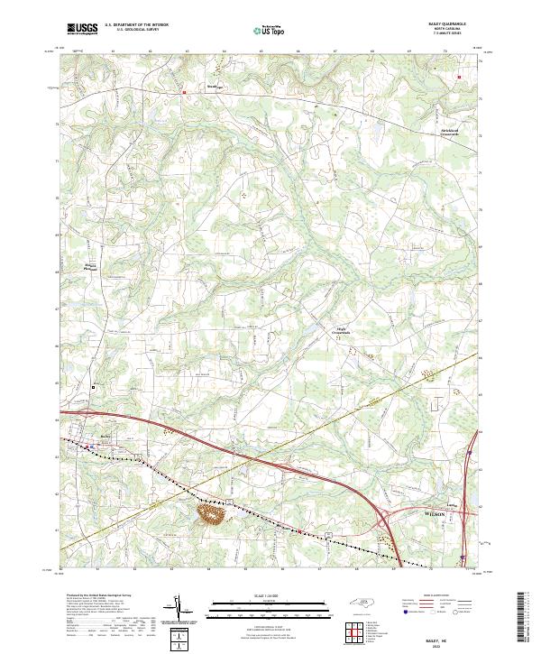 2022 Bailey2022 Print · USGSCoastal plain agriculture and wetlands meet near the Nash-Wilson county line in the early 2020s. Genealogists and historians can trace local landmarks like Bailey Cem, family-named roads, and settlements including Mount Pleasant, High Crossroads, and Lamm.
 - 2022 Map of Middlesex, 2022 Print
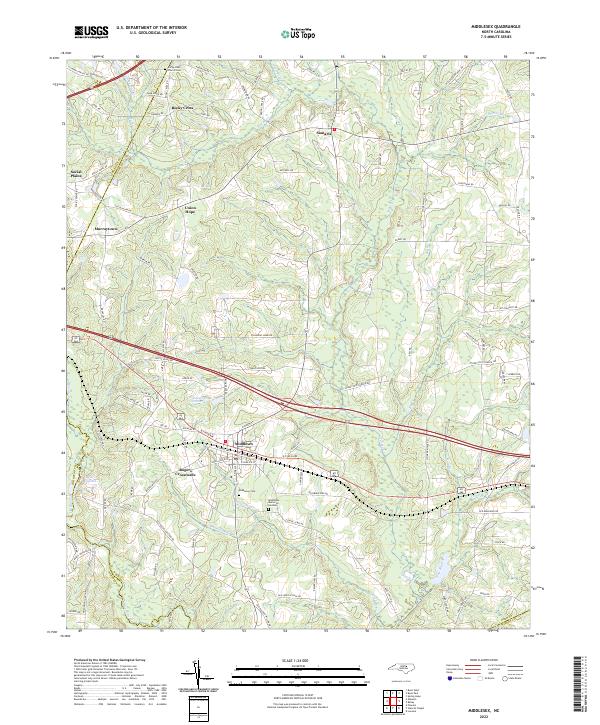 2022 Middlesex2022 Print · USGSMiddlesex and its rural Nash County surroundings are shown here in the early 2020s, highlighting a landscape of dispersed settlements and family-named landmarks. Researchers can trace local history through the Rocky Cross Church Cem, Taylors Millpond, and the community of Rogers Crossroads.
 - 2022 Map of Spring Hope, 2022 Print
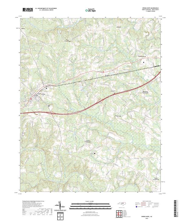 2022 Spring Hope2022 Print · USGSWestern Nash County is shown in detail during the early 2020s, centered on the community of Spring Hope and the surrounding rural plains. Genealogists and historians can trace local family landmarks and burial sites like Oakdale Cem, Meeks Cem, and Batchelor Crossroads.
 - 2022 Map of Elm City, 2022 Print
 2022 Elm City2022 Print · USGSEastern North Carolina crossroads and railroad towns appear here as they were in the early twenty-first century. Genealogists and historians can trace the paths of CSX rail lines and locate rural landmarks like Cedar Grove Cem and Penders Crossroads.
 - 2022 Map of Ringwood, 2022 Print
 2022 Ringwood2022 Print · USGSNorth Carolina's coastal plain interior comes into focus here at the start of the 2020s, where rural traditions meet modern interstate transit. Researchers can trace deep family roots across the Halifax and Nash county line via scattered landmarks like Wiggins Cem, Glenview, and Jack Horse Swamp.
 - 2022 Map of Winstead Crossroads, 2022 Print
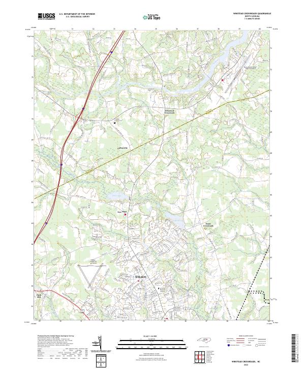 2022 Winstead Crossroads2022 Print · USGSThe northern edge of the coastal plain in the early 2020s shows the expansion of Wilson toward rural crossroads. Researchers can trace family sites at the Crumpler - Stallings Cem or explore the drainage of Toisnot Swamp and Finch Mill.
 - 2022 Map of Drake, 2022 Print
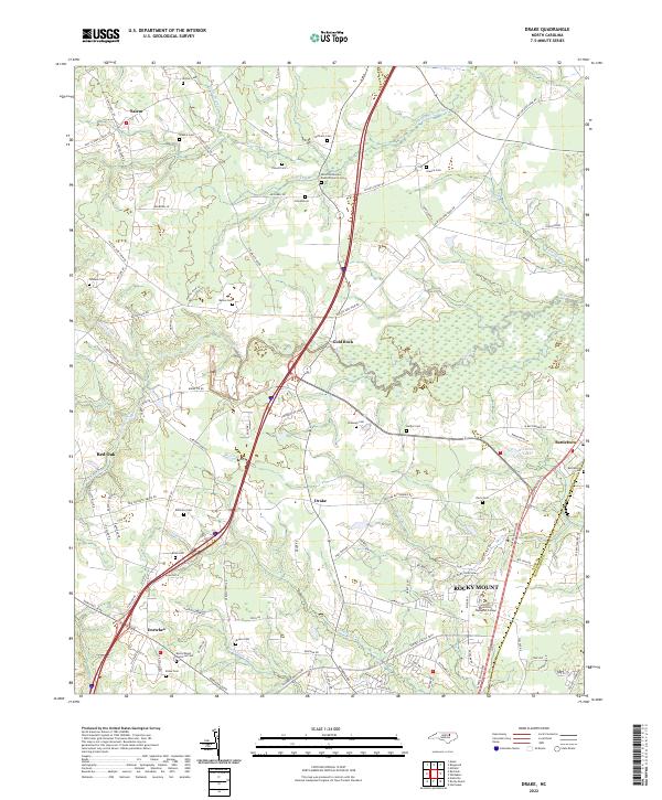 2022 Drake2022 Print · USGSNash County at the start of the 2020s shows a landscape of deep-rooted rural crossroads and modern expansion. Researchers can trace family history through numerous remote burial sites like Shiloh Missionary Baptist Church Cem or explore the watercourses of Swift Creek and Beaverdam Swamp.
 - 2022 Map of Whitakers, 2022 Print
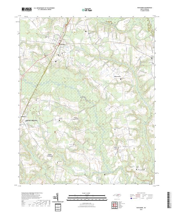 2022 Whitakers2022 Print · USGSThe community of Whitakers and its surrounding crossroads are mapped here in the early twenty-first century. Genealogists can trace family heritage through numerous burial sites like Jerusalem Cem and Carlyle Cem scattered along White Oak Swamp.
 - 2022 Map of Essex, 2022 Print
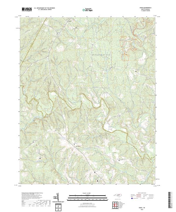 2022 Essex2022 Print · USGSThe borderlands of Halifax and Nash counties come into focus in the 2020s, showing a landscape defined by Fishing Creek and quiet crossroads. Researchers can trace family history through local landmarks like Aventon, Ita, and several family burial sites including Avent Cem.
 - 2022 Map of Nashville, 2022 Print
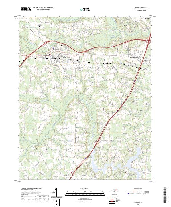 2022 Nashville2022 Print · USGSNashville and the surrounding Nash County countryside are documented in this recent survey during a period of steady growth. Researchers can locate family landmarks like Forest Hill Cem and the Nash County Courthouse or trace the waters of the Tar River Reservoir.
 - 2022 Map of Enfield, 2022 Print
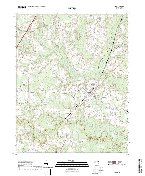 2022 Enfield2022 Print · USGSThe tri-county border area of Halifax, Nash, and Edgecombe comes into focus in this contemporary survey of the Enfield vicinity. Trace local family history through numerous landmarks including Old Bricks Cem, Sherrod Hts, and the vast Burnt Coat Swamp.
 - 2022 Map of Rocky Mount, 2022 Print
 2022 Rocky Mount2022 Print · USGSRocky Mount and its surrounding Nash and Edgecombe county communities are shown in this recent survey during a period of significant regional connectivity. Researchers can trace the layout of contemporary neighborhoods and landmarks like Edgecombe Community College, Pineview Cemetery, and the historic banks of the Tar River.
 - 2022 Map of Stancils Chapel, 2022 Print
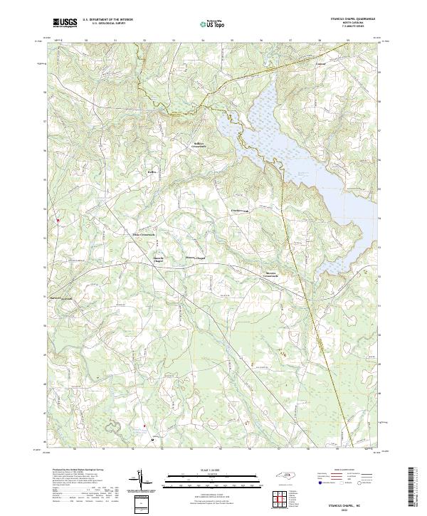 2022 Stancils Chapel2022 Print · USGSThe crossroads of Johnston and Wilson counties come into focus in the 2020s, revealing a landscape of rural chapels and reservoirs. Trace local heritage at Stancils Chapel, Shoeheel Cem, and the waters of Buckhorn Reservoir.
 - 2022 Map of Zebulon, 2022 Print
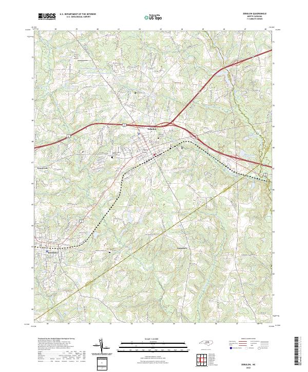 2022 Zebulon2022 Print · USGSWake County and Johnston County borders meet in this 2022 survey of the rapidly changing corridor between the growing towns of Zebulon and Wendell. Researchers can trace old family lines through Wakefield Cemetery, locate the site of Earpsboro, and explore the unique geography of Lizard Lick.
 - 2022 Map of Justice, 2022 Print
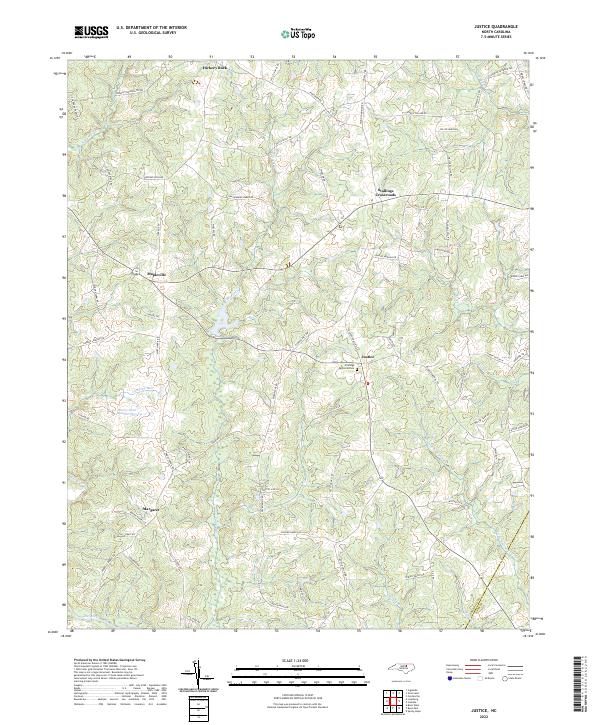 2022 Justice2022 Print · USGSFranklin and Nash Counties at the turn of the decade show a landscape of interconnected family lands and creek-fed bottomlands. Researchers can trace ancestral tracts near Stallings Crossroads, Hickory Rock, and Margaret along the Tar River.
 - 2022 Map of Centerville, 2022 Print
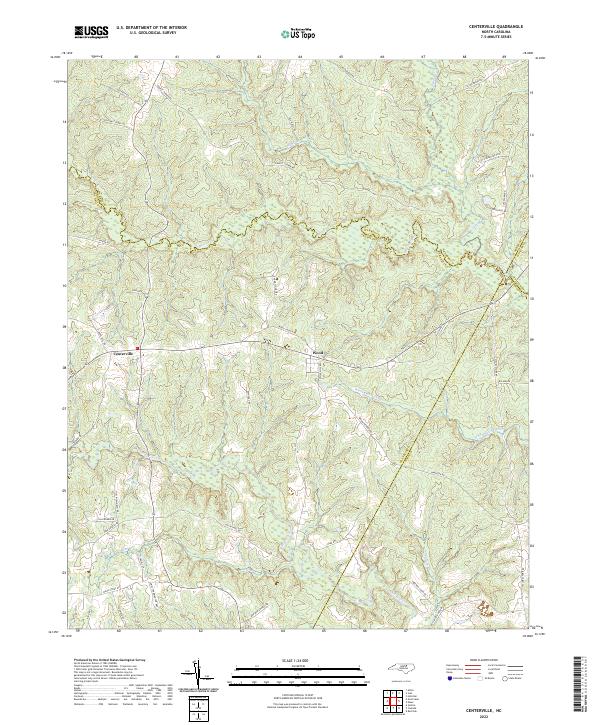 2022 Centerville2022 Print · USGSFranklin County and its surrounding borders are captured here in the early 2020s, showing a rural landscape defined by ancient creek systems and swamps. Researchers can trace family-named roads and landmarks like Freeman Cabin Rd, Pullen Pasture Rd, and the namesake Collins Mill Rd.
 - 2022 Map of Castalia, 2022 Print
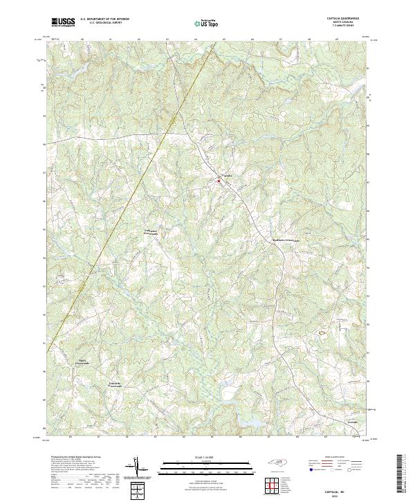 2022 Castalia2022 Print · USGSCastalia and its surrounding crossroads are captured in this recent survey, showcasing the enduring rural settlement patterns of the North Carolina interior. Genealogists and historians can trace the paths between Mays Crossroads, the hamlet of Corinth, and Bodies Millpond.
 - 2023 Map of Bunn East, 2023 Print
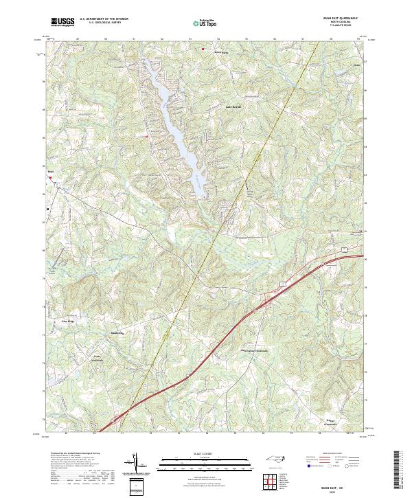 2023 Bunn East2023 Print · USGSFranklin and Nash counties come alive in this recent survey, showcasing the developed shoreline of Lake Royale alongside traditional rural crossroads. Trace local family history and transit patterns through sites like Daddysville, Hunts, and the Spring Hope Memorial Cem.
End of results
Showing maps 1-19 of 19
Top cities of Nash County
- Nashville historical maps
- Red Oak historical maps
- Spring Hope historical maps
- Middlesex historical maps
- Dortches historical maps
- Bailey historical maps
See more
Frequently asked questions
- What are the different types of historical maps available for Nash County?
- What is the oldest map of Nash County?
- Where can I purchase historical maps of Nash County for my home or office?
- Where can I download high-res historical maps of Nash County?
- Are there historical topographic maps available for Nash County?
- Is there historical aerial imagery available for Nash County?
- Where are historical maps of Nash County sourced from?