1960s Maps of Nash County, North Carolina
Explore 9 historic maps of Nash County from the 1960s. These maps offer a rare glimpse into what life looked like during the 1960s — showing old roads, neighborhoods, homes, and landmarks that have changed or disappeared over time.
Whether you're researching your family's past, planning a metal detecting trip, or studying how Nash County's landscape evolved across the 1960s, these high-resolution maps are a powerful tool for exploring the history of this region.
- Focus on a specific era: All maps on this page are from the 1960s, giving you a focused view of this time period.
- See what’s changed: Compare century-old streets, trails, and buildings to today's modern landscape using overlays and satellite layers.
- Research with precision: Use these maps for genealogy, historical research, land use analysis, or educational projects.
- View, download, or print: Maps are fully viewable online in high resolution, and can be downloaded or printed for your own records.
Start exploring Nash County's history through authentic maps from the 1960s. This is your window into the past.
Nash County, NC maps
(9)- 1961 Map of Whitakers, 1964 Print
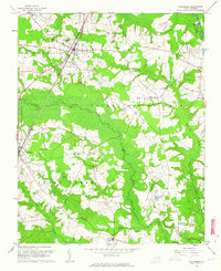 1961 Whitakers1964 Print · USGSCoastal Plain agriculture and rail travel define the Nash-Edgecombe borderlands during the early sixties. Researchers can trace family history through a network of small churches and crossroads like Jerusalem Ch, Speight Chapel, and Taylor Crossroads.2 unique versions available
 - 1961 Map of Enfield, 1964 Print
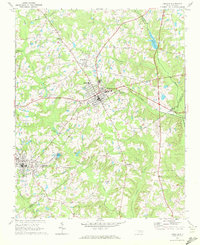
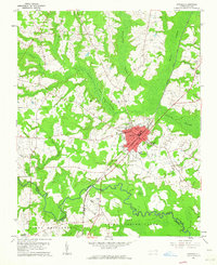 1961 Enfield1964 Print · USGSEnfield was a bustling railroad hub in the early 1960s, centered on the intersection of the Atlantic Coast Line and local routes. Genealogists can trace family names through landmarks like Pittman Cem and Overstreet Cem or locate the Inborden Sch and Bricks settlement.
 - 1962 Map of Greensboro
 1962 Greensboro1962 Print · USGSThe Piedmont region along the Virginia and North Carolina border comes alive in the early 1960s, showing a landscape defined by industry and new reservoirs. Trace the path of the Virginian RR or explore the early development of Greensboro and Durham.
 - 1963 Map of Ringwood, 1964 Print
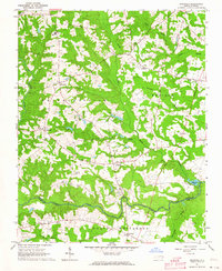 1963 Ringwood1964 Print · USGSHalifax County is captured here in the early sixties, showing a landscape defined by traditional crossroads like Ringwood and Glenview. Researchers can trace old family burial sites and rural institutions, from Knight Cem to the Eastman Sch near the swampy lowlands.
 - 1963 Map of Red Oak, 1964 Print
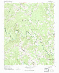
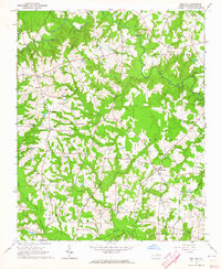 1963 Red Oak1964 Print · USGSNash County rural life is captured here in the early sixties, showing a landscape of family farms and creek-side communities. Researchers can locate dozens of family burial grounds like Taylor Cem and old church sites including Mt Zion Chapel and Philadelphia Ch.
 - 1963 Map of Essex, 1964 Print
 1963 Essex1964 Print · USGSCoastal plain farmland and tangled creek bottoms define this North Carolina borderland in the early sixties. Genealogists can trace family names at Lynch Cem and Silver Cem, or locate rural landmarks like Aventon and the local Brickyards.2 unique versions available
 - 1963 Map of Drake, 1964 Print
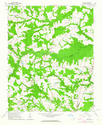 1963 Drake1964 Print · USGSCoastal Plain farmland and swampy creek bottoms define this Nash County area in the early sixties. Genealogists can trace family names at Dozier Cem and Harper Cem or locate community hubs like Dortches, Drake, and North Carolina Wesleyan College.2 unique versions available
 - 1966 Map of Greensboro
 1966 Greensboro1966 Print · USGSThe North Carolina and Virginia Piedmont thrives during the mid-sixties, showcasing a landscape of textile hubs and expanding river reservoirs. Researchers can trace the rail corridors of the Southern Railway, find local landmarks like Elon College, or locate the extensive Camp Butner Military Reservation.
 - 1968 Map of Zebulon, 1972 Print
 1968 Zebulon1972 Print · USGSThe eastern edges of Wake County meet Franklin and Nash in the late sixties, where small-town industry revolves around the rail lines. Local historians can trace family ties at St. Mathews Church or explore the origins of Lizard Lick and Wakefield.3 unique versions available
End of results
Showing maps 1-9 of 9
Top cities of Nash County
- Nashville historical maps
- Red Oak historical maps
- Spring Hope historical maps
- Middlesex historical maps
- Dortches historical maps
- Bailey historical maps
See more
Frequently asked questions
- What are the different types of historical maps available for Nash County?
- What is the oldest map of Nash County?
- Where can I purchase historical maps of Nash County for my home or office?
- Where can I download high-res historical maps of Nash County?
- Are there historical topographic maps available for Nash County?
- Is there historical aerial imagery available for Nash County?
- Where are historical maps of Nash County sourced from?