2020s Maps of Onslow County, North Carolina
Explore 24 historic maps of Onslow County from the 2020s. These maps offer a rare glimpse into what life looked like during the 2020s — showing old roads, neighborhoods, homes, and landmarks that have changed or disappeared over time.
Whether you're researching your family's past, planning a metal detecting trip, or studying how Onslow County's landscape evolved across the 2020s, these high-resolution maps are a powerful tool for exploring the history of this region.
- Focus on a specific era: All maps on this page are from the 2020s, giving you a focused view of this time period.
- See what’s changed: Compare century-old streets, trails, and buildings to today's modern landscape using overlays and satellite layers.
- Research with precision: Use these maps for genealogy, historical research, land use analysis, or educational projects.
- View, download, or print: Maps are fully viewable online in high resolution, and can be downloaded or printed for your own records.
Start exploring Onslow County's history through authentic maps from the 2020s. This is your window into the past.
Onslow County, NC maps
(24)- 2022 Map of Catherine Lake, 2022 Print
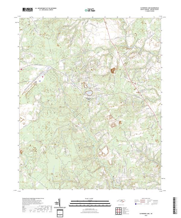 2022 Catherine Lake2022 Print · USGSCoastal plain settlements and drainage networks in Onslow County are documented here in the early twenty-first century. Researchers can trace the development around Catherine Lake and the Albert J Ellis Airport, alongside water features like Southwest Cr and Morgan Bay.
 - 2022 Map of Potters Hill, 2022 Print
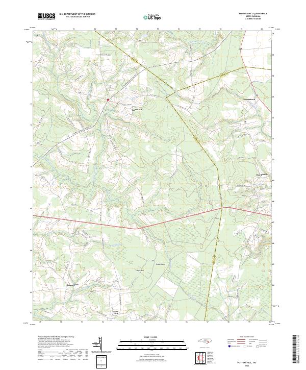 2022 Potters Hill2022 Print · USGSCoastal plain crossroads and sprawling wetlands define this part of Duplin County in the early 2020s. Researchers can locate historic rural centers like Quinns Store and Cedar Fork or trace the winding reaches of Tuckahoe Swamp and the New River.
 - 2022 Map of Richlands, 2022 Print
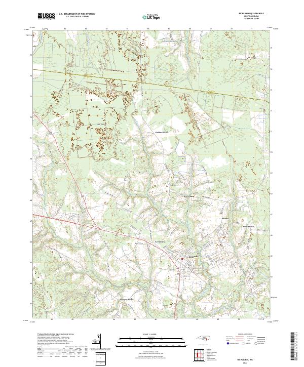 2022 Richlands2022 Print · USGSCoastal North Carolina at the start of the 2020s reveals a patchwork of established towns and rural crossroads nestled between extensive wetlands. Researchers can trace family-named settlements like Huffmantown and Ervintown or explore the drainage of Hell Pocosin.
 - 2022 Map of Maple Hill, 2022 Print
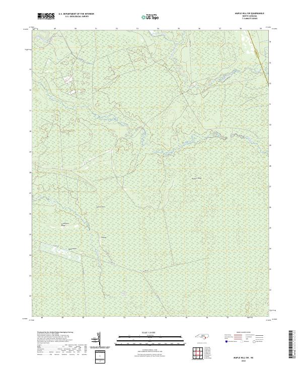
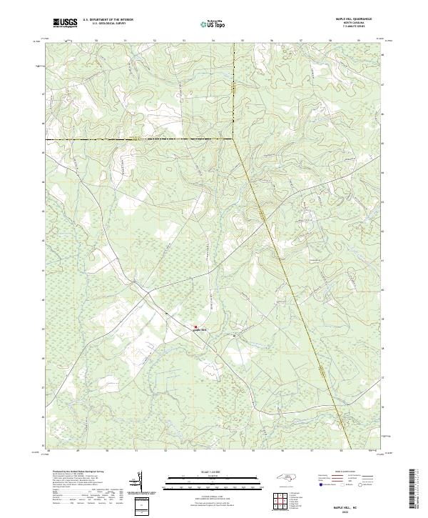 2022 Maple Hill2022 Print · USGSCoastal Pender County and its neighbors come alive in this modern survey of the swamp-fed lowlands. Genealogists can trace family-named routes like Sholar Mill Rd and Gurganus Rd near the sprawling Angola Swamp.
 - 2022 Map of Haws Run, 2022 Print
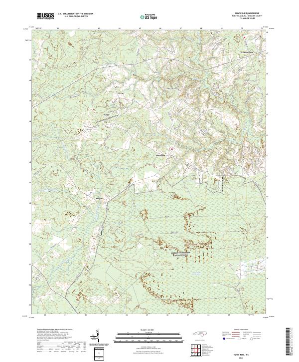 2022 Haws Run2022 Print · USGSCoastal North Carolina's wetland interior is surveyed here during the early 2020s, showing the intersection of rural life and the pocosin environment. Researchers can trace local landmarks from Sky Manor Airport to settlements like Padgett and Waltons Store.
 - 2022 Map of Jacksonville NW, 2022 Print
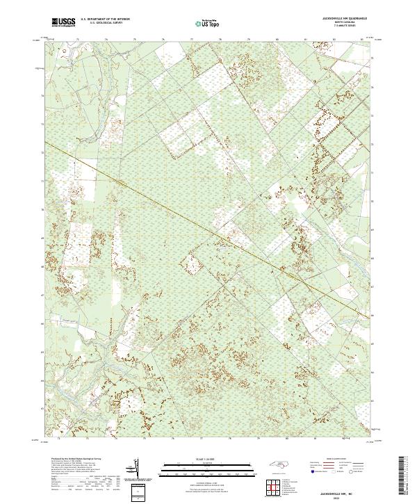 2022 Jacksonville NW2022 Print · USGSCoastal plain wetlands and headwaters define this Onslow County landscape in the early 2020s. Researchers can trace the hydrology of the White Oak Pocosin and follow the remote paths of Hoffman Forest Rd and Quaker Bridge Rd.
 - 2022 Map of Lyman, 2022 Print
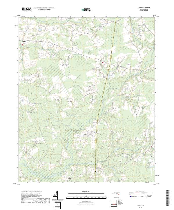 2022 Lyman2022 Print · USGSCoastal North Carolina at the turn of the decade reveals a landscape of rural crossroads and family-named homesteads along the Duplin and Onslow border. Researchers can trace local heritage through landmarks like Lee Baysden Pond, Fountain, and Cedar Fork Church Rd.
 - 2022 Map of Jacksonville NE, 2022 Print
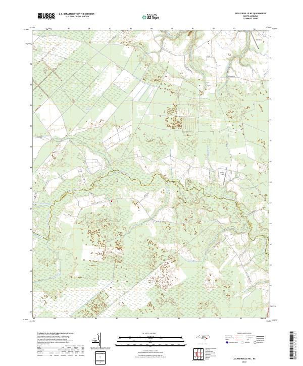 2022 Jacksonville NE2022 Print · USGSJones and Onslow counties appear in the early 2020s, showing a landscape defined by the winding White Oak River and its dense pocosin wetlands. Researchers can trace rural developments at Parker Field and navigate the distinct drainage patterns of Little Hell Cr and Mill Run.
 - 2022 Map of Browns Inlet, 2022 Print
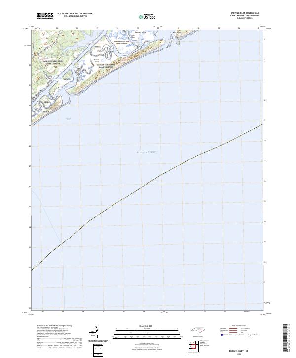 2022 Browns Inlet2022 Print · USGSThe Onslow County coast in the 2020s remains a dynamic environment of barrier islands and restricted military access roads. Researchers can trace the winding Intracoastal Waterway as it passes Browns Island and the tidal reaches of Browns Sound.
 - 2022 Map of Stella, 2022 Print
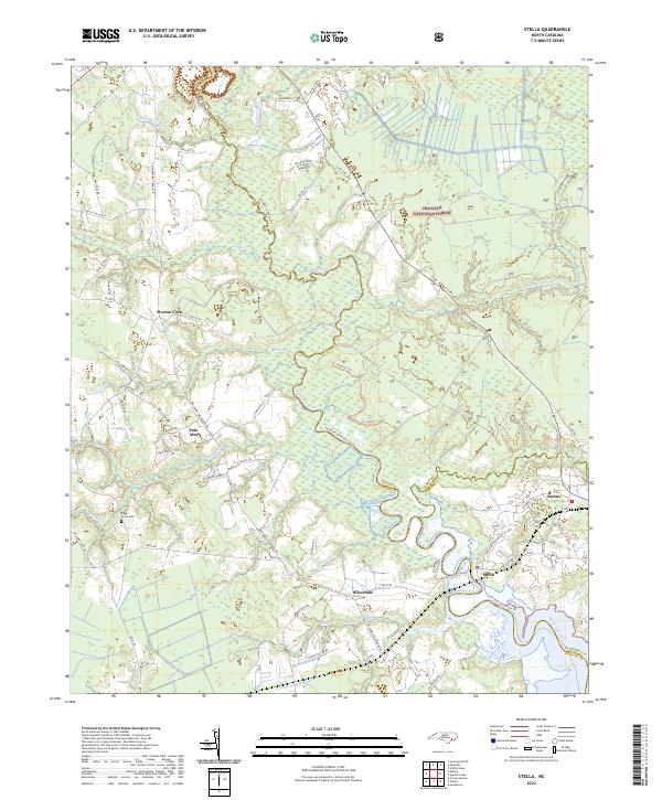 2022 Stella2022 Print · USGSCoastal North Carolina's riverine landscape is showcased here in the early twenty-first century as the White Oak River meanders toward the coast. Genealogists and local historians can locate small settlements like Silverdale and Stella, or trace family sites like the Riggs / Jones Cem.
 - 2022 Map of Hadnot Creek, 2022 Print
 2022 Hadnot Creek2022 Print · USGSCoastal Carteret County meets the vast woods of the Croatan National Forest in this modern survey of the North Carolina tidewater. Researchers can trace rural property access along Hadnot Farm Rd or explore the wilderness boundaries near Great Lake and Lakes Pocosin.
 - 2022 Map of Jacksonville South, 2022 Print
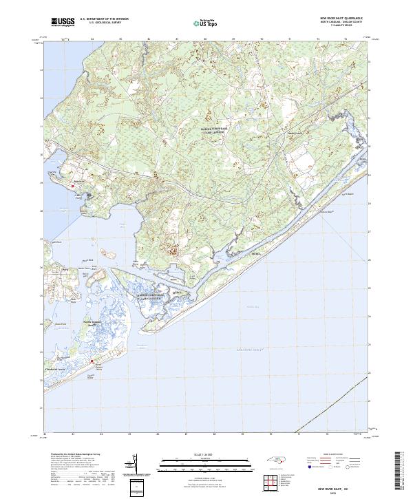
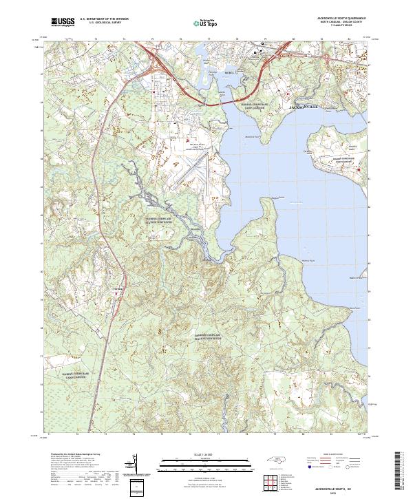 2022 Jacksonville South2022 Print · USGSCoastal North Carolina's military and maritime landscape is documented in this 2022 survey of Onslow County. Researchers can trace the modern layout of Jacksonville, the New River Marine Corps Air Station, and the hallowed grounds of Montford Point National Cemetery.
 - 2022 Map of Spicer Bay, 2022 Print
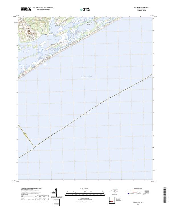 2022 Spicer Bay2022 Print · USGSCoastal Onslow County is seen here in the early 2020s, showing the residential expansion from Holly Ridge to the barrier island shores. Researchers can trace the developed waterfronts of North Topsail Beach and Sea Haven Beach or locate landings like Thomas Landing.
 - 2022 Map of Swansboro, 2022 Print
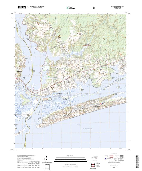 2022 Swansboro2022 Print · USGSThe Onslow and Carteret County coastline comes into sharp focus in the early 2020s, where the White Oak River meets the sound. Trace the development of Cape Carteret and Emerald Isle alongside the massive Croatan National Forest.
 - 2022 Map of Hubert, 2022 Print
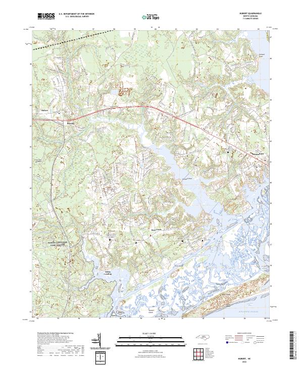 2022 Hubert2022 Print · USGSThe Onslow County coast near Hubert and Swansboro is mapped here in the early twenty-first century, showing the enduring maritime character of the region. Local historians can trace family ties at the Burn Family Cem, Campbell Cem, and the Oak Grove United Methodist Church.
 - 2022 Map of Maple Hill SW, 2022 Print
 2022 Maple Hill SW2022 Print · USGSCoastal North Carolina wetlands define this contemporary landscape at the Pender and Onslow county line. Researchers can trace the drainage of Holly Shelter Swamp and locate named high points like Bryants Ridge and Pine Island.
 - 2022 Map of Sneads Ferry, 2022 Print
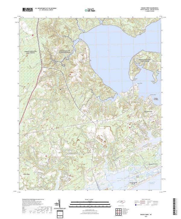 2022 Sneads Ferry2022 Print · USGSCoastal Onslow County is documented here at the start of the 2020s, showing a landscape of tidal inlets and growing shoreline communities. Researchers can trace family sites near McGlammy Cem or explore the maritime geography of Fulcher Landing and Stones Bay.
 - 2022 Map of Camp Lejeune, 2022 Print
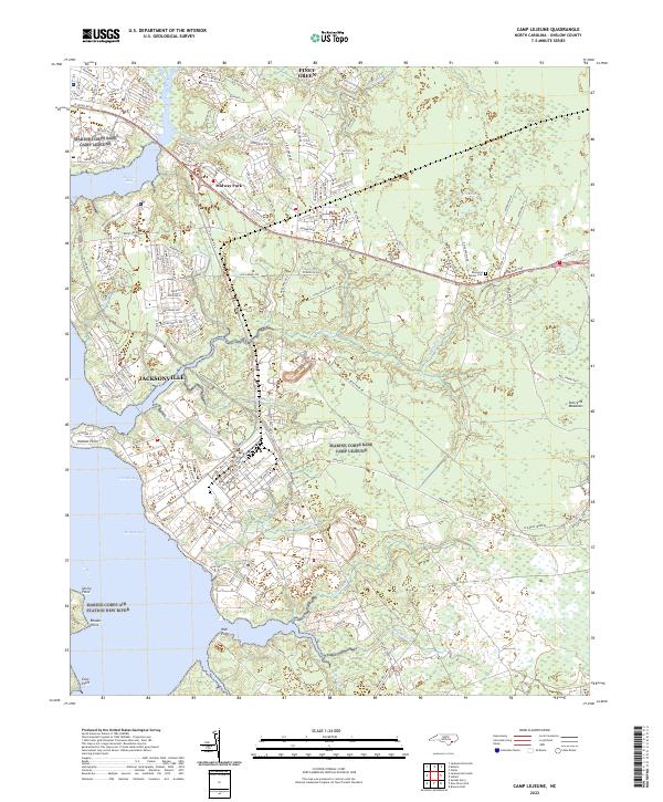 2022 Camp Lejeune2022 Print · USGSThe Onslow County coast during the early twenty-first century reveals a landscape defined by the growth of Jacksonville and Camp Lejeune. Trace family sites and coastal development near the Raymond Kellum Cem, Midway Park, and Piney Green.
 - 2022 Map of Folkstone, 2022 Print
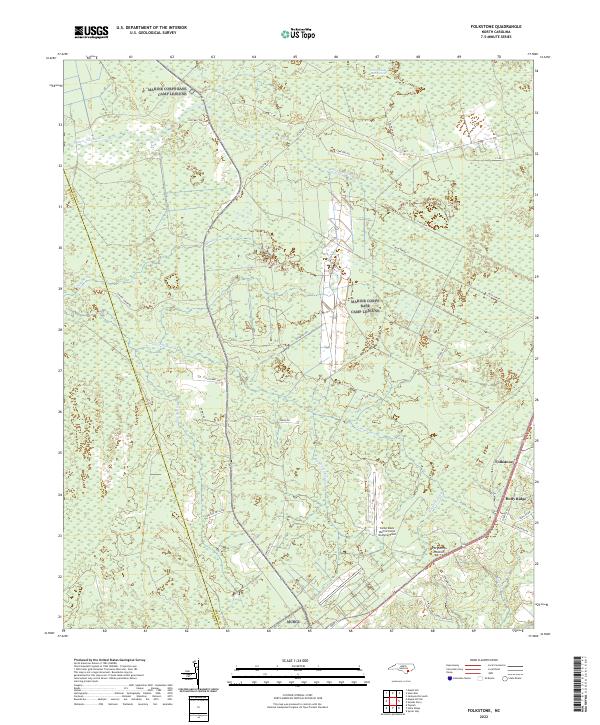 2022 Folkstone2022 Print · USGSEastern Onslow County at the start of the 2020s shows a landscape of expansive wetlands and coastal settlements. Genealogists and researchers can trace the roads around Folkstone and Holly Ridge or locate the Camp Davis Marine Corps Outlying Field.
 - 2022 Map of Holly Ridge, 2022 Print
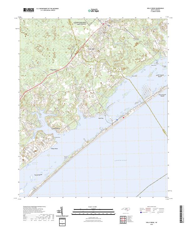 2022 Holly Ridge2022 Print · USGSThe North Carolina coast at Holly Ridge and Surf City comes into focus during this recent era of beach development and maritime travel. Researchers can trace land use from the Intracoastal Waterway to the runways of the Holly Ridge/Topsail Island Airport.
 - 2022 Map of Maysville, 2022 Print
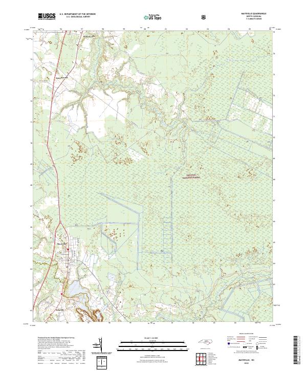 2022 Maysville2022 Print · USGSCoastal North Carolina's river-driven geography is on full display in this modern survey of the Jones County corridor. Researchers can trace the path of the White Oak River past family-linked sites like Donnie's Sawmill and through the streets of Maysville and Pollocksville.
 - 2022 Map of New River Inlet, 2022 Print
 2022 New River Inlet2022 Print · USGSThe Onslow County coast in recent years shows the intricate meeting of river and sea along the Intracoastal Waterway. Genealogists and historians can trace coastal settlements from Marines and Peru to the barrier island reach of North Topsail Beach.
 - 2022 Map of Jacksonville North, 2022 Print
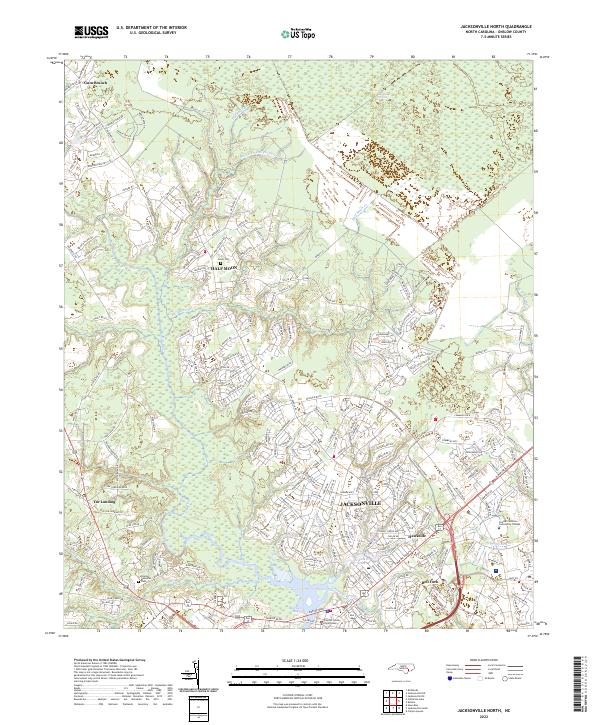 2022 Jacksonville North2022 Print · USGSJacksonville and the surrounding Onslow County wetlands are shown here during a period of modern expansion. Researchers can trace local history through the Greer Cem, the Onslow County Courthouse, and the rural crossroads of Gum Branch.
 - 2022 Map of Kellum, 2022 Print
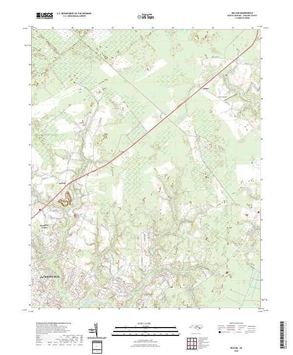 2022 Kellum2022 Print · USGSCoastal North Carolina at the start of the 2020s reveals the expanding residential footprints around Jacksonville and Pumpkin Center. Researchers can trace local landmarks like Epley Airport or the transition into the dense White Oak Pocosin.
End of results
Showing maps 1-24 of 24
Top cities of Onslow County
- Jacksonville historical maps
- Half Moon historical maps
- Swansboro historical maps
- Sneads Ferry historical maps
- Richlands historical maps
- Holly Ridge historical maps
See more
Frequently asked questions
- What are the different types of historical maps available for Onslow County?
- What is the oldest map of Onslow County?
- Where can I purchase historical maps of Onslow County for my home or office?
- Where can I download high-res historical maps of Onslow County?
- Are there historical topographic maps available for Onslow County?
- Is there historical aerial imagery available for Onslow County?
- Where are historical maps of Onslow County sourced from?