Old Maps of Pitt County, North Carolina for Genealogy
Trace your family roots with 159 historic maps of Pitt County. These high-res maps reveal old neighborhoods, homesites, landmarks, and streets — helping you uncover where your ancestors lived and how the area evolved over time.
- Explore historic neighborhoods: Identify where your relatives may have lived in the 1800s or 1900s.
- Compare maps over time: Trace the changes in streets, buildings, and landmarks for multi-generational research.
- Perfect for genealogy & ancestry research: Used by family historians and researchers to map out lineage and migration.
These maps are an incredible resource for exploring your personal connection to Pitt County's past.
Pitt County, NC maps
(159)- 1901 Map of Parmele, 1971 Print
 1901 Parmele1971 Print · USGSCoastal plain North Carolina at the turn of the century is defined here by the converging tracks at Parmele and the dense swampy lowlands. Genealogists can trace early homesteads and community hubs like Shiloh Mills, Dogtown, and the old Tram Road.
 - 1901 Map of Williamston, 1972 Print
 1901 Williamston1972 Print · USGSThe Roanoke River basin at the turn of the century shows a thriving network of steamboat landings and new rail lines. Genealogists and researchers can trace the river economy through Spellers Ferry Landing, Grabtown, and the Atlantic Coast Line R. R.
 - 1902 Map of Williamston, 1944 Print
 1902 Williamston1944 Print · USGSMartin County’s riverfront and rail corridors are frozen in time here at the dawn of the twentieth century. Genealogists and local historians can trace family roots through landings like Spellers Ferry Landing or settlements at Everetts and Goldpoint.
 - 1902 Map of Parmele, 1959 Print
 1902 Parmele1959 Print · USGSCoastal Plain North Carolina at the turn of the century shows a landscape defined by the arrival of the railroad. Genealogists and local historians can trace family roots in early settlements like Conetoe, Shiloh Mills, and the rail junction at Parmele.
 - 1902 Map of Ayden, 1962 Print
 1902 Ayden1962 Print · USGSCoastal plains and swampy bottomlands at the turn of the century reveal a landscape reliant on river transport and early rail. Genealogists can trace family-named river landings like Biddle Ldg. and Pearce Ldg. or follow the Atlantic Coast Line through Ayden.2 unique versions available
 - 1902 Map of Vanceboro, 1968 Print
 1902 Vanceboro1968 Print · USGSCoastal North Carolina at the turn of the century was a landscape of deep swamps and river landings. Genealogists and historians can trace timber tramroads through the Big Pocoson and locate family-named landings like Heath Ldg. and Ipock Ldg. along the Neuse River.
 - 1902 Map of Tarboro, 1968 Print
 1902 Tarboro1968 Print · USGSEdgecombe County at the dawn of the twentieth century was a landscape defined by the winding Tar River and the expansion of the Atlantic Coast Line. Genealogists can trace family names at Bullocks Crossroads, locate the old Steamboat Route, or explore early settlements like Pinetops and Princeville.
 - 1903 Map of Tarboro, 1935 Print
 1903 Tarboro1935 Print · USGSCoastal plain life in Edgecombe County at the opening of the century centered on river commerce and emerging rail lines. You can trace early family sites and rural junctions like Wiggins Crossroads, the Steamboat Route on the river, and the mill works along Sasnett Mill Swamp.2 unique versions available
 - 1903 Map of Winterville, 1954 Print
 1903 Winterville1954 Print · USGSPitt County at the dawn of the twentieth century was a landscape of river landings and new rail lines. Genealogists can trace early homesteads near Greenville and Winterville or locate landmarks like the Pitt County Poor Farm and Browns Old Ferry.
 - 1903 Map of Chocowinity, 1968 Print
 1903 Chocowinity1968 Print · USGSCoastal North Carolina comes alive in the early 1900s as steam power and rail lines intersect along the banks of the Tar River. Researchers can trace old river landings like Yankee Hall Ldg. and family-named landmarks including Woolard Crossroads and Shepherd Millpond.
 - 1904 Map of Ayden
 1904 Ayden1904 Print · USGSCoastal plain life at the dawn of the twentieth century revolved around the river bends and newly laid tracks of the Atlantic Coast Line. Researchers can trace ancestral landings like Village Ldg. and Pearce Ldg. or locate vanished sites like Honolulu and Redalia.4 unique versions available
 - 1904 Map of Falkland, 1936 Print
 1904 Falkland1936 Print · USGSCoastal plain life at the turn of the century centered on river landings and swamp-side settlements across Pitt and Greene counties. Genealogists and historians can trace family roots at Fountain P.O., the mills at Harris Millpond, and river traffic at Dupree Ldg.3 unique versions available
 - 1904 Map of Vanceboro, 1936 Print
 1904 Vanceboro1936 Print · USGSCoastal North Carolina at the turn of the century shows a landscape dominated by vast wetlands and the early timber industry. Researchers can trace historic river landings like Vanceboro Ldg. and Wilkes Ldg. or follow the old Tramroad routes through the Big Pocoson.
 - 1905 Map of Chocowinity
 1905 Chocowinity1905 Print · USGSCoastal North Carolina during the early 1900s centered on the busy waterways of the Tar River and the growing town of Washington. Genealogists and historians can trace old river landings such as Yankee Hall Ldg. and rural sites like Leggetts Crossroads or Pactolus.3 unique versions available
 - 1905 Map of Winterville, 1942 Print
 1905 Winterville1942 Print · USGSPitt County at the dawn of the twentieth century was a landscape shaped by the Tar River and the expanding A. C. L. R. R. network. Genealogists and local historians can trace family-named sites like Galloway Crossroads, identify the location of the Pitt County Poor Farm, or locate vanished river landings such as Pillsboro Ldg.
 - 1905 Map of Vanceboro, 1945 Print
 1905 Vanceboro1945 Print · USGSEastern North Carolina at the turn of the century is a landscape of expansive wetlands and river commerce. Genealogists and historians can trace the early timber industry through networks of Tramroad routes and find long-established river landings like Heath Ldg. and Ipock Ldg. along the Neuse River.
 - 1914 Map of Kinston
 1914 Kinston1914 Print · USGSBefore the onset of the First World War, the rural landscape of eastern North Carolina was a dense network of railroad sidings, country schools, and pocosin wetlands. Genealogists can trace family landmarks and forgotten settlements like Hookerton, Suggs Siding, and Saints Delight Church.3 unique versions available
 - 1916 Map of Kinston
 1916 Kinston1916 Print · USGSThe Neuse River and Contentnea Creek basins are shown here during the mid-1910s, capturing the transition of eastern North Carolina's rural landscape. Genealogists can locate family landmarks like Suggs School, Beulah Church, and Mewborns Crossroads.3 unique versions available
 - 1951 Map of Washington, 1959 Print
 1951 Washington1959 Print · USGSThe riverfront and rail crossroads of eastern North Carolina come alive in the early fifties, showing the growth of WASHINGTON and Chocowinity. Genealogists and historians can trace family locations near Cedar Grove Cem, Marsden Station, and numerous rural schools and chapels.3 unique versions available
 - 1953 Map of Rocky Mount, 1964 Print
 1953 Rocky Mount1964 Print · USGSEastern North Carolina in the mid-fifties is defined by its deep river basins and the vast wetlands of the Tidewater. Genealogists can trace family roots through hubs like Kinston and New Bern or explore the wilderness of Pettigrew State Park and Lake Mattamuskeet.4 unique versions available
 - 1954 Map of Rocky Mount
 1954 Rocky Mount1954 Print · USGSEastern North Carolina is mapped in the mid-fifties, showing a landscape of sounds, swamps, and steam-era rail lines. Genealogists can trace the rural road networks and rail spurs connecting towns like Tarboro, Greenville, and the remote Columbia.
 - 1979 Map of Leggetts Crossroads
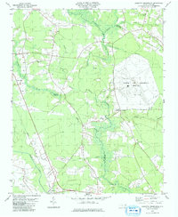 1979 Leggetts Crossroads1979 Print · USGSPitt and Beaufort counties were characterized by vast wetlands and international broadcasting infrastructure in the late 1970s. Researchers can locate dozens of family cemeteries and rural landmarks like the Voice of America (Site A) facility and Pactolus.
 - 1979 Map of Grimesland, 1980 Print
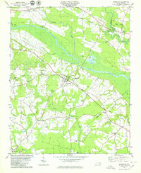 1979 Grimesland1980 Print · USGSThe Pitt and Beaufort County line in the late seventies reveals a landscape of riverfront landings and rail-linked crossroads. Genealogists can trace family names at Hams Crossroads or locate rural sites like White Oak Ch and Yankee Hall.
 - 1980 Map of Falkland, 1981 Print
 1980 Falkland1981 Print · USGSPitt County's rural landscape is captured here in the late seventies, centered on the river-bend settlement of Falkland. Researchers can trace old family sites and community centers like Sharp Point, Dupree Landing, and Kings Crossroads.2 unique versions available
 - 1981 Map of Robersonsville West
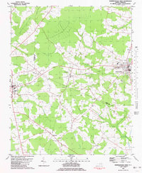 1981 Robersonsville West1981 Print · USGSCoastal plain settlements and railroad junctions define this 1980s landscape across the Pitt and Martin county lines. Genealogists and historians can trace family roots through numerous unnamed cemeteries and community hubs like Parmele, Hickory Grove Ch, and the Seaboard Coast Line tracks.
Showing maps 1-25 of 159
Top cities of Pitt County
- Greenville historical maps
- Ayden historical maps
- Winterville historical maps
- Farmville historical maps
- Bethel historical maps
- Fountain historical maps
See more
Frequently asked questions
- What are the different types of historical maps available for Pitt County?
- What is the oldest map of Pitt County?
- Where can I purchase historical maps of Pitt County for my home or office?
- Where can I download high-res historical maps of Pitt County?
- Are there historical topographic maps available for Pitt County?
- Is there historical aerial imagery available for Pitt County?
- Where are historical maps of Pitt County sourced from?