1900s (20th Century) Maps of Tyrrell County, North Carolina
Explore 45 historic maps of Tyrrell County from the 1900s (20th Century). These maps offer a rare glimpse into what life looked like during the 1900s — showing old roads, neighborhoods, homes, and landmarks that have changed or disappeared over time.
Whether you're researching your family's past, planning a metal detecting trip, or studying how Tyrrell County's landscape evolved across the 1900s, these high-resolution maps are a powerful tool for exploring the history of this region.
- Focus on a specific era: All maps on this page are from the 1900s, giving you a focused view of this time period.
- See what’s changed: Compare century-old streets, trails, and buildings to today's modern landscape using overlays and satellite layers.
- Research with precision: Use these maps for genealogy, historical research, land use analysis, or educational projects.
- View, download, or print: Maps are fully viewable online in high resolution, and can be downloaded or printed for your own records.
Start exploring Tyrrell County's history through authentic maps from the 1900s. This is your window into the past.
Tyrrell County, NC maps
(45)- 1906 Map of Hertford
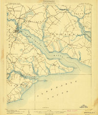 1906 Hertford1906 Print · USGSThe coastal plains of North Carolina near the Albemarle Sound are captured here during a period of river-reliant commerce and early rail growth. Researchers can trace the waterfront legacy of Hertford, the routes of the Norfolk and Southern RR, and rural post offices like Durants Neck PO.3 unique versions available
 - 1940 Map of Hertford
 1940 Hertford1940 Print · USGSThe coastal necks of Perquimans County are caught here in the early 1940s, showing a landscape defined by its deep relationship with the Albemarle Sound. Researchers can trace the waterfront history of Hertford or locate rural sites like the Durants Neck P O and Pleasant Grove Church.2 unique versions available
 - 1940 Map of Powells Point
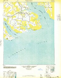
 1940 Powells Point1940 Print · USGSThe North Carolina coast at the start of the 1940s shows the Currituck peninsula just as the Wright Memorial Bridge opened it to more travel. Trace family roots and old landings in Jarvisburg, Powells Point, and Sawyers Lodge.2 unique versions available
 - 1940 Map of Wade Point, 1973 Print
 1940 Wade Point1973 Print · USGSCoastal Pasquotank County at the start of the 1940s shows a landscape of tidewater farming and strategic military aviation. Genealogists and historians can trace family locations near Weeksville, the Air Base, and the fishing grounds of the Frog Island Fishing Club.
 - 1943 Map of Wade Point
 1943 Wade Point1943 Print · USGSThe North Carolina tidewater during the mid-forties is captured here as coastal defense and local life intersect along the Pasquotank River. Trace wartime activity at the Naval Air Base or explore rural settlements like Old Trap, Weeksville, and Listers Corner.
 - 1943 Map of Columbia
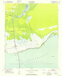
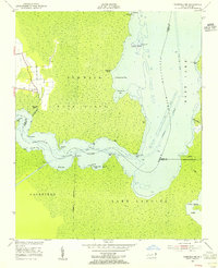
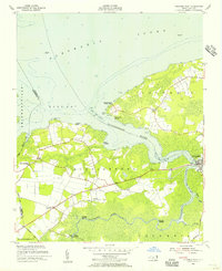
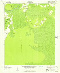
 1943 Columbia1943 Print · USGSCoastal Tyrrell and Hyde Counties are captured in the early 1940s, showing a landscape defined by timber industry and federal land projects. Researchers can trace the industrial docks at the Richmond Cedar Works Lumber Mill or locate the rural Scuppernong Farms (F.S.A.).
 - 1943 Map of Roanoke Island
 1943 Roanoke Island1943 Print · USGSCoastal North Carolina during the war years shows a network of maritime outposts and isolated mainland settlements connected by ferry. Trace the old village of Buffalo City, locate the Bodie Island Lighthouse, and find historic Coast Guard stations at Nags Head and Chicamacomico CG.
 - 1946 Map of Eastville, 1971 Print
 1946 Eastville1971 Print · USGSCoastal Virginia and the Outer Banks are captured here during a period of expanding naval and aerospace presence. Researchers can trace the path of the Penn Central railroad through Chincoteague and Modest Town, or locate landmarks like the Wright Brothers National Memorial.
 - 1946 Map of Currituck Sound, 1980 Print
 1946 Currituck Sound1980 Print · USGSThe Virginia and North Carolina coastline appears in detail during the mid-twentieth century as a network of maritime villages and military outposts. Genealogists and local historians can trace family locations from Virginia Beach south to Kitty Hawk, including landmarks like the Currituck Beach Lighthouse and the Wright Brothers National Memorial.
 - 1948 Map of Wade Point
 1948 Wade Point1948 Print · USGSCoastal Pasquotank County is seen here in the late 1940s, where the river-rich landscape meets the sound. Genealogists can trace family names and small hubs like Weeksville, Listers Corner, and the Frog Island Fishing Club along the intricate marshes and creeks.2 unique versions available
 - 1951 Map of Fairfield, 1953 Print
 1951 Fairfield1953 Print · USGSHyde County’s unique intersection of coastal wetlands and reclaimed farmland is captured here in the early fifties. Genealogists and local historians can locate rural landmarks like Star Zion Zion Ch, the settlement at Carmur, and the infrastructure of the Intracoastal Waterway.4 unique versions available
 - 1951 Map of New Lake SE, 1953 Print
 1951 New Lake SE1953 Print · USGSHyde County coastal wetlands and drainage projects are captured here in the early fifties, just as mid-century water management transformed the landscape. Researchers can trace the engineering of the Intracoastal Canal and find landmarks like Head Lake Island and the Florida Canal.4 unique versions available
 - 1953 Map of Norfolk, 1954 Print
 1953 Norfolk1954 Print · USGSCoastal Virginia and northeastern North Carolina appear here during the post-war industrial boom, showing the critical rail-and-sea connections of Hampton Roads. Genealogists can trace family roots through rural landmarks like Gethsemane Ch, the Caledonia State Prison Farm, and the vast interior of the Dismal Swamp.4 unique versions available
 - 1953 Map of Fairfield NE, 1955 Print
 1953 Fairfield NE1955 Print · USGSCoastal Tyrrell County in the early fifties is defined by the winding Alligator River and its labyrinth of marshy points. Genealogists and local historians can trace the settlement at Gum Neck or locate specific waterfront access at Gum Neck Landing and Grapevine Landing.3 unique versions available
 - 1953 Map of Columbia East, 1956 Print
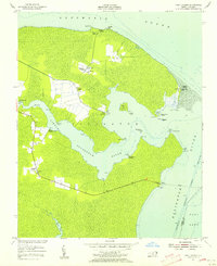
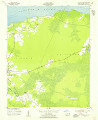 1953 Columbia East1956 Print · USGSCoastal Tyrrell County is captured here in the mid-1950s, showing a landscape defined by the Albemarle Sound and rural crossroads. Local historians can trace family roots through the placement of Malachi Chapel, Missionary Ch, and the small settlement at Soundside.2 unique versions available
 - 1953 Map of Scotia, 1956 Print
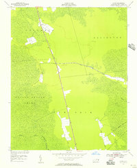 1953 Scotia1956 Print · USGSTyrrell County in the early 1950s shows a landscape of expansive wetlands and small rural outposts. You can trace the road network through Gum Neck, locate the Lookout Tower at Scotia, and follow the winding course of Juniper Creek.2 unique versions available
 - 1953 Map of East Lake, 1956 Print
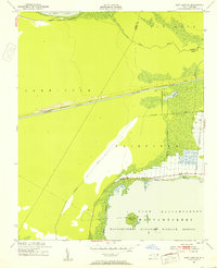
 1953 East Lake1956 Print · USGSCoastal Dare County in the early fifties shows a landscape of isolated shorelines and small water-bound communities. Trace family roots and local history through East Lake Landing, the ruins at Lake Neighborhood, and the Ferry crossing the Alligator River.3 unique versions available
 - 1953 Map of Columbia West, 1956 Print
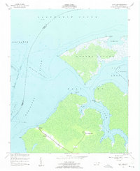
 1953 Columbia West1956 Print · USGSCoastal Tyrrell County in the early fifties shows a landscape deeply tied to the waters of the Scuppernong River and Albemarle Sound. Genealogists and historians can trace family locations near the New Jerusalem Ch and old landings like River Neck Landing or Simmons Landing.2 unique versions available
 - 1953 Map of Frying Pan, 1956 Print
 1953 Frying Pan1956 Print · USGSThe swampy peninsulas and river inlets of Tyrrell County are captured here in the mid-1950s. Genealogists and local historians can trace family locations near Frying Pan, Free Union Ch, and the landings along the Alligator River.3 unique versions available
 - 1953 Map of Fairfield NW, 1956 Print
 1953 Fairfield NW1956 Print · USGSCoastal North Carolina at the mid-century shows a landscape defined by the winding Alligator River and the rural settlements of the inner banks. Genealogists and local historians can trace family roots through landings and churches like Kilkenny Landing, Union Chapel, and Sawyer.3 unique versions available
 - 1953 Map of Fort Landing, 1956 Print
 1953 Fort Landing1956 Print · USGSCoastal Tyrrell County in the early fifties is a world of maritime landings and small marshland outposts. Genealogists and historians can trace family roots through the many local landmarks, from Alligator Chapel and Goat Neck to the old Ferry Landing.2 unique versions available
 - 1953 Map of Rocky Mount, 1964 Print
 1953 Rocky Mount1964 Print · USGSEastern North Carolina in the mid-fifties is defined by its deep river basins and the vast wetlands of the Tidewater. Genealogists can trace family roots through hubs like Kinston and New Bern or explore the wilderness of Pettigrew State Park and Lake Mattamuskeet.4 unique versions available
 - 1954 Map of Rocky Mount
 1954 Rocky Mount1954 Print · USGSEastern North Carolina is mapped in the mid-fifties, showing a landscape of sounds, swamps, and steam-era rail lines. Genealogists can trace the rural road networks and rail spurs connecting towns like Tarboro, Greenville, and the remote Columbia.
 - 1954 Map of Creswell, 1957 Print
 1954 Creswell1957 Print · USGSCoastal North Carolina was defined by its water-management systems and small farming hamlets in the mid-1950s. Genealogists can trace family roots through numerous local landmarks like Woodley Chapel, St Marys Ch, and the community of Cherry.2 unique versions available
 - 1954 Map of Creswell SE, 1957 Print
 1954 Creswell SE1957 Print · USGSTyrrell and Washington counties in the mid-1950s show a landscape shaped by drainage and quiet rural settlement. Genealogists can trace family locations near Holly Grove Ch, Woodleys Chapel, and the isolated community of New Lands.2 unique versions available
Showing maps 1-25 of 45
Top cities of Tyrrell County
Frequently asked questions
- What are the different types of historical maps available for Tyrrell County?
- What is the oldest map of Tyrrell County?
- Where can I purchase historical maps of Tyrrell County for my home or office?
- Where can I download high-res historical maps of Tyrrell County?
- Are there historical topographic maps available for Tyrrell County?
- Is there historical aerial imagery available for Tyrrell County?
- Where are historical maps of Tyrrell County sourced from?