
1953 Map of Scotia
USGS Topo · Published 1956About this map
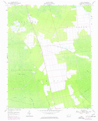
Scotia stands as a focal point in this 1950s study of the Tyrrell County landscape, situated where the road network meets the vast, water-heavy terrain of eastern North Carolina. The map illustrates a region dominated by its hydrology, specifically the Hollow Ground Swamp and the drainage patterns of Juniper Creek and the Northwest Fk Alligator R. These wetlands are framed by higher ground at Gum Neck and Columbia, where human activity is more concentrated. Evidence of local navigation and forest management is visible through the Lookout Tower near the main settlement and the corridor of Frying Pan Road. This era shows a community deeply integrated with its environment, where small family burial plots like the Cem near the northern boundary and localized landmarks like Coopers Cr define the rural geography.
Find a feature on this map
18 named features on this map. Tap any name to fly to it.
Don’t see what you’re looking for? This feature index may not catch every label — zoom into the map to look around manually.
Map Details
Editions of this 1953 Scotia Map
2 editions found
Other maps of this area

1943 · Columbia
USGS Topo · 1:125,000

1953 · Fairfield NE
USGS Topo · 1:24,000

1953 · Columbia East
USGS Topo · 1:24,000

1953 · Columbia West
USGS Topo · 1:24,000

1953 · Frying Pan
USGS Topo · 1:24,000

1953 · Fairfield NW
USGS Topo · 1:24,000
1953 · Fort Landing
USGS Topo · 1:24,000

1953 · Rocky Mount
USGS Topo · 1:250,000

1954 · Rocky Mount
USGS Topo · 1:250,000
1954 · Creswell SE
USGS Topo · 1:24,000