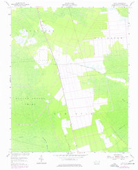
1953 Map of Scotia
USGS Topo · Published 1977About this map
Gum Neck and the surrounding coastal wetlands of Tyrrell County dominate this mid-century landscape, where a sparse network of roads and drainage projects defined local life. The small settlement of Scotia serves as a focal point near the northern edge of the map, marked by a nearby Lookout Tower and a small Cem. The terrain is characterized by expansive, saturated lowlands, including the formidable Hollow Ground Swamp and the headwaters of Juniper Creek.
Find a feature on this map
13 named features on this map. Tap any name to fly to it.
Don’t see what you’re looking for? This feature index may not catch every label — zoom into the map to look around manually.
Map Details
Editions of this 1953 Scotia Map
2 editions found
Other maps of this area

1943 · Columbia
USGS Topo · 1:125,000

1953 · Fairfield NE
USGS Topo · 1:24,000

1953 · Columbia East
USGS Topo · 1:24,000

1953 · Scotia
USGS Topo · 1:24,000

1953 · Columbia West
USGS Topo · 1:24,000

1953 · Frying Pan
USGS Topo · 1:24,000

1953 · Fairfield NW
USGS Topo · 1:24,000
1953 · Fort Landing
USGS Topo · 1:24,000

1953 · Rocky Mount
USGS Topo · 1:250,000

1954 · Rocky Mount
USGS Topo · 1:250,000