Old Maps of Wake County, North Carolina for Genealogy
Trace your family roots with 191 historic maps of Wake County. These high-res maps reveal old neighborhoods, homesites, landmarks, and streets — helping you uncover where your ancestors lived and how the area evolved over time.
- Explore historic neighborhoods: Identify where your relatives may have lived in the 1800s or 1900s.
- Compare maps over time: Trace the changes in streets, buildings, and landmarks for multi-generational research.
- Perfect for genealogy & ancestry research: Used by family historians and researchers to map out lineage and migration.
These maps are an incredible resource for exploring your personal connection to Wake County's past.
Wake County, NC maps
(191)- 1943 Map of Durham South
 1943 Durham South1943 Print · USGSDurham and its southern reaches are captured here in the early 1940s, showing a tobacco-and-rail landscape at its peak. Genealogists and local historians can trace legacy sites like Beechwood Cem, Lowes Grove, and Roger Grove Ch.2 unique versions available
 - 1943 Map of Raleigh
 1943 Raleigh1943 Print · USGSRaleigh and its surrounding Wake County townships are captured here in the early 1940s as a bustling nexus of rail and industry. Genealogists can trace family names through rural landmarks like Lassiters Mill, Method, and numerous country churches like Mt Bethel Church.2 unique versions available
 - 1943 Map of Creedmoor, 1957 Print
 1943 Creedmoor1957 Print · USGSGranville and Wake counties are shown here during the transformative years of the early 1940s. Researchers can locate dozens of specific rural landmarks, from the sprawling Camp Butner Military Reservation to local centers like Creedmoor and Mt Energy.2 unique versions available
 - 1944 Map of Creedmoor
 1944 Creedmoor1944 Print · USGSGranville County during the Second World War shows the massive footprint of Camp Butner alongside traditional rail towns. Genealogists can trace family roots through numerous country landmarks like Lattice Ch, Mt Vernon Cem, and Providence Sch.
 - 1951 Map of Raleigh, 1952 Print
 1951 Raleigh1952 Print · USGSMid-century Raleigh and its surrounding rural townships are shown here as the capital city expanded toward the Neuse River. Genealogists can trace family-named schools and crossroads like Lovely Hill Sch, Six Forks, and the historic mill at Lassiters Mill.3 unique versions available
 - 1951 Map of Durham South, 1953 Print
 1951 Durham South1953 Print · USGSThe mid-century landscape south of Durham shows a region on the cusp of modernization as the airport and highway networks began to expand. Genealogists and historians can locate rural landmarks such as Pearsontown, Lowes Grove, and Holland Chapel among the busy rail corridors of the Norfolk Southern.3 unique versions available
 - 1951 Map of Durham North, 1953 Print
 1951 Durham North1953 Print · USGSThe northern reaches of Durham and Orange Counties are captured here in the early fifties, just as post-war development began to meet the region's agricultural roots. Genealogists can trace family landmarks like the Duke Homestead and rural hubs such as Bahama, Rougemont, and the Orange Factory.3 unique versions available
 - 1953 Map of Raleigh, 1965 Print
 1953 Raleigh1965 Print · USGSCentral North Carolina in the early sixties shows a landscape of growing towns and military hubs before the full expansion of the interstate system. Genealogists can trace family footprints across the Piedmont through Wake Forest, Siler City, and the large Fort Bragg Military Reservation.4 unique versions available
 - 1953 Map of Greensboro, 1981 Print
 1953 Greensboro1981 Print · USGSThe Piedmont borderlands of North Carolina and Virginia show a landscape defined by new reservoirs and old rail lines. Trace family roots and the changing river geography through Elon College, the John H Kerr Reservoir, and South Boston.
 - 1954 Map of Greensboro
 1954 Greensboro1954 Print · USGSThe Piedmont borderlands of North Carolina and Virginia come alive in this mid-fifties study of a region defined by its rivers and rails. Researchers can trace the growing Buggs Island Lake or follow the paths of the Southern Ry and Seaboard Air Line RR through towns like Oxford and Reidsville.
 - 1954 Map of Raleigh
 1954 Raleigh1954 Print · USGSThe North Carolina Piedmont and Sandhills are captured in the mid-fifties during a period of steady regional growth. Genealogists and historians can trace the development of towns like Siler City or locate landmarks such as Falls of Neuse and Camp Mackall.
 - 1962 Map of Greensboro
 1962 Greensboro1962 Print · USGSThe Piedmont region along the Virginia and North Carolina border comes alive in the early 1960s, showing a landscape defined by industry and new reservoirs. Trace the path of the Virginian RR or explore the early development of Greensboro and Durham.
 - 1964 Map of Lake Wheeler, 1965 Print
 1964 Lake Wheeler1965 Print · USGSWake County south of the capital city shows a mix of rapid suburban growth and deep-rooted rural history during the mid-sixties. Genealogists and local historians can trace family sites like Franklin Cem alongside landmarks such as Yates Millpond and McCullers Crossroads.5 unique versions available
 - 1964 Map of Garner, 1965 Print
 1964 Garner1965 Print · USGSGarner and the surrounding townships of Wake County are shown in the mid-sixties as the rail-side communities began to expand. Researchers can locate family landmarks and rural hubs like Hayes Chapel, Rand Cem, and the State Agriculture Experiment Station near Clayton.4 unique versions available
 - 1964 Map of Selma, 1965 Print
 1964 Selma1965 Print · USGSEastern Johnston County flourished as a rail and river hub in the mid-sixties, dominated by the crossing of the Neuse River. Researchers can trace old family sites and crossroads from Archers Lodge to Pine Level, including the Harrison High Sch and Branch Chapel.
 - 1964 Map of Angier, 1965 Print
 1964 Angier1965 Print · USGSAngier and the surrounding tobacco-farming country appear here in the mid-1960s at the junction of three counties. Genealogists and researchers can trace local family roots through numerous cemeteries and country churches like St Ann Ch, Fellowship Ch, and Ogburn Crossroads.3 unique versions available
 - 1964 Map of Clayton, 1965 Print
 1964 Clayton1965 Print · USGSThe Neuse River valley in Johnston and Wake Counties is captured here in the mid-1960s, showing the early expansion of the Clayton area. Researchers can locate numerous family burial sites like Stephenson Cem and rural centers such as Archers Lodge and Shotwell.3 unique versions available
 - 1964 Map of Edmondson, 1965 Print
 1964 Edmondson1965 Print · USGSJohnston County in the early sixties was a landscape of crossroads communities and family-run mills. Genealogists can locate specific family landmarks such as Penny Cem, trace the waters near McGee Mill, and find vanished gathering spots like Drug Store.3 unique versions available
 - 1964 Map of Garner, 1965 Print
 1964 Garner1965 Print · USGSThe rural landscapes south of Raleigh were transitioning from farm to suburb in the mid-sixties. Researchers can trace family roots at numerous country churches like Wooten Chapel Ch or locate sites such as McCullers, Willow Springs, and the historic McGee Mill.
 - 1966 Map of Greensboro
 1966 Greensboro1966 Print · USGSThe North Carolina and Virginia Piedmont thrives during the mid-sixties, showcasing a landscape of textile hubs and expanding river reservoirs. Researchers can trace the rail corridors of the Southern Railway, find local landmarks like Elon College, or locate the extensive Camp Butner Military Reservation.
 - 1967 Map of Knightdale, 1972 Print
 1967 Knightdale1972 Print · USGSEastern Wake County comes into focus in the mid-1960s, showing the rural character and emerging infrastructure between the capital and the coastal plain. Genealogists and local historians can trace family locations near Lizard Lick, Eagle Rock, and Hephzibah Ch.4 unique versions available
 - 1967 Map of Rolesville, 1972 Print
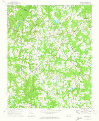 1967 Rolesville1972 Print · USGSWake County and Franklin County are captured in the late sixties as traditional agricultural crossroads begin to meet modern utility. Genealogists and local historians can trace family roots through Rolesville Cem or locate old community centers like Fowlers Crossroads and Harris Crossroads.3 unique versions available
 - 1967 Map of Wake Forest, 1972 Print
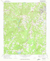 1967 Wake Forest1972 Print · USGSNorthern Wake County in the late sixties shows a landscape of growing crossroads and river communities centered around Wake Forest. Genealogists can locate family landmarks at Stony Hill Ch, Forestville, and the historic Southeastern Theological Seminary campus.6 unique versions available
 - 1967 Map of Bayleaf, 1972 Print
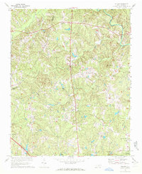 1967 Bayleaf1972 Print · USGSNorthern Wake County appears here in the late sixties, just before the rapid suburban growth of Raleigh began to transform these rural communities. Researchers can trace family sites near Wake-Minster, find the Soapstone Quarry, and locate old landmarks like Six Forks and Hickory Grove Ch.4 unique versions available
 - 1968 Map of Bunn West, 1972 Print
 1968 Bunn West1972 Print · USGSThe Franklin and Wake county line in the late sixties reveals a landscape of small farming communities and country crossroads. Genealogists can trace family names through landmarks like Union Gospel Tabernacle or the rural settlements of Pearces and New Hope.2 unique versions available
Showing maps 1-25 of 191
Top cities of Wake County
- Raleigh historical maps
- Cary historical maps
- Apex historical maps
- Wake Forest historical maps
- Fuquay-Varina historical maps
- Garner historical maps
See more
Frequently asked questions
- What are the different types of historical maps available for Wake County?
- What is the oldest map of Wake County?
- Where can I purchase historical maps of Wake County for my home or office?
- Where can I download high-res historical maps of Wake County?
- Are there historical topographic maps available for Wake County?
- Is there historical aerial imagery available for Wake County?
- Where are historical maps of Wake County sourced from?