1970s Maps of Warren County, North Carolina
Explore 18 historic maps of Warren County from the 1970s. These maps offer a rare glimpse into what life looked like during the 1970s — showing old roads, neighborhoods, homes, and landmarks that have changed or disappeared over time.
Whether you're researching your family's past, planning a metal detecting trip, or studying how Warren County's landscape evolved across the 1970s, these high-resolution maps are a powerful tool for exploring the history of this region.
- Focus on a specific era: All maps on this page are from the 1970s, giving you a focused view of this time period.
- See what’s changed: Compare century-old streets, trails, and buildings to today's modern landscape using overlays and satellite layers.
- Research with precision: Use these maps for genealogy, historical research, land use analysis, or educational projects.
- View, download, or print: Maps are fully viewable online in high resolution, and can be downloaded or printed for your own records.
Start exploring Warren County's history through authentic maps from the 1970s. This is your window into the past.
Warren County, NC maps
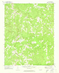
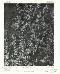
(18)- 1970 Map of Macon, 1973 Print
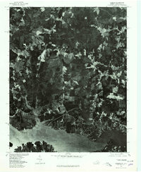
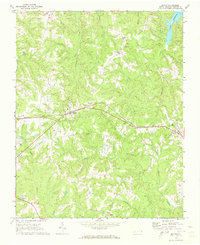 1970 Macon1973 Print · USGSWarren County at the start of the 1970s reveals a landscape of rural communities connected by the Seaboard Coast Line railroad. You can trace the historic layout of Macon and Vaughan alongside rural landmarks like Greenwood Ch and Oakville.2 unique versions available
 - 1970 Map of Vicksboro, 1973 Print
 1970 Vicksboro1973 Print · USGSVance County in the early seventies was a land of small crossroads communities and family-named creek branches. Researchers can trace the legacy of rural life through landmarks like Weldons Mill, the Seaboard Coast Line rail route, and local churches such as Hughes Grove Ch.
 - 1970 Map of Middleburg, 1973 Print
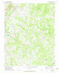
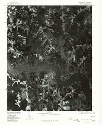
 1970 Middleburg1973 Print · USGSVance and Warren counties are shown here in the early 1970s as the regional landscape adjusted to the reservoir shoreline and the development of Soul City. Researchers can trace local heritage through the Seaboard Coast Line rail stops and rural landmarks like Nutbush Sch and Morning Star Ch.2 unique versions available
 - 1970 Map of Warrenton, 1973 Print
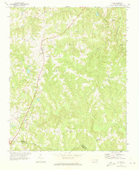
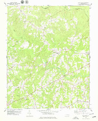
 1970 Warrenton1973 Print · USGSWarren County at the start of the seventies centered on the rail junction at Norlina and the county seat of Warrenton. Genealogists can trace family names at Old Warrenton Cem or explore rural community life at Warren Plains and Snow Hill.
 - 1971 Map of Inez, 1973 Print
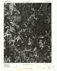
 1971 Inez1973 Print · USGSWarren County at the start of the seventies reveals a landscape of enduring rural crossroads and creek-side settlements. Genealogists and local historians can trace the foundations of Inez, Grove Hill, and Liberia, alongside landmarks like Shady Grove Ch and the Lookout Tower.
 - 1971 Map of Afton, 1973 Print
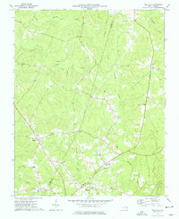
 1971 Afton1973 Print · USGSThe rural communities of Warren County come into focus in the early 1970s, organized around country roads and woodland creeks. Genealogists can trace family roots through numerous sites like Warren Academy, Sulphur Springs Ch, and the settlement at Elberon.
 - 1973 Map of Hollister, 1977 Print
 1973 Hollister1977 Print · USGSThe rural borderlands of Halifax and Warren Counties come into focus in the early 1970s, showing a landscape defined by creeks and country roads. Genealogists can locate family landmarks like White Rock Ch, Lees Chapel, and the timber-era remnants of the Porter Grade.
 - 1973 Map of Littleton, 1977 Print
 1973 Littleton1977 Print · USGSThe border of Warren and Halifax Counties in the early 1970s is captured here as the Seaboard Coast Line passes through several rural communities. Researchers can trace the layout of Littleton, find Panacea Springs, and locate country churches like Ashley Grove Ch.
 - 1977 Map of Middleburg, 1978 Print
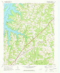
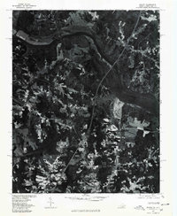
 1977 Middleburg1978 Print · USGSThe North Carolina countryside appears in sharp detail in the late 1970s, showing the intersection of agricultural life and major transit lines. Researchers can trace the footprints of Middleburg, Manson, and Drewry alongside the John H Kerr Reservoir.
 - 1977 Map of John H Kerr Dam, 1978 Print
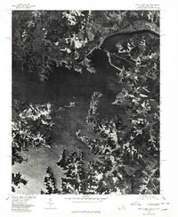 1977 John H Kerr Dam1978 Print · USGSThe Mecklenburg County borderlands appear in high-contrast aerial detail during the late seventies, showing the managed waters of the John H Kerr Reservoir. Researchers can trace the sprawling shoreline and rural tracts near Rose Hill and the massive John H Kerr Dam.
 - 1977 Map of Bracey, 1979 Print
 1977 Bracey1979 Print · USGSThe Roanoke River valley and the Virginia-North Carolina borderlands are seen here in the late seventies. Researchers can trace the sprawling shoreline of Lake Gaston and locate regional crossroads like Bracey and Palmer Springs.
 - 1977 Map of Littleton, 1979 Print
 1977 Littleton1979 Print · USGSThe town of Littleton and the southern shores of Lake Gaston are captured in this late-seventies aerial survey of the North Carolina interior. Genealogists and historians can examine the precise layout of Littleton and nearby Vaughan or trace the timberlines near Enterprise.
 - 1977 Map of Gasburg, 1979 Print
 1977 Gasburg1979 Print · USGSThe Virginia and North Carolina borderlands come into focus in the late seventies as reservoir living begins to shape the rural landscape. Researchers can trace land use patterns around Lake Gaston and the settlements of Gasburg and Ebony.
 - 1977 Map of South Hill SE, 1979 Print
 1977 South Hill SE1979 Print · USGSMecklenburg County and the borderlands of North Carolina come into focus in the late seventies as the shoreline of Lake Gaston reshapes the land. Researchers can trace the development of lakeside tracts near Joyceville and the rural road junctions at Five Forks.
 - 1977 Map of Macon, 1979 Print
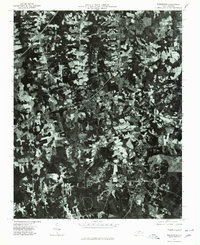
 1977 Macon1979 Print · USGSWarren County during the late seventies is captured in this aerial orthophotomap, showing the rural landscape just south of the Virginia border. Genealogists and local historians can trace the clearings and homesites in Macon, Vaughan, and Embro.
 - 1977 Map of Warrenton, 1979 Print
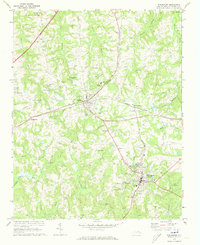
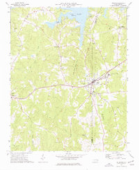
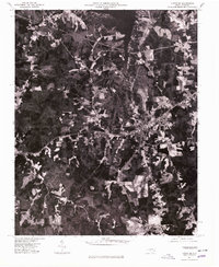
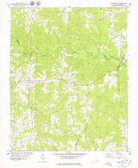
 1977 Warrenton1979 Print · USGSWarren County in the late seventies is captured in this detailed aerial perspective of its primary settlements and rural corridors. Genealogists and local historians can trace the exact footprints of homes and businesses in Warrenton, Norlina, and Ridgeway.
 - 1978 Map of Gold Sand, 1979 Print
 1978 Gold Sand1979 Print · USGSFranklin and Warren County rural life in the late seventies is centered on crossroads like Gold Sand and Alert. Trace family sites near Mountain Grove Ch, the Gold Sand Sch, and the winding banks of Sandy Creek.2 unique versions available
 - 1978 Map of Centerville, 1979 Print
 1978 Centerville1979 Print · USGSThe Franklin and Warren County borderlands appear here in the late seventies as a landscape of winding creeks and rural crossroads. Local historians can trace the foundations of these communities through landmarks like Fork Chapel, Wester Ch, and the settlement of Wood.
End of results
Showing maps 1-18 of 18
Top cities of Warren County
Frequently asked questions
- What are the different types of historical maps available for Warren County?
- What is the oldest map of Warren County?
- Where can I purchase historical maps of Warren County for my home or office?
- Where can I download high-res historical maps of Warren County?
- Are there historical topographic maps available for Warren County?
- Is there historical aerial imagery available for Warren County?
- Where are historical maps of Warren County sourced from?