1970s Maps of Dunn County, North Dakota
Explore 44 historic maps of Dunn County from the 1970s. These maps offer a rare glimpse into what life looked like during the 1970s — showing old roads, neighborhoods, homes, and landmarks that have changed or disappeared over time.
Whether you're researching your family's past, planning a metal detecting trip, or studying how Dunn County's landscape evolved across the 1970s, these high-resolution maps are a powerful tool for exploring the history of this region.
- Focus on a specific era: All maps on this page are from the 1970s, giving you a focused view of this time period.
- See what’s changed: Compare century-old streets, trails, and buildings to today's modern landscape using overlays and satellite layers.
- Research with precision: Use these maps for genealogy, historical research, land use analysis, or educational projects.
- View, download, or print: Maps are fully viewable online in high resolution, and can be downloaded or printed for your own records.
Start exploring Dunn County's history through authentic maps from the 1970s. This is your window into the past.
Dunn County, ND maps
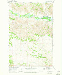
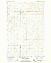
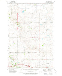
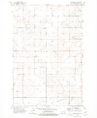
(44)- 1970 Map of Mandaree, 1973 Print
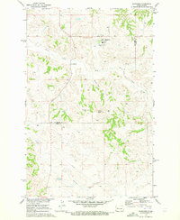 1970 Mandaree1973 Print · USGSMcKenzie and Dunn counties are captured here in the 1970s within the Fort Berthold Indian Reservation. Researchers can trace the development of Mandaree and locate distinctive landforms like Eagle Nest Butte and Phaelens Butte.
 - 1970 Map of Halliday NE, 1973 Print
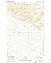
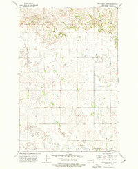
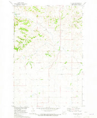 1970 Halliday NE1973 Print · USGSDunn County at the start of the 1970s shows a landscape shaped by the waters of the Missouri River Basin project. Genealogists and local historians can locate St Johns Cem and trace the winding courses of Hans Creek and Steel Creek.2 unique versions available
 - 1970 Map of Hay Flat, 1973 Print
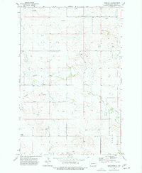
 1970 Hay Flat1973 Print · USGSDunn County's high plains meet the intricate new shoreline of the Missouri River Basin during the early seventies. Genealogists and local historians can locate Lincoln Memorial Cem and trace the rugged coulees surrounding Old Man Dancing Butte.
 - 1970 Map of String Buttes, 1973 Print
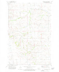
 1970 String Buttes1973 Print · USGSDunn County at the start of the 1970s shows a landscape transformed by the waters of the Missouri River Basin project. Genealogists and local historians can locate Independence Ch and trace the original shorelines of Skunk Creek Bay and Heart Butte.
 - 1970 Map of Lost Bridge, 1973 Print
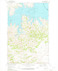
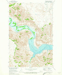
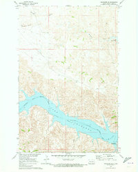
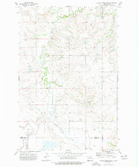
 1970 Lost Bridge1973 Print · USGSDunn County at the start of the 1970s shows the Missouri River's transformation into a massive reservoir. Trace the rising shoreline of Lake Sakakawea and the wild terrain around North Killdeer Mountain and Corral Creek.2 unique versions available
 - 1970 Map of Figure 4 Ranch, 1973 Print
 1970 Figure 4 Ranch1973 Print · USGSMcKenzie and Dunn counties are captured here in the early 1970s, showing a landscape defined by ranching and the eastern reservation line. Researchers can trace land use through the Figure 4 Ranch, find the rural Faith Ch, and follow the breaks of Bear Den Creek.
 - 1970 Map of Dunn Center NW, 1973 Print
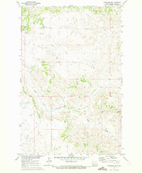
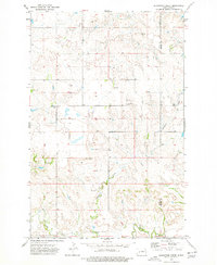
 1970 Dunn Center NW1973 Print · USGSDunn County, North Dakota, is captured here in the early seventies, showing a landscape defined by ranching terrain and rail infrastructure. Genealogists and researchers can locate Peace Cem or trace the Burlington Northern line as it follows the banks of Spring Creek.
 - 1970 Map of Mandaree SW, 1973 Print
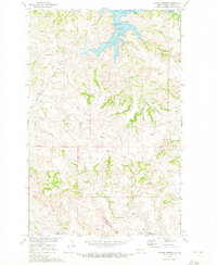
 1970 Mandaree SW1973 Print · USGSDunn County at the start of the 1970s shows a landscape transformed by the waters of Lake Sakakawea. Genealogists and historians can trace the Fort Berthold Indian Reservation Boundary as it meets the Little Missouri River and Moccasin Creek.2 unique versions available
 - 1970 Map of Golden Valley NW, 1973 Print
 1970 Golden Valley NW1973 Print · USGSMercer County and the Missouri River Basin are captured here in the early 1970s, showcasing a landscape of high prairie and reservation lands. Genealogists and historians can locate the Defiance Cem and trace the drainage of Goodman Creek and Horse Creek across this rural territory.
 - 1970 Map of Halliday NW, 1973 Print
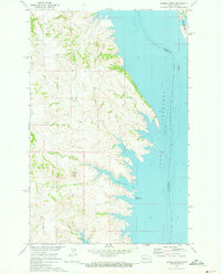
 1970 Halliday NW1973 Print · USGSDunn County lands meet the water’s edge in the early 1970s, where the Missouri River Basin development transformed the local landscape. Genealogists and researchers can trace the Fort Berthold Indian Reservation Boundary and shorelines of Wolf Chief Bay and Hans Creek.
 - 1970 Map of Saddle Butte, 1973 Print
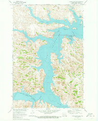
 1970 Saddle Butte1973 Print · USGSThe Missouri River breaks in western North Dakota are shown just as the reservoir reached its mature levels in the early seventies. Genealogists and researchers can trace the submerged county lines and find landmarks like Saddle Butte and Saddle Butte Bay.
 - 1970 Map of Dunn Center NE, 1973 Print
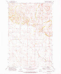
 1970 Dunn Center NE1973 Print · USGSDunn County, North Dakota, is captured in the early 1970s as the regional landscape adjusted to the presence of the Missouri River Basin project. Genealogists and land researchers can trace property lines and fence lines near Chimney Butte, several Gravel Pits, and the shoreline of Lake Sakakawea.
 - 1970 Map of Mandaree SE, 1973 Print
 1970 Mandaree SE1973 Print · USGSThe Missouri River Basin development transformed this Dunn County landscape in the early seventies. Trace the rising waters of Lake Sakakawea against high points like McGregory Buttes and find early energy infrastructure such as a pipeline.
 - 1970 Map of Mandaree NE, 1973 Print
 1970 Mandaree NE1973 Print · USGSIn the early 1970s, the Missouri River Basin landscape was recorded during a period of regional development. Genealogists and historians can trace local landmarks like St Anthonys Ch and follow the natural drainages of Skunk Creek and Squaw Creek across the Fort Berthold Indian Reservation.
 - 1970 Map of Saddle Butte SW, 1973 Print
 1970 Saddle Butte SW1973 Print · USGSDunn County’s badlands meet the sprawling reservoir of Lake Sakakawea in the early seventies, marking a landscape transformed by the Missouri River Basin project. Trace the intricate shoreline from Hidatsa Bay to the mouth of the Little Missouri River.
 - 1973 Map of Marshall SE, 1977 Print
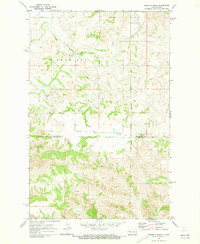
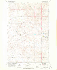 1973 Marshall SE1977 Print · USGSThe North Dakota high plains of the early seventies are documented here at the boundary of two counties. Researchers can locate agricultural landmarks like Storage Bins and trace the vital water sources identified by several Spring and Well sites across the terrain.
 - 1973 Map of Boyle, 1977 Print
 1973 Boyle1977 Print · USGSStark and Dunn Counties are captured in the early seventies, showing a landscape shaped by transportation and the prairie environment. Trace the infrastructure of the Burlington Northern railroad and locate water sources like the Gaging Sta along the Green River.
 - 1973 Map of Willow Creek West, 1977 Print
 1973 Willow Creek West1977 Print · USGSDunn County and its neighboring borders are captured in the early 1970s, showcasing the rural water networks of the High Plains. Researchers can trace the winding Knife River and its southern Branch, or locate local landmarks like the Gravel Pit.
 - 1973 Map of Schaffner Creek, 1977 Print
 1973 Schaffner Creek1977 Print · USGSDunn County and Mercer County are captured here during the early 1970s, showing a traditional landscape of prairie homesteads and creek drainages. Genealogists can locate family landmarks such as St Martins Ch, Broncho Cem, and the path of Schaffner Creek.
 - 1973 Map of Manning SE, 1977 Print
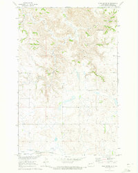
 1973 Manning SE1977 Print · USGSDunn County's high plains landscape is captured in the early seventies, showing a rural environment defined by its creek beds and land boundaries. Researchers can trace the paths of Russian Spring Creek and Deep Creek or locate local industrial sites like the Gravel Pits.
 - 1973 Map of Marshall SW, 1977 Print
 1973 Marshall SW1977 Print · USGSThe high plains of Dunn County come into focus during the early 1970s, showing a rural landscape anchored by isolated farmsteads and community hubs. Genealogists can locate family landmarks such as Ridgeway Ch, the local School, and the Ridgeway Community Center.
 - 1973 Map of New Hradec South, 1977 Print
 1973 New Hradec South1977 Print · USGSThe rural borders of Stark and Dunn counties come alive in the early 1970s, showing a landscape of traditional ranching transitioning into an era of energy extraction. Genealogists and historians can trace the vicinity of New Hradec and locate specific features like Dutch Henry Butte, North Duck Creek, and early oil infrastructure.
 - 1973 Map of New Hradec North, 1977 Print
 1973 New Hradec North1977 Print · USGSThe northern reaches of the New Hradec community in the early 1970s reveal a landscape of prairie plateaus and winding river breaks. Genealogists and local historians can trace the foundations of the area at the St Peter and Paul School and St Anthony Cem.
 - 1973 Map of Ziner Butte, 1977 Print
 1973 Ziner Butte1977 Print · USGSDunn County's high prairie comes into focus during the early 1970s, showcasing a landscape of isolated buttes and essential water sources. Researchers can locate the Vang Chi Cem and trace the paths of Stray Creek and the Knife River through this rural terrain.
 - 1973 Map of Hirschville SW, 1977 Print
 1973 Hirschville SW1977 Print · USGSDunn County ranching and energy land is captured here in the 1970s, showcasing the high plains before further modern development. Genealogists and historians can trace essential water sources and rural infrastructure through Russian Spring Cr, several Well sites, and a crossing Pipeline.
Showing maps 1-25 of 44
Top cities of Dunn County
- Killdeer historical maps
- Halliday historical maps
- Dodge historical maps
- Dunn Center historical maps
- Manning historical maps
Frequently asked questions
- What are the different types of historical maps available for Dunn County?
- What is the oldest map of Dunn County?
- Where can I purchase historical maps of Dunn County for my home or office?
- Where can I download high-res historical maps of Dunn County?
- Are there historical topographic maps available for Dunn County?
- Is there historical aerial imagery available for Dunn County?
- Where are historical maps of Dunn County sourced from?