1900s (20th Century) Maps of Dunn County, North Dakota
Explore 73 historic maps of Dunn County from the 1900s (20th Century). These maps offer a rare glimpse into what life looked like during the 1900s — showing old roads, neighborhoods, homes, and landmarks that have changed or disappeared over time.
Whether you're researching your family's past, planning a metal detecting trip, or studying how Dunn County's landscape evolved across the 1900s, these high-resolution maps are a powerful tool for exploring the history of this region.
- Focus on a specific era: All maps on this page are from the 1900s, giving you a focused view of this time period.
- See what’s changed: Compare century-old streets, trails, and buildings to today's modern landscape using overlays and satellite layers.
- Research with precision: Use these maps for genealogy, historical research, land use analysis, or educational projects.
- View, download, or print: Maps are fully viewable online in high resolution, and can be downloaded or printed for your own records.
Start exploring Dunn County's history through authentic maps from the 1900s. This is your window into the past.
Dunn County, ND maps
(73)- 1953 Map of Dickinson, 1968 Print
 1953 Dickinson1968 Print · USGSWestern North Dakota in the fifties remains a landscape of rail-linked prairie towns and rugged badlands. Trace the local impact of the Northern Pacific railroad through Dickinson or locate early rural landmarks like Rainy Butte Church and Boys Ranch.2 unique versions available
 - 1953 Map of Watford City, 1968 Print
 1953 Watford City1968 Print · USGSNorth Dakota's badlands and the Missouri River basin are captured here during the 1950s and 60s as the Garrison Dam changed the landscape. Researchers can trace old rail lines like the Great Northern or find rural outposts such as Grassy Butte and Halliday.3 unique versions available
 - 1957 Map of Dickinson
 1957 Dickinson1957 Print · USGSSouthwestern North Dakota in the mid-fifties is a landscape of coal mining and tight-knit rural school districts. Genealogists can trace family footprints through numerous country schools like Fisher School and parish churches like St Stephens.
 - 1957 Map of Watford City
 1957 Watford City1957 Print · USGSWestern North Dakota's landscape is captured here during the mid-fifties as the Missouri River valley undergoes massive change following the creation of Garrison Reservoir. Genealogists and historians can trace dozens of rural schools like Divide School and early settlements such as Arnegard and Grassy Butte.
 - 1958 Map of Lone Butte SE, 1960 Print
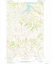
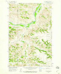 1958 Lone Butte SE1960 Print · USGSDunn and McKenzie counties show their rugged ranching character in the late 1950s as they are mapped for the Missouri River Basin project. Genealogists and historians can locate family landmarks like the Erickson Ranch, Olson Ranch, and the Quilliam Sch.2 unique versions available
 - 1958 Map of North Killdeer Mountain, 1960 Print
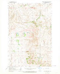
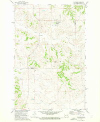
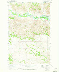
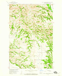 1958 North Killdeer Mountain1960 Print · USGSDunn County ranching life is captured here in the late fifties, dominated by the rise of North Killdeer Mountain. Genealogists can trace family-named sites across the coulees, from the Hanson Ranch and Sandvick Ranch to the remote Brown Ranch.2 unique versions available
 - 1959 Map of Dickinson North
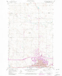 1959 Dickinson North1959 Print · USGSDickinson and the surrounding Stark County prairies are captured here during the mid-century oil boom. Researchers can trace the development of the State Teachers College and locate family history at St Patricks Cem or rural School No 9.2 unique versions available
 - 1959 Map of Croff, 1960 Print
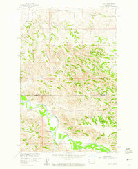 1959 Croff1960 Print · USGSMcKenzie County was a landscape of remote cattle operations and small rural outposts during the late fifties. Genealogists and local historians can trace the locations of the Croff Sch, the Kennedy Ranch, and the path of the Little Missouri River.
 - 1959 Map of Lone Butte NE, 1961 Print
 1959 Lone Butte NE1961 Print · USGSMcKenzie and Dunn Counties appear here in the late fifties as a landscape of isolated ranching and river breaks. Genealogists and researchers can trace family-named sites like Johnson Ranch or Mandal Ranch and landmarks like Haystack Butte along the Little Missouri River.2 unique versions available
 - 1962 Map of Davis Buttes, 1964 Print
 1962 Davis Buttes1964 Print · USGSNorth Dakota's high plains meet Cold War defense and new infrastructure in the early sixties as a major highway is carved across the landscape. You can trace the rural layout of the day, from the Dickinson Air Force Station to the Versippi Sch and various gravel pits.2 unique versions available
 - 1962 Map of Belfield NE, 1964 Print
 1962 Belfield NE1964 Print · USGSThe high plains of Stark and Billings counties are captured here in the early sixties, showing the rail-centered community of Zenith. Researchers can trace the extractive history of the region through labeled sites like Walters Mine, Karsky Mine, and several local Scoria Pits.2 unique versions available
 - 1963 Map of Fairfield SE, 1964 Print
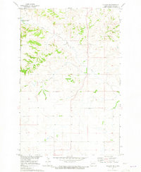
 1963 Fairfield SE1964 Print · USGSBillings and Dunn counties are captured in the early 1960s, showing a remote prairie landscape of family farms and ethnic roots. Genealogists can locate rural landmarks such as the Ukrania School, St Demetrius Cemetery, and Barta School.2 unique versions available
 - 1963 Map of Hungry Man Butte, 1964 Print
 1963 Hungry Man Butte1964 Print · USGSThe high plains along the Billings and Dunn county line appear here in the early sixties, showing a landscape of ranching and remote schoolhouses. Researchers can trace the Knife River and Crooked Creek drainages or locate the Snow Sch and Hungry Man Butte.
 - 1967 Map of Watford City
 1967 Watford City1967 Print · USGSWestern North Dakota is captured during a period of landscape transformation as the Missouri River valley was reshaped by the new Garrison Reservoir. Genealogists and local historians can trace the foundations of Watford City, find the Elkhorn Ranch Site, or locate rural landmarks like Ziner Butte and Grassy Butte.
 - 1967 Map of Sanish SE, 1969 Print
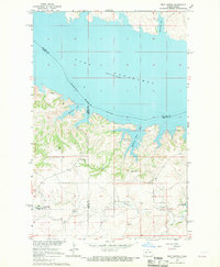
 1967 Sanish SE1969 Print · USGSThe Missouri River breaks in Mountrail County are shown during a transformative era in the late sixties as the reservoir fills the valley. Researchers can trace the Fort Berthold Indian Reservation Boundary and locate Shell Creek Ch and the Little Shell Creek Public Use Area.
 - 1967 Map of Twin Buttes, 1969 Print
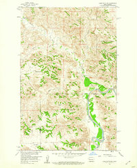
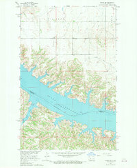
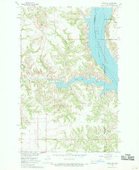
 1967 Twin Buttes1969 Print · USGSThe rising waters of Lake Sakakawea define this part of Mercer and Dunn County during the late 1960s. Researchers can locate numerous local landmarks including St Joseph Ch, Twin Buttes, and several rural cemeteries like Chase Cem.
 - 1967 Map of New Town SW, 1970 Print
 1967 New Town SW1970 Print · USGSMountrail County's shoreline was dramatically reshaped by the mid-1960s as the Missouri River valley transitioned into a vast reservoir. Researchers can trace the Fort Berthold Indian Reservation Boundary and locate local landmarks like Little Shell Ch and the Van Hook State Game Management Area.
 - 1967 Map of Sanish SW, 1970 Print
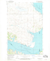
 1967 Sanish SW1970 Print · USGSMcKenzie County's badlands terrain meets the rising waters of the Missouri River in the late sixties. Trace the inundated shoreline of Lake Sakakawea and find landmarks like Blue Butte or the Bear Den Creek Public Use Area.
 - 1967 Map of New Town SE, 1970 Print
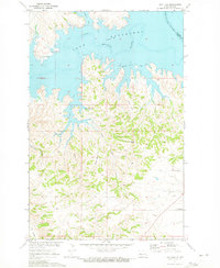
 1967 New Town SE1970 Print · USGSLake Sakakawea and the Missouri River Basin were undergoing significant transformation in the late sixties as reservoir waters reshaped the landscape. Researchers can trace submerged river channels and shoreline features like Independence Point and Lucky Mound Creek Bay.
 - 1970 Map of Mandaree, 1973 Print
 1970 Mandaree1973 Print · USGSMcKenzie and Dunn counties are captured here in the 1970s within the Fort Berthold Indian Reservation. Researchers can trace the development of Mandaree and locate distinctive landforms like Eagle Nest Butte and Phaelens Butte.
 - 1970 Map of Halliday NE, 1973 Print
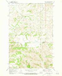
 1970 Halliday NE1973 Print · USGSDunn County at the start of the 1970s shows a landscape shaped by the waters of the Missouri River Basin project. Genealogists and local historians can locate St Johns Cem and trace the winding courses of Hans Creek and Steel Creek.2 unique versions available
 - 1970 Map of Hay Flat, 1973 Print
 1970 Hay Flat1973 Print · USGSDunn County's high plains meet the intricate new shoreline of the Missouri River Basin during the early seventies. Genealogists and local historians can locate Lincoln Memorial Cem and trace the rugged coulees surrounding Old Man Dancing Butte.
 - 1970 Map of String Buttes, 1973 Print
 1970 String Buttes1973 Print · USGSDunn County at the start of the 1970s shows a landscape transformed by the waters of the Missouri River Basin project. Genealogists and local historians can locate Independence Ch and trace the original shorelines of Skunk Creek Bay and Heart Butte.
 - 1970 Map of Lost Bridge, 1973 Print
 1970 Lost Bridge1973 Print · USGSDunn County at the start of the 1970s shows the Missouri River's transformation into a massive reservoir. Trace the rising shoreline of Lake Sakakawea and the wild terrain around North Killdeer Mountain and Corral Creek.2 unique versions available
 - 1970 Map of Figure 4 Ranch, 1973 Print
 1970 Figure 4 Ranch1973 Print · USGSMcKenzie and Dunn counties are captured here in the early 1970s, showing a landscape defined by ranching and the eastern reservation line. Researchers can trace land use through the Figure 4 Ranch, find the rural Faith Ch, and follow the breaks of Bear Den Creek.
Showing maps 1-25 of 73
Top cities of Dunn County
- Killdeer historical maps
- Halliday historical maps
- Dodge historical maps
- Dunn Center historical maps
- Manning historical maps
Frequently asked questions
- What are the different types of historical maps available for Dunn County?
- What is the oldest map of Dunn County?
- Where can I purchase historical maps of Dunn County for my home or office?
- Where can I download high-res historical maps of Dunn County?
- Are there historical topographic maps available for Dunn County?
- Is there historical aerial imagery available for Dunn County?
- Where are historical maps of Dunn County sourced from?