1900s (20th Century) Maps of Buchanan Valley Township, North Dakota
Explore 7 historic maps of Buchanan Valley Township from the 1900s (20th Century). These maps offer a rare glimpse into what life looked like during the 1900s — showing old roads, neighborhoods, homes, and landmarks that have changed or disappeared over time.
Whether you're researching your family's past, planning a metal detecting trip, or studying how Buchanan Valley Township's landscape evolved across the 1900s, these high-resolution maps are a powerful tool for exploring the history of this region.
- Focus on a specific era: All maps on this page are from the 1900s, giving you a focused view of this time period.
- See what’s changed: Compare century-old streets, trails, and buildings to today's modern landscape using overlays and satellite layers.
- Research with precision: Use these maps for genealogy, historical research, land use analysis, or educational projects.
- View, download, or print: Maps are fully viewable online in high resolution, and can be downloaded or printed for your own records.
Start exploring Buchanan Valley Township's history through authentic maps from the 1900s. This is your window into the past.
Buchanan Valley Township, ND maps
(7)- 1954 Map of Bismarck, 1967 Print
 1954 Bismarck1967 Print · USGSBismarck and the Missouri River basin are shown in the mid-1960s as the Oahe Reservoir reshaped the valley. Genealogists can trace family-named landmarks like Dog Tooth Buttes and small prairie settlements such as Fort Yates, Selfridge, and Brisbane.2 unique versions available
 - 1958 Map of Bismarck
 1958 Bismarck1958 Print · USGSCentral North Dakota in the late fifties is defined by the Missouri River and the sprawling Standing Rock Indian Reservation. Genealogists and historians can trace rail-line outposts like Sedalia Siding or explore local landmarks like Saint Anthony and Fort Lincoln State Park/Museum.
 - 1971 Map of Moffit SW, 1973 Print
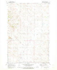 1971 Moffit SW1973 Print · USGSEmmons County land is captured here in the early seventies, dominated by the lingering lines of a nineteenth-century military frontier. Researchers can trace the Old Fort Rice Military Reservation Boundary and locate local landmarks like Rattlesnake Butte and Devils Gulch.
 - 1971 Map of Moffit SE, 1973 Print
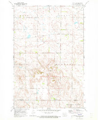
 1971 Moffit SE1973 Print · USGSEmmons County prairie and the community of Hazelton are shown here as they appeared in the early seventies. Researchers can trace the Burlington Northern rail line and locate landmarks like the local Townhall and Dutton Slough.
 - 1971 Map of Moffit NW, 1973 Print
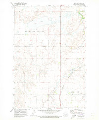
 1971 Moffit NW1973 Print · USGSCentral North Dakota’s rugged breaks and prairie flats are captured here in the early seventies as the railroad and ranching economy shaped the land. Genealogists and local historians can trace family-named landmarks like Black Leg Ranch and the rail siding at Brittin.
 - 1971 Map of Moffit, 1973 Print
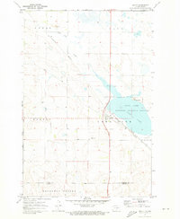 1971 Moffit1973 Print · USGSThe rural landscape around Moffit comes into focus during the early 1970s, as the Burlington Northern and Soo Line railroads cross the prairie. Researchers can trace local landmarks like Moffit Cemetery, Moffit Butte, and the protected waters of Long Lake.
 - 1979 Map of Bismarck, 1980 Print
 1979 Bismarck1980 Print · USGSBismarck and Mandan sit at the heart of this late-century North Dakota survey, where the Missouri River flows past historic frontier outposts. Trace the old Soo Line rail corridors or locate family landmarks near St Anthony, Fort Rice, and Custer Flats.
End of results
Showing maps 1-7 of 7
Top cities near Buchanan Valley Township
- Cannonball District historical maps
- Cannon Ball historical maps
- Sterling historical maps
- Hazelton historical maps
Frequently asked questions
- What are the different types of historical maps available for Buchanan Valley Township?
- What is the oldest map of Buchanan Valley Township?
- Where can I purchase historical maps of Buchanan Valley Township for my home or office?
- Where can I download high-res historical maps of Buchanan Valley Township?
- Are there historical topographic maps available for Buchanan Valley Township?
- Is there historical aerial imagery available for Buchanan Valley Township?
- Where are historical maps of Buchanan Valley Township sourced from?