Old Maps of Foster County, North Dakota for Hiking & Exploration
Hike through history with 152 historic maps of Foster County. Explore old trails, ghost towns, and forgotten backroads — perfect for outdoor adventurers and local explorers.
- Rediscover forgotten places: Map out old mining camps, roads, and footpaths that no longer exist on modern maps.
- Layer with modern tools: Combine with LiDAR or satellite views to plan hikes through historical terrain.
- Made for exploration: Popular among hikers, overlanders, and local history lovers.
Use these maps to find adventure and explore the hidden past of Foster County.
Foster County, ND maps
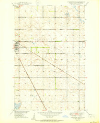
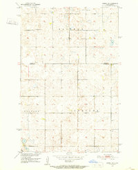
(152)- 1900 Map of Pingree
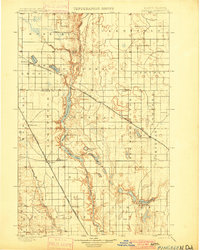 1900 Pingree1900 Print · USGSStutsman and Foster counties come alive in the final years of the nineteenth century as railroads began to stitch together the vast prairie. Researchers can trace the early rail stops at Pingree, Kensal, and Buchanan alongside the waters of Jim Lake and Spiritwood Lake.2 unique versions available
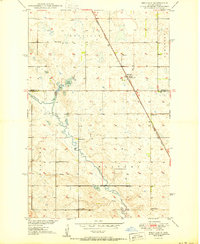
 - 1944 Map of Brantford, 1963 Print
 1944 Brantford1963 Print · USGSEddy and Foster Counties appear here during the mid-1940s, showing a prairie landscape shaped by the Great Northern railroad and the James River. Researchers can locate numerous rural schoolhouses and church sites like Kvernes Ch and Columbia Sch.
 - 1946 Map of Brantford
 1946 Brantford1946 Print · USGSCentral North Dakota’s prairie landscape is captured here in the mid-1940s, showing a rural economy tied to the Great Northern rail line. Genealogists can trace family footprints through numerous township schools and landmarks like Kvernes Ch or the Grace City Cem.2 unique versions available
 - 1948 Map of New Rockford
 1948 New Rockford1948 Print · USGSNew Rockford and the surrounding prairies are captured here in the years following the war. Genealogists and historians can trace the foundations of local townships through landmarks like Barlow Cem, Guptill, and the Rockford Consolidated Sch.2 unique versions available
 - 1948 Map of Cathay
 1948 Cathay1948 Print · USGSWells County was a network of rail-towns and prairie parishes in the years following the war. Researchers can trace the family legacies of Cathay and Bremen, identifying rural landmarks like St Josephs Ch, Lake View Cem, and numerous one-room schoolhouses.2 unique versions available
 - 1948 Map of Carrington
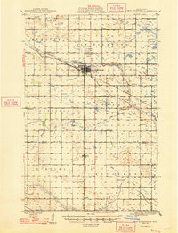
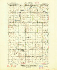
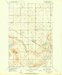
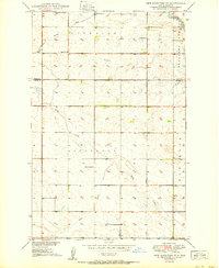
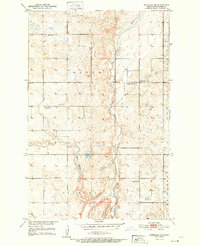
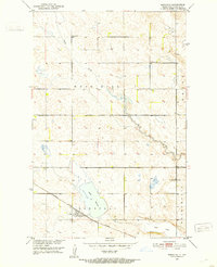
 1948 Carrington1948 Print · USGSCarrington and the surrounding Foster County prairies are captured here in the late 1940s at a peak of rail-based agriculture. Genealogists and local historians can locate dozens of numbered country schools, such as School No 1 and School No 4, and trace the path of the Northern Pacific railroad.
 - 1949 Map of Cathay SE
 1949 Cathay SE1949 Print · USGSWells County and Foster County farmland is captured here in the late 1940s, centered on the rail-driven hamlet of Lemert. Genealogists can locate family landmarks like Stavanger Ch, the Norwegian Lutheran Cem, and numerous rural schools.2 unique versions available
 - 1949 Map of Grace City, 1977 Print
 1949 Grace City1977 Print · USGSGrace City and the surrounding prairie of Foster County are shown here in the late 1940s at the intersection of rail and river. Researchers can locate family landmarks like the Grace City Cem, Lutheran Cem, and the path of the Great Northern railroad.
 - 1950 Map of Carrington East
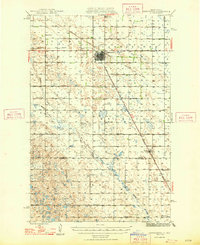
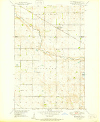
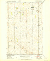
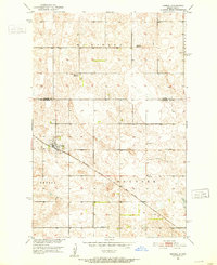
 1950 Carrington East1950 Print · USGSFoster County at the start of the 1950s shows a landscape defined by the intersection of major rail lines and rural township schools. Trace the junction of the Northern Pacific and find local landmarks like School No 1 and Carrington Cem.2 unique versions available
 - 1950 Map of Melville
 1950 Melville1950 Print · USGSThe North Dakota prairie near the Foster and Stutsman County line is captured here just after the war. Local historians can trace the rural school system through School No 1 and School No 3, alongside the Northern Pacific rail siding at Melville.2 unique versions available
 - 1950 Map of Grace City
 1950 Grace City1950 Print · USGSGrace City sits at a vital rail and river crossing in Foster County during the mid-century. Researchers can trace the Great Northern tracks past Grace City Cem or locate family plots at the Lutheran Cem near the James River.
 - 1950 Map of Brantford
 1950 Brantford1950 Print · USGSFoster County prairie life is centered on the railroad siding of Brantford at the midpoint of the twentieth century. Genealogists and local historians can locate several rural landmarks including Kvernes Ch, the Brantford Cem, and School No 3 along the James River.
 - 1950 Map of New Rockford SE
 1950 New Rockford SE1950 Print · USGSMid-century Foster and Eddy County come to life in this survey of the North Dakota plains during the Missouri River Basin development. Genealogists and local historians can locate early schoolhouses like Estabrook Sch and trace the original paths of Kelly Creek and the James River.
 - 1950 Map of Barlow
 1950 Barlow1950 Print · USGSMid-century Foster County is captured here at a time when the rural schoolhouse and steam-era rail lines still defined the Dakota prairie. Genealogists and historians can trace the foundations of Barlow and Guptill, locating landmarks like Barlow Cem and several numbered schoolhouses.2 unique versions available
 - 1950 Map of Carrington SW
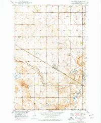
 1950 Carrington SW1950 Print · USGSMid-century Stutsman County is defined here by its rural schoolhouses and the winding course of Pipestem Creek. Genealogists and local historians can locate early family landmarks like Pleasant Valley Ch, Calvary Cem, and the high point at Mount Moriah.2 unique versions available
 - 1950 Map of Carrington West
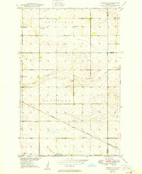
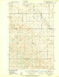
 1950 Carrington West1950 Print · USGSCarrington and the surrounding Foster County prairie are shown here during the mid-century peak of the rail-and-agriculture era. Local researchers can pinpoint rural landmarks like Town Hall, School No 2, and the early Landing Field near the junction of two major railroads.2 unique versions available
 - 1951 Map of Bordulac NE
 1951 Bordulac NE1951 Print · USGSFoster County prairie life is documented here during the early fifties, showing the rural township structure before modern consolidation. Family historians can locate schools like School No 3, the Brethren Cem, and landmarks along the James River.
 - 1951 Map of Arrowwood Lake
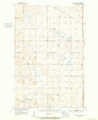
 1951 Arrowwood Lake1951 Print · USGSStutsman County, North Dakota, is captured here in the early fifties during the active development of the Missouri River Basin. Genealogists and historians can trace the fading rural school system through School No 2 (Abandoned) and locate the Refuge Headquarters along Arrowwood Lake.
 - 1951 Map of Kensal, 1952 Print
 1951 Kensal1952 Print · USGSThe North Dakota prairie around the mid-century shows a landscape of distributed rural schoolhouses and rail-dependent settlements. Genealogists and local historians can locate Kensal, St Johns Cem, and several local schools like McKinley Sch No 2.
 - 1951 Map of Kensal NW, 1952 Print
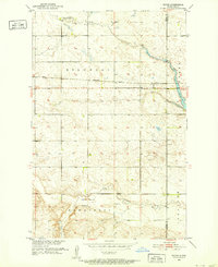
 1951 Kensal NW1952 Print · USGSFoster County’s agricultural heartland is documented here just after the war, showing a rural landscape defined by one-room schoolhouses and the rail line. Researchers can locate vanished landmarks like Campbell Sch No 4 or trace the path of the Great Northern railroad.
 - 1951 Map of Dover, 1952 Print
 1951 Dover1952 Print · USGSWells County ranching and rail life are preserved here in the early fifties as the Missouri River Basin program took shape. Researchers can trace the Northern Pacific line through Dover, identifying the Bilodeau Sch and Brethren Cem.2 unique versions available
 - 1951 Map of Bordulac SW, 1953 Print
 1951 Bordulac SW1953 Print · USGSNorth Dakota's prairie landscape is captured here in the early fifties, showing the rural crossroads of Stutsman and Foster Counties. Researchers can trace early transport routes like the Northern Pacific railroad and locate local landmarks such as Millers Spur and Arrowwood Sch.
 - 1951 Map of Kensal SE, 1953 Print
 1951 Kensal SE1953 Print · USGSThe rural townships of Stutsman County are captured here in the early fifties, documenting the agricultural grid and township school system. Researchers can locate local landmarks like the Eastman Cem, School No 3, and the Corinne Sch.2 unique versions available
 - 1951 Map of Bordulac, 1953 Print
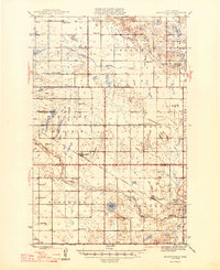
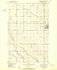
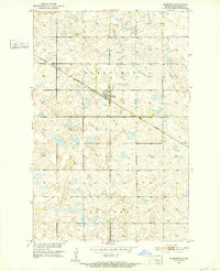
 1951 Bordulac1953 Print · USGSBordulac and the surrounding Foster County prairie are captured here in the early fifties, showing the vital rail-and-farm network. Genealogists can locate family lands across Rose Hill and Bucephalia or find long-standing landmarks like St Johns Ch and School No 3.
 - 1951 Map of Glenfield, 1982 Print
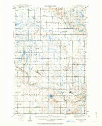
 1951 Glenfield1982 Print · USGSMid-century Foster County comes into focus in this survey of the prairie landscape during the early 1950s. Genealogists and local historians can trace the hub of Glenfield, the Great Northern rail line, and rural landmarks like School No 1.
Showing maps 1-25 of 152
Top cities of Foster County
- Carrington historical maps
- Glenfield historical maps
- Bordulac historical maps
- McHenry historical maps
- Grace City historical maps
- Melville historical maps
Frequently asked questions
- What are the different types of historical maps available for Foster County?
- What is the oldest map of Foster County?
- Where can I purchase historical maps of Foster County for my home or office?
- Where can I download high-res historical maps of Foster County?
- Are there historical topographic maps available for Foster County?
- Is there historical aerial imagery available for Foster County?
- Where are historical maps of Foster County sourced from?