
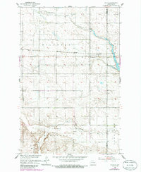
1951 Map of Dover
USGS Topo · Published 1952About this map
Pipestem Creek meanders through this portion of Wells County, shaping a landscape defined by prairie potholes and glacial till. The small settlement of Dover serves as a local hub along the Northern Pacific railroad line, which cuts horizontally across the terrain. This 1951 survey reveals the agricultural layout of the Missouri River Basin development program, where rural life centered around institutions like the Bilodeau Sch and the Brethren Cem.
Find a feature on this map
14 named features on this map. Tap any name to fly to it.
Don’t see what you’re looking for? This feature index may not catch every label — zoom into the map to look around manually.
Map Details
Editions of this 1951 Dover Map
2 editions found
Other maps of this area

1948 · New Rockford
USGS Topo · 1:62,500

1948 · Cathay
USGS Topo · 1:62,500

1948 · Carrington
USGS Topo · 1:62,500

1949 · Cathay
USGS Topo · 1:24,000

1949 · Cathay SE
USGS Topo · 1:24,000

1950 · Barlow
USGS Topo · 1:24,000

1950 · Carrington SW
USGS Topo · 1:24,000

1950 · Carrington West
USGS Topo · 1:24,000

1951 · Sykeston
USGS Topo · 1:24,000

1952 · New Rockford
USGS Topo · 1:250,000