
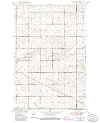
1949 Map of Cathay SE
USGS Topo · Published 1949About this map
Minneapolis St Paul And Sault Ste Marie railroad tracks cut diagonally across this prairie landscape, anchoring the small settlement of Lemert. The terrain is defined by the glacial depressions and drainage patterns of Rocky Run and Pipestem Creek, which meander through townships including Fairville and Woodward. Local genealogy and community life are well-represented by the Norwegian Lutheran Cem and Stavanger Ch in the northwest corner, along with several rural schoolhouses such as School No 1 and School No 2 that served the surrounding farmsteads. These landmarks reflect the mid-century agricultural and religious character of Wells County before the consolidation of rural school districts.
Find a feature on this map
19 named features on this map. Tap any name to fly to it.
Don’t see what you’re looking for? This feature index may not catch every label — zoom into the map to look around manually.
Map Details
Editions of this 1949 Cathay SE Map
2 editions found
Other maps of this area

1948 · New Rockford
USGS Topo · 1:62,500

1948 · Cathay
USGS Topo · 1:62,500

1948 · Carrington
USGS Topo · 1:62,500

1948 · Bremen
USGS Topo · 1:24,000

1949 · Bremen
USGS Topo · 1:24,000

1949 · Cathay
USGS Topo · 1:24,000

1949 · Munster
USGS Topo · 1:24,000

1950 · New Rockford
USGS Topo · 1:24,000

1950 · Barlow
USGS Topo · 1:24,000

1950 · Carrington West
USGS Topo · 1:24,000