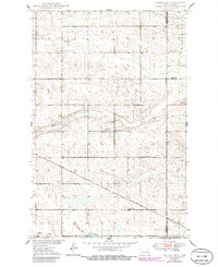
1949 Map of Cathay SE
USGS Topo · Published 1986About this map
Fairville and Woodward townships define this central North Dakota prairie landscape, characterized by the winding path of Rocky Run and Pipestem Creek. The map documents a sparse but vital community network established during the mid-20th century, anchored by the settlement of Lemert and the Soo Line railroad which cuts diagonally across the southern sections. Local heritage is deeply rooted in the rural infrastructure, evidenced by the Norwegian Lutheran Cem and Stavanger Ch located in the northwest. These cultural landmarks, alongside School No 3, provide a clear picture of the early social organization of Wells County before more modern agricultural shifts occurred. The topography is marked by numerous small depressions and drainage patterns typical of this region, with a local Gravel Pit indicating the small-scale extractive industry of the era.
Find a feature on this map
13 named features on this map. Tap any name to fly to it.
Don’t see what you’re looking for? This feature index may not catch every label — zoom into the map to look around manually.
Map Details
Editions of this 1949 Cathay SE Map
2 editions found
Other maps of this area

1948 · New Rockford
USGS Topo · 1:62,500

1948 · Cathay
USGS Topo · 1:62,500

1948 · Carrington
USGS Topo · 1:62,500

1948 · Bremen
USGS Topo · 1:24,000

1949 · Bremen
USGS Topo · 1:24,000

1949 · Cathay
USGS Topo · 1:24,000

1949 · Cathay SE
USGS Topo · 1:24,000

1949 · Munster
USGS Topo · 1:24,000

1950 · New Rockford
USGS Topo · 1:24,000

1950 · Barlow
USGS Topo · 1:24,000