Old Maps of Emerado, North Dakota for Metal Detecting
Plan your next treasure hunt with 12 historic maps of Emerado. Find old homesites, ghost towns, trails, and gathering spots that may be lost to time — perfect for identifying promising metal detecting locations.
- Locate forgotten sites: Uncover places like long-lost settlements, abandoned rail lines, or gathering spots.
- Plan better hunts: Use map overlays combined with LiDAR or satellite views to narrow in on historically rich areas.
- Made for detectorists: Thousands of hobbyists use these maps to discover relics, coins, and hidden history.
Use these historic maps to boost your research and find new opportunities beneath the surface of Emerado.
Emerado, ND maps
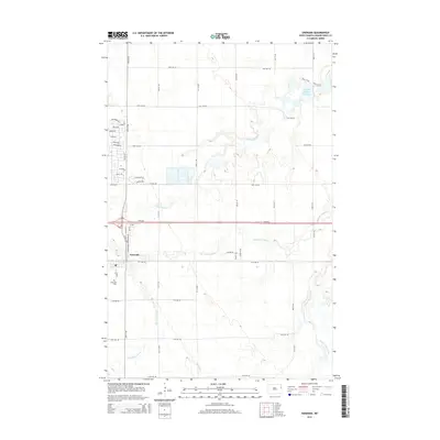
(12)- 1934 Map of Emerado
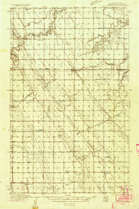 1934 Emerado1934 Print · USGSThe Red River Valley prairie is captured here in the mid-1930s, showing a landscape of strictly gridded farmsteads and rural townships. Genealogists can trace family connections through numerous local landmarks like Mc Cray Sch, Blooming Town Hall, and the Washington Ch.4 unique versions available
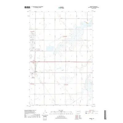
 - 1936 Map of Emerado
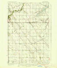 1936 Emerado1936 Print · USGSGrand Forks County agriculture thrived in the mid-1930s as the railroad and new highways bridged the prairie. Genealogists can locate family-named landmarks and rural hubs like the Blooming Town Hall, Gilbert Sch, and Emerado Evangelical Ch.3 unique versions available
 - 1952 Map of Grand Forks, 1967 Print
 1952 Grand Forks1967 Print · USGSThe Red River Valley in the early fifties is shown here at the height of its rail-and-river agricultural economy. Researchers can locate small-town landmarks like the Pleasant View School, the Immanuel Lutheran Church, and trace the path of the Soo Line Railroad.3 unique versions available
 - 1956 Map of Grand Forks
 1956 Grand Forks1956 Print · USGSThe Red River Valley in the mid-fifties is captured here as a thriving corridor of grain elevators and rail-linked towns along the North Dakota and Minnesota border. Researchers can trace historic church sites like Immanuel Lutheran Church, vanished rail stops at Tilde Junction, and the boundaries of the White Earth Indian Reservation.
 - 1963 Map of Emerado, 1964 Print
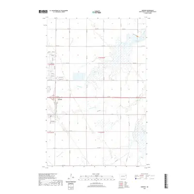
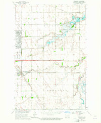 1963 Emerado1964 Print · USGSThe Red River Valley's transition into the Cold War era is evident here, showing the growth of Grand Forks Air Force Base alongside traditional farming life. Genealogists can locate Emerado Cem and rural landmarks like Oakville Sch or Ascension Ch.2 unique versions available
 - 1966 Map of Grand Forks
 1966 Grand Forks1966 Print · USGSThe Red River Valley in the mid-sixties shows a landscape shaped by rail-line commerce and complex water management. Genealogists and historians can trace rail-side towns like Emerado and Hunter or locate rural landmarks like the Pleasant View Church.
 - 1985 Map of Grand Forks
 1985 Grand Forks1985 Print · USGSThe Red River Valley in the mid-1980s was a landscape of deep-rooted agriculture and rising military significance. Genealogists and researchers can trace the rail-tied development of towns like Larimore and Northwood alongside major landmarks like Grand Forks Air Force Base and Turtle River State Park.2 unique versions available
 - 2011 Map of Emerado, 2011 Print
 2011 Emerado2011 Print · USGSCovers Emerado, including Grand Forks County, United States, and other nearby areas
 - 2014 Map of Emerado, 2014 Print
 2014 Emerado2014 Print · USGSCovers Emerado, including Grand Forks County, United States, and other nearby areas
 - 2018 Map of Emerado, 2018 Print
 2018 Emerado2018 Print · USGSCovers Emerado, including Grand Forks County, United States, and other nearby areas
 - 2020 Map of Emerado, 2020 Print
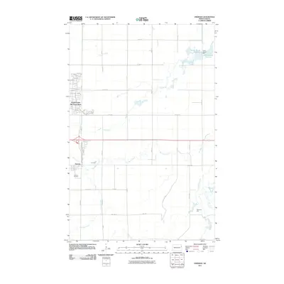
 2020 Emerado2020 Print · USGSCovers Emerado, including Grand Forks County, United States, and other nearby areas
 - 2024 Map of Emerado, 2024 Print
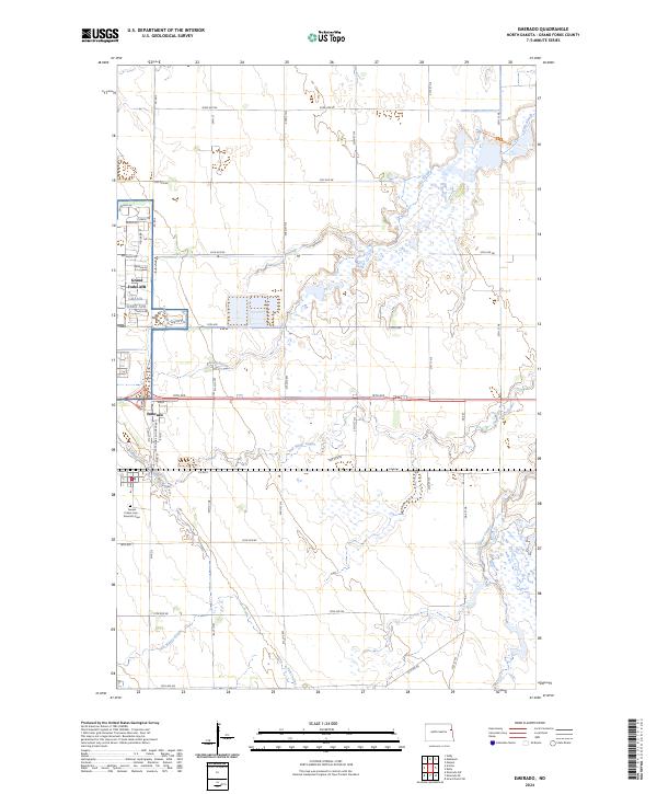 2024 Emerado2024 Print · USGSGrand Forks County is shown at a moment of transition between military infrastructure and prairie conservation. Genealogists and local historians can trace the streets of Grand Forks AFB or locate family sites at Sunset Prairie Cem - Emerado Cem and Emerado.
End of results
Showing maps 1-12 of 12
Top cities near Emerado
- Grand Forks historical maps
- Mekinock historical maps
- Northwood historical maps
- Manvel historical maps
- Arvilla historical maps
- Gilby historical maps
Frequently asked questions
- What are the different types of historical maps available for Emerado?
- What is the oldest map of Emerado?
- Where can I purchase historical maps of Emerado for my home or office?
- Where can I download high-res historical maps of Emerado?
- Are there historical topographic maps available for Emerado?
- Is there historical aerial imagery available for Emerado?
- Where are historical maps of Emerado sourced from?