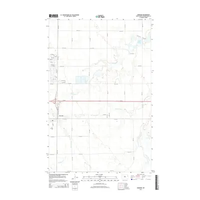
2014 Map of Emerado
USGS Topo · Published 2014About this map
The town of Emerado serves as the focal point for this eastern North Dakota landscape, where the flat Red River Valley topography is interrupted by a complex network of glacial drainage features. The hydrology of the region is notably bifurcated, with Salt Water Coulee, Salt Coulee, and Fresh Water Coulee defining the local drainage patterns. To the northeast, the Kellys Slough Reservoir and the expansive Kelly Slough indicate a unique wetland environment, managed in part by features such as the Pool 5 Trail and Pool 2 Trail. The map details the residential expansion of Emerado with numerous named streets such as Steen Blvd, Hickam Dr, and Sunflake Cir, while the Emerado Cem on the southwestern edge of town provides a specific point of interest for those researching local family history.
Find a feature on this map
46 named features on this map. Tap any name to fly to it.
Don’t see what you’re looking for? This feature index may not catch every label — zoom into the map to look around manually.
Map Details
Editions of this 2014 Emerado Map
This is the sole edition of this map. No revisions or reprints were ever made.
Other maps of this area

1926 · Ardoch
USGS Topo · 1:62,500

1934 · Emerado
USGS Topo · 1:48,000

1934 · Grand Forks
USGS Topo · 1:62,500

1936 · Emerado
USGS Topo · 1:62,500

1938 · Grand Forks
USGS Topo · 1:62,500

1952 · Grand Forks
USGS Topo · 1:250,000

1952 · Thief River Falls
USGS Topo · 1:250,000

1956 · Thief River Falls
USGS Topo · 1:250,000

1956 · Grand Forks
USGS Topo · 1:250,000

1957 · Thief River Falls
USGS Topo · 1:250,000