1970s Maps of Watford City, North Dakota
Explore 2 historic maps of Watford City from the 1970s. These maps offer a rare glimpse into what life looked like during the 1970s — showing old roads, neighborhoods, homes, and landmarks that have changed or disappeared over time.
Whether you're researching your family's past, planning a metal detecting trip, or studying how Watford City's landscape evolved across the 1970s, these high-resolution maps are a powerful tool for exploring the history of this region.
- Focus on a specific era: All maps on this page are from the 1970s, giving you a focused view of this time period.
- See what’s changed: Compare century-old streets, trails, and buildings to today's modern landscape using overlays and satellite layers.
- Research with precision: Use these maps for genealogy, historical research, land use analysis, or educational projects.
- View, download, or print: Maps are fully viewable online in high resolution, and can be downloaded or printed for your own records.
Start exploring Watford City's history through authentic maps from the 1970s. This is your window into the past.
Watford City, ND maps
(2)- 1978 Map of Schafer, 1979 Print
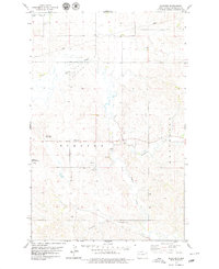 1978 Schafer1979 Print · USGSMcKenzie County during the late seventies reveals a landscape of winding creek beds and expanding municipal infrastructure. Researchers can trace the layout of Schafer, locate the Schafer Cem, and see early footprints of the Watford City Golf Course.
 - 1978 Map of Watford City, 1979 Print
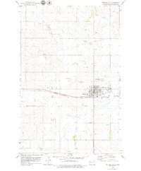 1978 Watford City1979 Print · USGSIn the late 1970s, this North Dakota hub shows the intersection of the Burlington Northern railroad and the growing infrastructure of Watford City. Researchers can trace the layout of the Watford City Municipal Airport and numerous local Gravel Pits.
End of results
Showing maps 1-2 of 2
Top cities near Watford City
Frequently asked questions
- What are the different types of historical maps available for Watford City?
- What is the oldest map of Watford City?
- Where can I purchase historical maps of Watford City for my home or office?
- Where can I download high-res historical maps of Watford City?
- Are there historical topographic maps available for Watford City?
- Is there historical aerial imagery available for Watford City?
- Where are historical maps of Watford City sourced from?