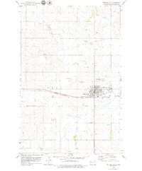
1978 Map of Watford City
USGS Topo · Published 1979About this map
Watford City serves as the focal point of this late 1970s McKenzie County survey, situated at a vital transportation junction where the Burlington Northern railroad and regional highways converge. The town's infrastructure at this time is detailed, showing the Watford City Municipal Airport, a Radio Tower, and various Well locations. The surrounding landscape is defined by the drainage patterns of Tobacco Garden Creek, Cherry Creek, and Spring Creek, which cut through the North Dakota plains. Evidence of local industry is clear from the numerous Gravel Pits and Gravel Pit markings scattered across the township lines. The map also documents the municipal expansion of the era, including a Trailer Park on the northern edge of the city and various Sewage Disposal Ponds required for the growing community.
Find a feature on this map
20 named features on this map. Tap any name to fly to it.
Don’t see what you’re looking for? This feature index may not catch every label — zoom into the map to look around manually.
Map Details
Editions of this 1978 Watford City Map
This is the sole edition of this map. No revisions or reprints were ever made.
Other maps of this area

1953 · Watford City
USGS Topo · 1:250,000

1957 · Watford City
USGS Topo · 1:250,000

1958 · Stocke Butte
USGS Topo · 1:24,000

1958 · Tepee Buttes
USGS Topo · 1:24,000

1959 · Lone Butte NW
USGS Topo · 1:24,000

1967 · Watford City
USGS Topo · 1:250,000

1978 · Watford City NW
USGS Topo · 1:24,000

1978 · Arnegard
USGS Topo · 1:24,000

1978 · Schafer
USGS Topo · 1:24,000

1978 · Watford City NE
USGS Topo · 1:24,000