1900s (20th Century) Maps of Pierce County, North Dakota
Explore 58 historic maps of Pierce County from the 1900s (20th Century). These maps offer a rare glimpse into what life looked like during the 1900s — showing old roads, neighborhoods, homes, and landmarks that have changed or disappeared over time.
Whether you're researching your family's past, planning a metal detecting trip, or studying how Pierce County's landscape evolved across the 1900s, these high-resolution maps are a powerful tool for exploring the history of this region.
- Focus on a specific era: All maps on this page are from the 1900s, giving you a focused view of this time period.
- See what’s changed: Compare century-old streets, trails, and buildings to today's modern landscape using overlays and satellite layers.
- Research with precision: Use these maps for genealogy, historical research, land use analysis, or educational projects.
- View, download, or print: Maps are fully viewable online in high resolution, and can be downloaded or printed for your own records.
Start exploring Pierce County's history through authentic maps from the 1900s. This is your window into the past.
Pierce County, ND maps
(58)- 1940 Map of Aylmer
 1940 Aylmer1940 Print · USGSPierce and Sheridan Counties come into focus just before the war, showing the peak of the North Dakota rail-and-prairie economy. Genealogists can pinpoint exact locations for family landmarks like Hillsdale Ch, White Sch, and Martin Cem.3 unique versions available
 - 1941 Map of Selz
 1941 Selz1941 Print · USGSPierce and Wells Counties are shown in the late thirties as a landscape of rural school districts and bustling rail towns. Genealogists can locate family landmarks such as the Sheyenne River Academy, St Anthony Cem, and dozens of numbered country schools.2 unique versions available
 - 1950 Map of Wellsburg
 1950 Wellsburg1950 Print · USGSThe mid-century plains of Wells County are defined here by the winding Sheyenne River and the critical Great Northern rail corridor. Genealogists can locate several rural landmarks including Wellsburg, Odessa Sch No 1, and Butte De Morale.
 - 1951 Map of Harvey
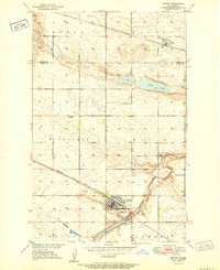 1951 Harvey1951 Print · USGSMid-century Wells County is captured here during a time of bustling rail commerce and established township life. Genealogists and local historians can trace family roots through several dedicated sites, including St Anthony Cem, Sunnyside Cem, and the Sheyenne River Academy.2 unique versions available
 - 1951 Map of Martin, 1952 Print
 1951 Martin1952 Print · USGSThe rural prairie landscape surrounding Martin is shown in detail during the early fifties as the railroad connected these remote townships. Genealogists can trace family roots through sites like Reform Cem, Hillsdale Ch, and several local schoolhouses.2 unique versions available
 - 1951 Map of Selz NE, 1952 Print
 1951 Selz NE1952 Print · USGSBenson and Pierce Counties are captured here in the early fifties, showing a rural landscape defined by the winding North Fork Sheyenne River. Genealogists and local historians can trace schoolhouse locations like Strasburg Sch No 2 or visit the site of St Boniface Cem.
 - 1951 Map of Anamoose SW, 1953 Print
 1951 Anamoose SW1953 Print · USGSSheridan and McHenry counties appear here in the early fifties as a landscape of prairie potholes and isolated farmsteads. Researchers can locate early country schools like Georgetown Sch No 4 and burial sites including Berlin Cem and Baptist Cem.
 - 1951 Map of Selz NW, 1953 Print
 1951 Selz NW1953 Print · USGSPierce County’s rural landscape is captured here in the early fifties, showing a network of townships and prairie school districts. Genealogists can locate family landmarks like the Strasburg Cem, Eden Valley Ch, and New German School No 4.2 unique versions available
 - 1952 Map of New Rockford, 1968 Print
 1952 New Rockford1968 Print · USGSThe North Dakota prairie during the mid-1950s was a landscape of rail-dependent farm towns and vast wildlife refuges. Genealogists and historians can trace the foundations of local communities at Fort Totten Indian Agenc, Concordia Lutheran Church, and the Bowdon Country Church and Cemetery.3 unique versions available
 - 1953 Map of Devils Lake, 1968 Print
 1953 Devils Lake1968 Print · USGSNorth Dakota's northern plains are captured here in the mid-fifties, showing a landscape of rail-fed grain elevators and prairie wetlands. Genealogists can locate family landmarks like Rose Hill School, Hurricane Lake Church, and the Turtle Mountain Indian Reservation.3 unique versions available
 - 1954 Map of Tunbridge, 1956 Print
 1954 Tunbridge1956 Print · USGSPierce County farming communities and the prairie landscape appear in high detail during the mid-1950s. Genealogists can locate Tunbridge Ch, Bethel Ch, and rural schoolhouses like Brazil School No 1 alongside the Great Northern railroad.2 unique versions available
 - 1954 Map of Towner NE, 1956 Print
 1954 Towner NE1956 Print · USGSThe rural prairie of McHenry and Pierce Counties comes into focus in the 1950s, showing a landscape defined by scattered farmsteads and glacial wetlands. Researchers can locate vanished rural landmarks like Norman School No 2 and Dewey School No 3 near the shores of Horseshoe Lake.
 - 1954 Map of Overly SE, 1956 Print
 1954 Overly SE1956 Print · USGSThe Rolette and Pierce County borderlands in the mid-fifties reveal a classic North Dakota prairie landscape of section-line roads and rural schoolhouses. Researchers can trace the locations of the Zion Cem, Banner School No 14, and the winding course of Wolf Creek.
 - 1954 Map of Barton, 1956 Print
 1954 Barton1956 Print · USGSThe northern Great Plains landscape around Barton is captured here during the mid-fifties, showing the intersection of three counties. Researchers can trace the path of the Great Northern railroad and locate rural landmarks like Pleasant Valley Sch.2 unique versions available
 - 1954 Map of Berwick, 1956 Print
 1954 Berwick1956 Print · USGSNorth Dakota's prairie landscape in the mid-fifties is defined here by its scattered rural schoolhouses and the Great Northern rail line. Genealogists can trace family roots through landmarks like Zion Ch and the German Sch No 2.
 - 1954 Map of Round Lake, 1956 Print
 1954 Round Lake1956 Print · USGSPierce County’s prairie pothole region comes to life in this mid-fifties survey of the Barton area. Genealogists and historians can locate three distinct schoolhouses, including Dewey Sch No 4, alongside the Southwest Barton Cem and Marker Ch.
 - 1954 Map of Rugby NW, 1956 Print
 1954 Rugby NW1956 Print · USGSPierce County prairie life is captured here in the mid-fifties, just northwest of the geographic center of the continent. Genealogists can trace rural school districts like Burke Sch No 3 and locate family landmarks near Goose Lake or the Torgerson hills.
 - 1954 Map of Leverich, 1956 Print
 1954 Leverich1956 Print · USGSPierce County farming and transportation are captured here in the mid-fifties, centered on the Great Northern tracks. Genealogists can trace rural education at Hendrickson School No 3 or locate the settlement of Leverich.
 - 1954 Map of Willow City, 1956 Print
 1954 Willow City1956 Print · USGSNorth Dakota's northern prairie is captured in the mid-1950s as the Great Northern rail line still tied these small farming townships together. Genealogists and local historians can locate Immanuel Ch, Notre Dame Cem, and rural schoolhouses like Norman Sch No 1.
 - 1954 Map of Towner SE, 1956 Print
 1954 Towner SE1956 Print · USGSMcHenry County prairie life in the mid-fifties is centered on the rail-side settlement of Berwick. Researchers can trace the Great Northern rail line and locate local landmarks like the Berwick Cem near the Pierce Co line.
 - 1954 Map of Minot, 1964 Print
 1954 Minot1964 Print · USGSNorth Dakota's northern borderlands are captured here in the mid-fifties, showing a landscape defined by the winding Souris River and the rise of the Turtle Mountains. Genealogists can locate family-named sidings like Hurd Siding and Truro Siding alongside the vital Great Northern rail lines.3 unique versions available
 - 1954 Map of McClusky, 1968 Print
 1954 McClusky1968 Print · USGSCentral North Dakota was undergoing a profound transformation in the fifties as the newly formed Lake Sakakawea reshaped the Missouri River valley. Genealogists and historians can trace rail-town development along the Soo Line and locate historic markers like Garrison Dam or the Lewis and Clark Trail.3 unique versions available
 - 1955 Map of Rugby, 1956 Print
 1955 Rugby1956 Print · USGSRugby and the surrounding North Dakota prairies are captured here in the mid-fifties at the geographical heart of the continent. Genealogists can trace rural school districts and family landmarks like Little Flower Cem and the Lincoln Sch No 1 site.2 unique versions available
 - 1955 Map of Rolette SW, 1956 Print
 1955 Rolette SW1956 Print · USGSThe North Dakota prairie along the Rolette and Pierce county line is captured here in the mid-fifties during the development of the Missouri River Basin. Genealogists and local historians can locate rural landmarks like Dewey Sch No 2 and Gilmore Lake among the many glacial potholes.
 - 1956 Map of New Rockford
 1956 New Rockford1956 Print · USGSMid-century central North Dakota is captured here as a landscape of prairie rail towns and vast wildlife refuges. Trace family roots at the Bowdon Country Church and Cemetery or locate the old St Michael Mission School and Fort Totten.
Showing maps 1-25 of 58
Top cities of Pierce County
Frequently asked questions
- What are the different types of historical maps available for Pierce County?
- What is the oldest map of Pierce County?
- Where can I purchase historical maps of Pierce County for my home or office?
- Where can I download high-res historical maps of Pierce County?
- Are there historical topographic maps available for Pierce County?
- Is there historical aerial imagery available for Pierce County?
- Where are historical maps of Pierce County sourced from?