
1951 Map of Selz NW
USGS Topo · Published 1953About this map
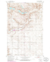
The North Fork Sheyenne River meanders through the heart of this Pierce County landscape, defining the rural character of the early 1950s. The region is marked by a grid of school districts and townships, including Alexander, Truoman, and Hagel. This survey documents a social geography anchored by local education, featuring distributed schoolhouses such as Strasburg School No 4, Sampson School No 1, and Odessa School No 3. In the southern portion of the map, the Great Northern railroad provides a critical transportation link for the agrarian community. Water features like Sandy Lakes and Lesmeister Lake are surrounded by terrain scattered with several Gravel Pits, indicating local industry. Spiritual and memorial life is centered at the Eden Valley Ch and the Strasburg Cem, which remain as vital touchstones for family historians and genealogists.
Find a feature on this map
18 named features on this map. Tap any name to fly to it.
Don’t see what you’re looking for? This feature index may not catch every label — zoom into the map to look around manually.
Map Details
Editions of this 1951 Selz NW Map
2 editions found
Other maps of this area

1940 · Aylmer
USGS Topo · 1:62,500

1941 · Selz
USGS Topo · 1:62,500

1950 · Wellsburg
USGS Topo · 1:24,000
1951 · Harvey
USGS Topo · 1:24,000

1951 · Martin
USGS Topo · 1:24,000

1951 · Selz NE
USGS Topo · 1:24,000

1952 · New Rockford
USGS Topo · 1:250,000

1953 · Devils Lake
USGS Topo · 1:250,000

1954 · Minot
USGS Topo · 1:250,000

1954 · McClusky
USGS Topo · 1:250,000