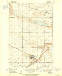
1951 Map of Harvey
USGS Topo · Published 1951About this map
Harvey serves as the primary hub of this North Dakota landscape, where the Minneapolis St Paul and Sault Ste Marie line meets the banks of the Sheyenne River. The map reveals a post-war rural infrastructure defined by township schools and small-town religious sites, such as the Sheyenne River Academy and several family-named burial grounds like Sunnyside Cem and Cooke Cem. To the north, the village of Selz sits along the Great Northern railroad, surrounded by the high-elevation terrain of Truman and Hagel. This survey provides a distinct look at the mid-century agricultural organization of the region, including rural education outposts like Wells Sch No 1 and Hillsdale Sch No 31 and the local importance of water bodies like Goose Lake.
Find a feature on this map
24 named features on this map. Tap any name to fly to it.
Don’t see what you’re looking for? This feature index may not catch every label — zoom into the map to look around manually.
Map Details
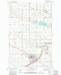
Editions of this 1951 Harvey Map
2 editions found
Other maps of this area

1940 · Aylmer
USGS Topo · 1:62,500

1941 · Selz
USGS Topo · 1:62,500

1945 · Manfred
USGS Topo · 1:62,500

1946 · Sheyenne Lake
USGS Topo · 1:48,000

1947 · Sheyenne Lake
USGS Topo · 1:62,500

1948 · Manfred
USGS Topo · 1:62,500

1950 · Wellsburg
USGS Topo · 1:24,000

1950 · Manfred NW
USGS Topo · 1:24,000

1950 · Sheyenne Lake NE
USGS Topo · 1:24,000

1950 · Manfred
USGS Topo · 1:24,000