Old Maps of Greene, North Dakota for Academic Research
Study the evolution of Greene with 9 high-resolution historic maps. Whether you're teaching, researching, or modeling changes in land use, these maps provide essential visual documentation of urban, environmental, and geographic change.
- Analyze long-term change: Track patterns in development, transportation, and natural features.
- Ideal for environmental or urban studies: Support academic projects with primary historical map data.
- Use in the classroom or lab: Educators and researchers rely on these maps to bring historical context to life.
These maps are a powerful tool for teaching, research, and visualizing how Greene has changed over the decades.
Greene, ND maps
(9)- 1949 Map of Greene
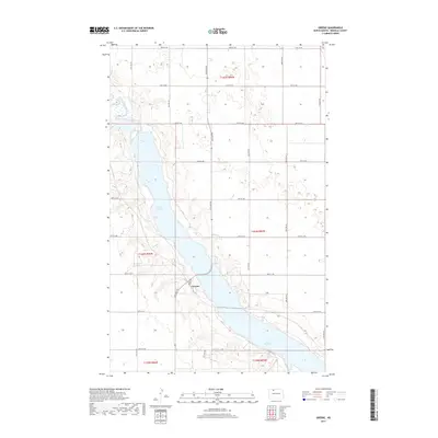
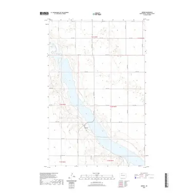
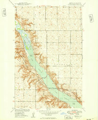 1949 Greene1949 Print · USGSRenville County is defined by the development of the Souris River valley in the late 1940s. Genealogists and local historians can trace the tracks of the Minneapolis St Paul and Sault Ste Marie through Greene and past School No 1.
 - 1951 Map of Grano
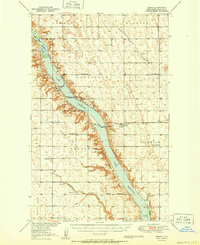 1951 Grano1951 Print · USGSRenville County is shown at mid-century as a grid of northern prairie townships shaped by the river valley and the rail. Genealogists can locate family landmarks like Gethsemane Ch, Grano Cem, and schools such as Sauer Sch or Clay Center Sch.
 - 1954 Map of Minot, 1964 Print
 1954 Minot1964 Print · USGSNorth Dakota's northern borderlands are captured here in the mid-fifties, showing a landscape defined by the winding Souris River and the rise of the Turtle Mountains. Genealogists can locate family-named sidings like Hurd Siding and Truro Siding alongside the vital Great Northern rail lines.3 unique versions available
 - 1958 Map of Minot
 1958 Minot1958 Print · USGSNorthern North Dakota is shown here during the mid-fifties, dominated by the rail-driven growth of Minot and the surrounding grain-farming prairie. Genealogists can trace family connections to border towns like Westhope or explore the vast reaches of the Turtle Mountains.
 - 2011 Map of Greene, 2011 Print
 2011 Greene2011 Print · USGSCovers Greene, including Renville County, United States, and other nearby areas
 - 2014 Map of Greene, 2014 Print
 2014 Greene2014 Print · USGSCovers Greene, including Renville County, United States, and other nearby areas
 - 2017 Map of Greene, 2017 Print
 2017 Greene2017 Print · USGSCovers Greene, including Renville County, United States, and other nearby areas
 - 2020 Map of Greene, 2020 Print
 2020 Greene2020 Print · USGSCovers Greene, including Renville County, United States, and other nearby areas
 - 2024 Map of Greene, 2024 Print
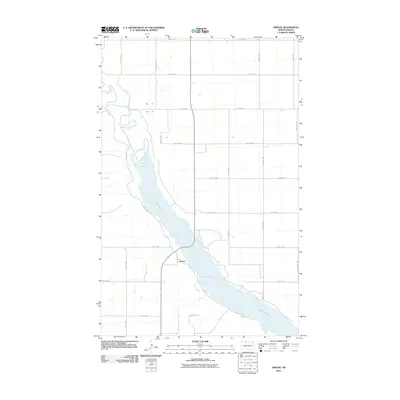
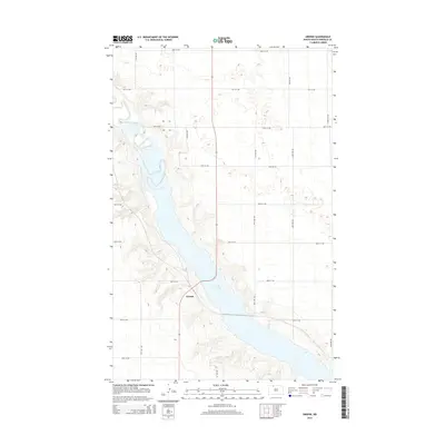
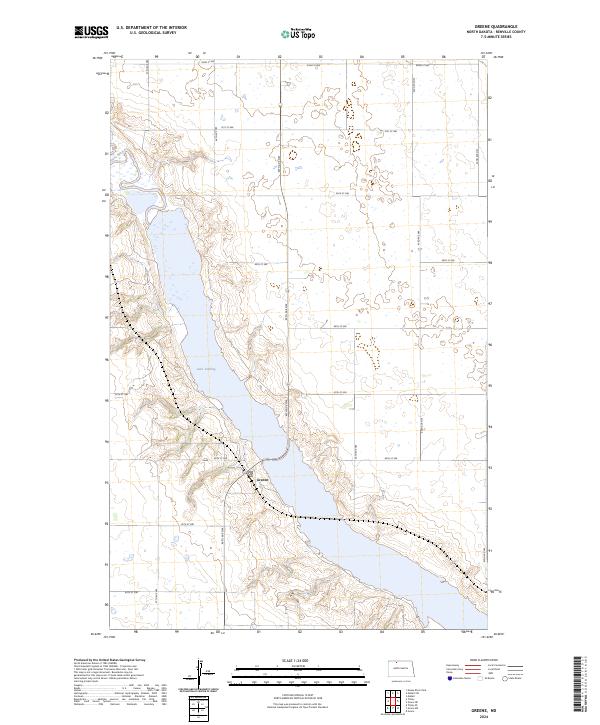 2024 Greene2024 Print · USGSRenville County is defined by the sweeping valley of the Souris River in this modern look at the North Dakota plains. Researchers can trace the settlement at Greene and the sprawling boundaries of the Upper Souris National Wildlife Refuge along Lake Darling.
End of results
Showing maps 1-9 of 9
Top cities near Greene
- Mohall historical maps
- Carpio historical maps
- Donnybrook historical maps
- Tolley historical maps
- Loraine historical maps
- Grano historical maps
Frequently asked questions
- What are the different types of historical maps available for Greene?
- What is the oldest map of Greene?
- Where can I purchase historical maps of Greene for my home or office?
- Where can I download high-res historical maps of Greene?
- Are there historical topographic maps available for Greene?
- Is there historical aerial imagery available for Greene?
- Where are historical maps of Greene sourced from?