1980s Maps of Sheridan County, North Dakota
Explore 3 historic maps of Sheridan County from the 1980s. These maps offer a rare glimpse into what life looked like during the 1980s — showing old roads, neighborhoods, homes, and landmarks that have changed or disappeared over time.
Whether you're researching your family's past, planning a metal detecting trip, or studying how Sheridan County's landscape evolved across the 1980s, these high-resolution maps are a powerful tool for exploring the history of this region.
- Focus on a specific era: All maps on this page are from the 1980s, giving you a focused view of this time period.
- See what’s changed: Compare century-old streets, trails, and buildings to today's modern landscape using overlays and satellite layers.
- Research with precision: Use these maps for genealogy, historical research, land use analysis, or educational projects.
- View, download, or print: Maps are fully viewable online in high resolution, and can be downloaded or printed for your own records.
Start exploring Sheridan County's history through authentic maps from the 1980s. This is your window into the past.
Sheridan County, ND maps
(3)- 1981 Map of Pelican Lake SE, 1982 Print
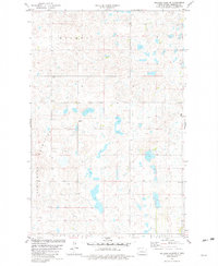 1981 Pelican Lake SE1982 Print · USGSSheridan County's glacial landscape is captured here in the early eighties, showing the distinct prairie pothole terrain near the Prophets Mountains. Researchers can locate a rural Cem and trace the section roads through Holmes and Mcclusky.
 - 1981 Map of Alkali Lake, 1982 Print
 1981 Alkali Lake1982 Print · USGSThe prairie pothole region of McLean and Sheridan Counties is captured here in the early eighties, showing a landscape shaped by water and conservation. Researchers can locate remote rural landmarks like Tabor Cem, the local Townhall, and the shores of Alkali Lake.
 - 1981 Map of Siebold Lake, 1982 Print
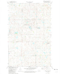 1981 Siebold Lake1982 Print · USGSThe Sheridan and McLean county line in the early 1980s reveals a prairie landscape shifting toward conservation and wildlife management. Researchers can trace land usage across Byersville and Holmes, locating features like Siebold Lake and several Gravel Pits.
End of results
Showing maps 1-3 of 3
Top cities of Sheridan County
Frequently asked questions
- What are the different types of historical maps available for Sheridan County?
- What is the oldest map of Sheridan County?
- Where can I purchase historical maps of Sheridan County for my home or office?
- Where can I download high-res historical maps of Sheridan County?
- Are there historical topographic maps available for Sheridan County?
- Is there historical aerial imagery available for Sheridan County?
- Where are historical maps of Sheridan County sourced from?