1960s Maps of Sheridan County, North Dakota
Explore 8 historic maps of Sheridan County from the 1960s. These maps offer a rare glimpse into what life looked like during the 1960s — showing old roads, neighborhoods, homes, and landmarks that have changed or disappeared over time.
Whether you're researching your family's past, planning a metal detecting trip, or studying how Sheridan County's landscape evolved across the 1960s, these high-resolution maps are a powerful tool for exploring the history of this region.
- Focus on a specific era: All maps on this page are from the 1960s, giving you a focused view of this time period.
- See what’s changed: Compare century-old streets, trails, and buildings to today's modern landscape using overlays and satellite layers.
- Research with precision: Use these maps for genealogy, historical research, land use analysis, or educational projects.
- View, download, or print: Maps are fully viewable online in high resolution, and can be downloaded or printed for your own records.
Start exploring Sheridan County's history through authentic maps from the 1960s. This is your window into the past.
Sheridan County, ND maps
(8)- 1960 Map of Lincoln Valley SE, 1961 Print
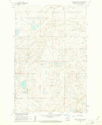 1960 Lincoln Valley SE1961 Print · USGSSheridan County's prairie landscape is captured here in the early sixties, showing a rural community organized around its local school districts. Genealogists and historians can trace the locations of the Advent Cem and numerous country schools like Schiller Sch No 3 and Hellman Sch No 4.
 - 1960 Map of Horse Lake, 1961 Print
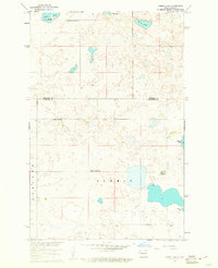 1960 Horse Lake1961 Print · USGSThe prairie pothole region of North Dakota is captured here in the early sixties at the Sheridan and Burleigh County line. Genealogists can locate specific rural landmarks like Johns Lake Ch, Schrunk Sch No 1, and Johns Lake Sch No 3.2 unique versions available
 - 1960 Map of Florence Lake, 1961 Print
 1960 Florence Lake1961 Print · USGSThe prairie pothole region of Burleigh and Sheridan Counties comes to life in the early sixties, showing a landscape shaped by water and wind. Genealogists and local historians can locate early rural schools like Whittaker Sch and School No 2 among the shores of Salt Lake.
 - 1960 Map of Denhoff, 1961 Print
 1960 Denhoff1961 Print · USGSSheridan County's prairie landscape is captured here in the early sixties, centered on the rail-side community of Denhoff. Researchers can trace the distribution of rural education through Whittaker Sch No 2 and locate the local Denhoff Cems.
 - 1960 Map of Lincoln Valley, 1962 Print
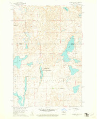
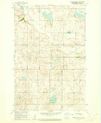
 1960 Lincoln Valley1962 Print · USGSSheridan County's rural townships are documented here in the early sixties, showing the detailed distribution of prairie homesteads and school districts. Researchers can find old community sites like Lincoln Valley and trace the paths to Gransville Sch No 1 or the Reformed Ch.2 unique versions available
 - 1960 Map of Lincoln Valley SW, 1962 Print
 1960 Lincoln Valley SW1962 Print · USGSSheridan County at the start of the sixties reveals a landscape of dispersed prairie schoolhouses and rural parishes. Genealogists can trace family roots through landmarks like Westheim Cem, the Reformed Ch, and Mountain City Sch No 1.2 unique versions available
 - 1960 Map of Lincoln Valley NW, 1963 Print
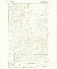
 1960 Lincoln Valley NW1963 Print · USGSSheridan County in the early sixties remained a landscape of prairie wetlands and one-room schoolhouses. Genealogists can trace rural family life through the locations of Skogmo Cem, Highland Sch No 1, and the Sheyenne River headwaters.2 unique versions available
 - 1961 Map of Pelican Lake, 1963 Print
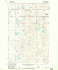
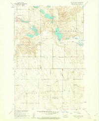
 1961 Pelican Lake1963 Print · USGSThe rural landscapes of McLean and Sheridan Counties come into focus during the early sixties, showing a region of high ridges and prairie lakes. Researchers can locate vanished rural landmarks like School No 1, Our Savior Cemetery, and the prominent Prophets Mountain.
End of results
Showing maps 1-8 of 8
Top cities of Sheridan County
Frequently asked questions
- What are the different types of historical maps available for Sheridan County?
- What is the oldest map of Sheridan County?
- Where can I purchase historical maps of Sheridan County for my home or office?
- Where can I download high-res historical maps of Sheridan County?
- Are there historical topographic maps available for Sheridan County?
- Is there historical aerial imagery available for Sheridan County?
- Where are historical maps of Sheridan County sourced from?