1990s Maps of Porcupine District, North Dakota
Explore 9 historic maps of Porcupine District from the 1990s. These maps offer a rare glimpse into what life looked like during the 1990s — showing old roads, neighborhoods, homes, and landmarks that have changed or disappeared over time.
Whether you're researching your family's past, planning a metal detecting trip, or studying how Porcupine District's landscape evolved across the 1990s, these high-resolution maps are a powerful tool for exploring the history of this region.
- Focus on a specific era: All maps on this page are from the 1990s, giving you a focused view of this time period.
- See what’s changed: Compare century-old streets, trails, and buildings to today's modern landscape using overlays and satellite layers.
- Research with precision: Use these maps for genealogy, historical research, land use analysis, or educational projects.
- View, download, or print: Maps are fully viewable online in high resolution, and can be downloaded or printed for your own records.
Start exploring Porcupine District's history through authentic maps from the 1990s. This is your window into the past.
Porcupine District, ND maps
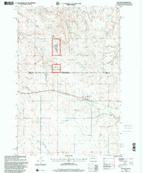
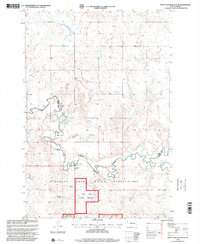
(9)- 1998 Map of Lookout Butte, 2001 Print
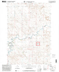 1998 Lookout Butte2001 Print · USGSThe Grant and Sioux county line in the late nineties is defined by the northern reaches of the Standing Rock Indian Reservation. Genealogists and historians can trace local landmarks like Communion Cem, the R Halverson Ranch, and the winding path of Cedar Creek.
 - 1998 Map of Lookout Butte SE, 2001 Print
 1998 Lookout Butte SE2001 Print · USGSThe Standing Rock Indian Reservation and Cedar River National Grassland define this prairie landscape in the late 1990s. Trace the paths of the Cannonball River and Cedar Creek, or locate the Knispell Wildlife Area and various local Windmill sites.
 - 1998 Map of Keldron, 2001 Print
 1998 Keldron2001 Print · USGSDakota ranching country is documented here during the late 1990s, showing the intersection of the Standing Rock Indian Reservation and the Cedar River National Grassland. Genealogists and historians can trace family-named sites like the O Benson Ranch and C Johnson Ranch near the quiet settlement of Keldron.
 - 1998 Map of Pitt Creek, 2001 Print
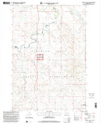
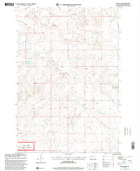
 1998 Pitt Creek2001 Print · USGSGrant and Sioux counties meet along the high plains in the late 1990s, where ranching and conservation define the landscape. Trace family landmarks like the E Texler Ranch and explore the bounds of the Standing Rock Indian Reservation.
 - 1998 Map of Watauga, 2001 Print
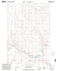
 1998 Watauga2001 Print · USGSThe borderlands of South Dakota and North Dakota come alive in this late 1990s survey centered on the rail-side community of Watauga. Genealogists and historians can locate family landmarks like Tomac Ranch, the local Cemetery, and scattered Windmills across the plains.
 - 1998 Map of Shields SW, 2001 Print
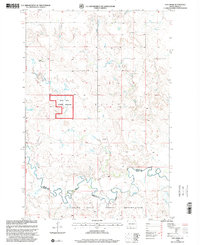
 1998 Shields SW2001 Print · USGSSioux County in the late nineties remains a landscape of open prairie and conservation lands within the Standing Rock Indian Reservation. Researchers can trace land use patterns across the Cedar River National Grassland or locate landmarks like Leaf on the Hill Creek and a lonely Windmill.
 - 1998 Map of Parks Hills, 2001 Print
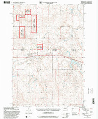
 1998 Parks Hills2001 Print · USGSThe border of the Standing Rock Indian Reservation meets the winding Cedar Creek in the late nineties. Researchers can trace the rugged topography of PARKS HILLS and Saddle Buttes, or locate landmarks like Colville Hill and a specific Drill Hole.
 - 1998 Map of Morristown, 2001 Print
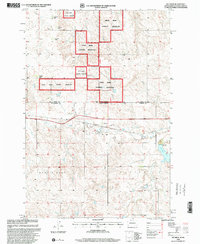
 1998 Morristown2001 Print · USGSThe borderlands of Corson County come into focus during the late 1990s, showing the town of Morristown surrounded by the Cedar River National Grassland. Genealogists and local historians can locate family landmarks like the A Maier Ranch or the community Cem near the banks of Hay Creek.
 - 1998 Map of Pretty Rock Butte SE, 2001 Print
 1998 Pretty Rock Butte SE2001 Print · USGSThe northern plains near the Sioux and Grant County line appear in the late nineties as a vast landscape of open range and tribal lands. Researchers can locate specific family properties like the H Westphal Ranch and trace the winding course of Cedar Creek.
End of results
Showing maps 1-9 of 9
Top cities near Porcupine District
Top neighborhoods of Porcupine District
Frequently asked questions
- What are the different types of historical maps available for Porcupine District?
- What is the oldest map of Porcupine District?
- Where can I purchase historical maps of Porcupine District for my home or office?
- Where can I download high-res historical maps of Porcupine District?
- Are there historical topographic maps available for Porcupine District?
- Is there historical aerial imagery available for Porcupine District?
- Where are historical maps of Porcupine District sourced from?