Old Maps of Porcupine District, North Dakota for Metal Detecting
Plan your next treasure hunt with 164 historic maps of Porcupine District. Find old homesites, ghost towns, trails, and gathering spots that may be lost to time — perfect for identifying promising metal detecting locations.
- Locate forgotten sites: Uncover places like long-lost settlements, abandoned rail lines, or gathering spots.
- Plan better hunts: Use map overlays combined with LiDAR or satellite views to narrow in on historically rich areas.
- Made for detectorists: Thousands of hobbyists use these maps to discover relics, coins, and hidden history.
Use these historic maps to boost your research and find new opportunities beneath the surface of Porcupine District.
Porcupine District, ND maps
(164)- 1953 Map of McIntosh, 1965 Print
 1953 McIntosh1965 Print · USGSThe north-central Dakota prairie is captured here during the mid-fifties, showing the vast Standing Rock Indian Reservation and the newly formed Oah E Reservoir. Genealogists and historians can trace the Chicago Milwaukee St Paul and Pacific rail line through stops like McIntosh, Walker, and Eagle Butte.3 unique versions available
 - 1954 Map of Bismarck, 1967 Print
 1954 Bismarck1967 Print · USGSBismarck and the Missouri River basin are shown in the mid-1960s as the Oahe Reservoir reshaped the valley. Genealogists can trace family-named landmarks like Dog Tooth Buttes and small prairie settlements such as Fort Yates, Selfridge, and Brisbane.2 unique versions available
 - 1958 Map of Bismarck
 1958 Bismarck1958 Print · USGSCentral North Dakota in the late fifties is defined by the Missouri River and the sprawling Standing Rock Indian Reservation. Genealogists and historians can trace rail-line outposts like Sedalia Siding or explore local landmarks like Saint Anthony and Fort Lincoln State Park/Museum.
 - 1958 Map of McIntosh
 1958 McIntosh1958 Print · USGSThe north-central Dakotas appear here in the mid-1950s as massive engineering projects and rail lines shaped the plains. Researchers can trace tribal lands within the Standing Rock Indian Reservation and locate local landmarks like the Keller Mine or the Virginia Siding.
 - 1971 Map of Lookout Butte, 1973 Print
 1971 Lookout Butte1973 Print · USGSThe North Dakota prairie along the Standing Rock reservation border comes into focus in the early 1970s. Trace local history through landmarks like Communion Cemetery, Lookout Butte, and the winding path of Cedar Creek.
 - 1971 Map of Shields SW, 1973 Print
 1971 Shields SW1973 Print · USGSThe Standing Rock Indian Reservation in Sioux County is captured here during the early seventies. Genealogists and researchers can trace the section lines across the prairie landscape and find local features like Leaf On The Hill Creek and a Gravel Pit.
 - 1971 Map of Froelich Dam, 1973 Print
 1971 Froelich Dam1973 Print · USGSSioux County in the early seventies centers on the development of the Froelich Dam State Management Area. Researchers can trace the path of the C M St P & P railroad and locate rural landmarks like Porcupine Creek and the Porcupine Hills.
 - 1971 Map of Shields, 1973 Print
 1971 Shields1973 Print · USGSThe border between Grant and Sioux counties follows the winding path of the Cannonball River in the early 1970s. Local researchers can trace the rail corridor of the C M St P & P and locate specific sites like the community of Shields and various Gravel Pits.
 - 1971 Map of Solen SW, 1973 Print
 1971 Solen SW1973 Print · USGSSioux County's river-cut prairie is captured in the early seventies, dominated by the winding path of the Cannonball River. Researchers can trace the Old Railroad Grade and locate local landmarks like Fairview Cem and Dogtooth.
 - 1971 Map of Lookout Butte SE, 1973 Print
 1971 Lookout Butte SE1973 Print · USGSThe Sioux and Grant County borderlands in the early 1970s are defined by the winding waters of the Cannonball River and the Standing Rock Reservation line. Researchers can trace land boundaries and natural water sources like Cedar Creek, Leaf on the Hill Creek, and a local Gravel Pit.
 - 1971 Map of Porcupine, 1973 Print
 1971 Porcupine1973 Print · USGSSioux County's rail and reservation land are captured here in the early seventies, centered on the Standing Rock Indian Reservation. Genealogists and historians can trace the tracks of the Chicago Milwaukee St Paul and Pacific through the settlements of Shields, Porcupine, and Chadwick.
 - 1971 Map of Timmer, 1973 Print
 1971 Timmer1973 Print · USGSThe prairie landscape of south-central North Dakota is captured here in the early 1970s, as the Cannonball River winds along the Standing Rock Indian Reservation Boundary. Researchers can locate the community of Timmer and its local landmarks, including St George Ch and the old Chicago Milwaukee St Paul and Pacific Railroad Grade.
 - 1971 Map of Selfridge, 1974 Print
 1971 Selfridge1974 Print · USGSSelfridge and the surrounding prairie are captured here in the early seventies, centered on the Standing Rock Indian Reservation. Genealogists and local historians can trace the town's rail-oriented layout along the Milwaukee Road and locate the St Philomena Cem to the south.
 - 1971 Map of Pamplin Hills, 1974 Print
 1971 Pamplin Hills1974 Print · USGSThe Sioux County landscape within the Standing Rock Indian Reservation is documented here during the early seventies. Genealogists and historians can trace the topography of the Pamplin Hills and the precise boundaries of T. 130 N. and R. 83 W.
 - 1971 Map of Maple Leaf, 1974 Print
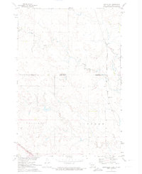 1971 Maple Leaf1974 Print · USGSThe northern plains borderland comes into focus in the early 1970s as the rail line still threads through the Standing Rock reservation. Researchers can trace the path of the Chicago Milwaukee St Paul and Pacific railroad through the settlement of Maple Leaf and along the banks of Oak Creek.
 - 1972 Map of Morristown, 1975 Print
 1972 Morristown1975 Print · USGSMorristown and the surrounding Standing Rock Indian Reservation are documented here in the early 1970s. Trace the paths of the Milwaukee St Paul and Pacific railroad as it passes by Morristown Lake and landmarks like Peaked Butte.
 - 1972 Map of Walker, 1975 Print
 1972 Walker1975 Print · USGSThe borderlands of South and North Dakota in the early 1970s are defined here by isolated prairie settlements and long-haul rail lines. Genealogists and historians can trace the community of Walker along the Chicago Milwaukee St Paul and Pacific railroad near Pamplin Rock.
 - 1972 Map of Pretty Rock Butte SE, 1975 Print
 1972 Pretty Rock Butte SE1975 Print · USGSThe Grant and Sioux county borderlands are captured here in the early 1970s, defined by the winding Cedar Creek. Researchers can trace the Standing Rock Indian Reservation Boundary and locate the historic Gaging Station and Pretty Rock butte.
 - 1972 Map of Round Top, 1975 Print
 1972 Round Top1975 Print · USGSThe North Dakota plains of the early 1970s are mapped here as the Standing Rock Indian Reservation meets three county lines. Genealogists and local historians can locate rural landmarks like Menz Sch and trace the Indian Reservation Boundary along the banks of Cedar Creek.
 - 1972 Map of Keldron, 1975 Print
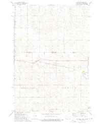 1972 Keldron1975 Print · USGSThe Dakota plains meet along the state line in the early seventies, centered on the rail-side community of Keldron. Local historians can trace the rural infrastructure of Sioux and Corson Counties, including the Knoke Sch and the Milwaukee Road line.
 - 1972 Map of Watauga, 1975 Print
 1972 Watauga1975 Print · USGSCorson County, South Dakota, is captured in the early 1970s as a high-plains rail corridor within the Standing Rock Indian Reservation. Local historians can trace the path of the Chicago Milwaukee St Paul and Pacific through the settlements of Watauga and Bigham.
 - 1972 Map of Hump Butte, 1975 Print
 1972 Hump Butte1975 Print · USGSThe Standing Rock Indian Reservation borderland is captured in the early seventies, showing a landscape defined by the Chicago Milwaukee St Paul and Pacific railroad. Researchers can trace land use patterns around Hump Butte and local water sources like Seilers Dam.
 - 1972 Map of McIntosh, 1975 Print
 1972 McIntosh1975 Print · USGSCorson County, South Dakota, is captured here in the early seventies as a vital rail and ranching crossroads on the Standing Rock Indian Reservation. Trace local family history at St Bonaventure Cemetery or follow the path of the Chicago Milwaukee St Paul and Pacific railroad.2 unique versions available
 - 1972 Map of Thunder Hawk, 1975 Print
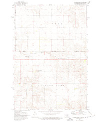 1972 Thunder Hawk1975 Print · USGSThe Dakota borderlands come into focus in the early 1970s as the Chicago Milwaukee St Paul and Pacific rail line connects small prairie outposts. Genealogists and historians can trace the tracks through Thunder Hawk and locate landmarks like Thunder Hawk Butte and the settlement of Wheatland.
 - 1972 Map of Tatanka Lake, 1975 Print
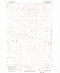 1972 Tatanka Lake1975 Print · USGSThe borderlands of the Dakotas appear in the early 1970s, showing the intersection of Sioux and Corson counties. Researchers can trace the path of the Chicago Milwaukee St Paul and Pacific rail line as it passes Tatanka Lake and the heights of Leaf-on Hill.
Showing maps 1-25 of 164
Top cities near Porcupine District
Top neighborhoods of Porcupine District
Frequently asked questions
- What are the different types of historical maps available for Porcupine District?
- What is the oldest map of Porcupine District?
- Where can I purchase historical maps of Porcupine District for my home or office?
- Where can I download high-res historical maps of Porcupine District?
- Are there historical topographic maps available for Porcupine District?
- Is there historical aerial imagery available for Porcupine District?
- Where are historical maps of Porcupine District sourced from?