Old Maps of Marmarth, North Dakota for Genealogy
Trace your family roots with 10 historic maps of Marmarth. These high-res maps reveal old neighborhoods, homesites, landmarks, and streets — helping you uncover where your ancestors lived and how the area evolved over time.
- Explore historic neighborhoods: Identify where your relatives may have lived in the 1800s or 1900s.
- Compare maps over time: Trace the changes in streets, buildings, and landmarks for multi-generational research.
- Perfect for genealogy & ancestry research: Used by family historians and researchers to map out lineage and migration.
These maps are an incredible resource for exploring your personal connection to Marmarth's past.
Marmarth, ND maps
(10)- 1953 Map of Dickinson, 1968 Print
 1953 Dickinson1968 Print · USGSWestern North Dakota in the fifties remains a landscape of rail-linked prairie towns and rugged badlands. Trace the local impact of the Northern Pacific railroad through Dickinson or locate early rural landmarks like Rainy Butte Church and Boys Ranch.2 unique versions available
 - 1957 Map of Dickinson
 1957 Dickinson1957 Print · USGSSouthwestern North Dakota in the mid-fifties is a landscape of coal mining and tight-knit rural school districts. Genealogists can trace family footprints through numerous country schools like Fisher School and parish churches like St Stephens.
 - 1980 Map of Marmarth
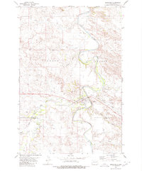 1980 Marmarth1980 Print · USGSThe Little Missouri River valley in the late twentieth century reveals a landscape defined by the Chicago Milwaukee St Paul and Pacific railroad and ranching life. Genealogists and historians can trace the townsite of Marmarth, find the Riverside Cemetery, and locate the Rodeo Ground and Pretty Butte.
 - 1981 Map of Bowman
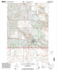
 1981 Bowman1981 Print · USGSSouthwestern North Dakota in the early eighties was a landscape of high-plains ranching and rail-centered commerce. Genealogists and historians can trace the rail towns of Bowman, Marmarth, and Amidon while identifying landmarks like White Butte and Talbot Butte.
 - 1997 Map of Marmarth, 2001 Print
 1997 Marmarth2001 Print · USGSThe rail-and-river town of Marmarth is shown in the late nineties as it sits within the Little Missouri National Grassland. Researchers can trace the local landscape from Riverside Cem to the Rodeo Ground and the banks of the Little Missouri River.
 - 2011 Map of Marmarth, 2011 Print
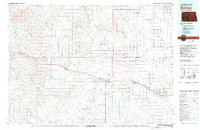
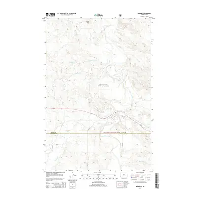
 2011 Marmarth2011 Print · USGSCovers Marmarth, including Slope County, Bowman County, and other nearby areas
 - 2014 Map of Marmarth, 2014 Print
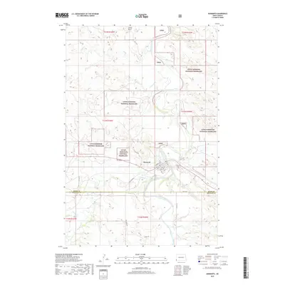
 2014 Marmarth2014 Print · USGSCovers Marmarth, including Slope County, Bowman County, and other nearby areas
 - 2018 Map of Marmarth, 2018 Print
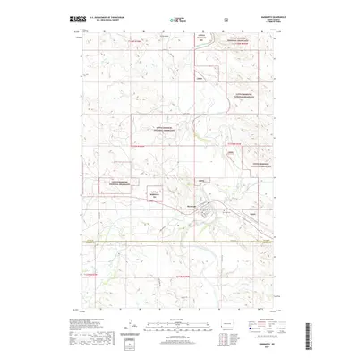
 2018 Marmarth2018 Print · USGSCovers Marmarth, including Slope County, Bowman County, and other nearby areas
 - 2020 Map of Marmarth, 2020 Print
 2020 Marmarth2020 Print · USGSCovers Marmarth, including Slope County, Bowman County, and other nearby areas
 - 2024 Map of Marmarth, 2024 Print
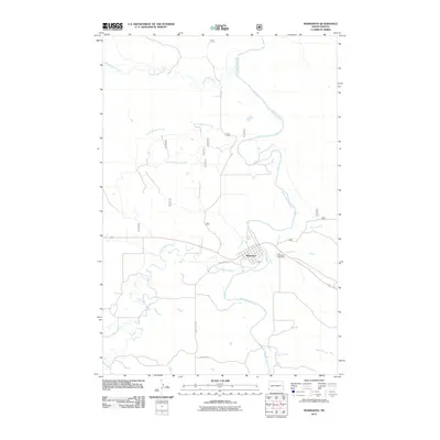
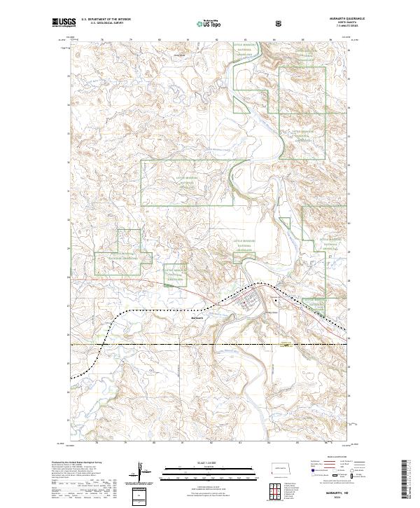 2024 Marmarth2024 Print · USGSThe rail and river town of Marmarth is captured here in the contemporary era as it sits amidst the wide Little Missouri National Grassland. Researchers can trace the local street grid near Riverside Cem and follow the paths of Little Beaver Creek and the BNSF Railway.
End of results
Showing maps 1-10 of 10
Top cities near Marmarth
Frequently asked questions
- What are the different types of historical maps available for Marmarth?
- What is the oldest map of Marmarth?
- Where can I purchase historical maps of Marmarth for my home or office?
- Where can I download high-res historical maps of Marmarth?
- Are there historical topographic maps available for Marmarth?
- Is there historical aerial imagery available for Marmarth?
- Where are historical maps of Marmarth sourced from?