Old Maps of Tokio, Wood Lake District for Academic Research
Study the evolution of Tokio with 15 high-resolution historic maps. Whether you're teaching, researching, or modeling changes in land use, these maps provide essential visual documentation of urban, environmental, and geographic change.
- Analyze long-term change: Track patterns in development, transportation, and natural features.
- Ideal for environmental or urban studies: Support academic projects with primary historical map data.
- Use in the classroom or lab: Educators and researchers rely on these maps to bring historical context to life.
These maps are a powerful tool for teaching, research, and visualizing how Tokio has changed over the decades.
Tokio, Wood Lake District maps
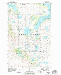
(15)- 1928 Map of Tokio, 1954 Print
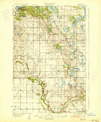
 1928 Tokio1954 Print · USGSThe Devils Lake Indian Reservation and the shores of Devils Lake are captured here in the late 1920s. Genealogists and local historians can trace the Great Northern rail line through Tokio or locate rural landmarks like Wood Lake Ch and Fort Totten P O.
 - 1931 Map of Tokio
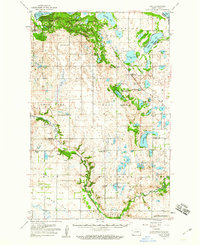
 1931 Tokio1931 Print · USGSThe southern shores of Devils Lake come into focus in the late twenties, detailing the area around Fort Totten P O and the Devils Lake Indian Reservation. Genealogists can trace local landmarks like Devils Heart and numerous rural schoolhouses including School No 2 and School No 4.2 unique versions available
 - 1950 Map of Tokio, 1952 Print
 1950 Tokio1952 Print · USGSBenson County at the start of the 1950s was a landscape defined by the shifting waters of the Devils Lake basin and the lifeline of the railroad. Researchers can trace the mid-century footprints of Saint Michael and Tokio, or find local landmarks like Wood Lake Ch and Devils Heart Butte.
 - 1951 Map of Tokio, 1959 Print
 1951 Tokio1959 Print · USGSBenson County in the early 1950s is a landscape defined by the intersection of military history, tribal lands, and glacial lakes. Genealogists and historians can trace old routes like the Old Indian Military Road or locate family sites near Tokio, Saint Michael, and Wood Lake Ch.
 - 1952 Map of New Rockford, 1968 Print
 1952 New Rockford1968 Print · USGSThe North Dakota prairie during the mid-1950s was a landscape of rail-dependent farm towns and vast wildlife refuges. Genealogists and historians can trace the foundations of local communities at Fort Totten Indian Agenc, Concordia Lutheran Church, and the Bowdon Country Church and Cemetery.3 unique versions available
 - 1956 Map of New Rockford
 1956 New Rockford1956 Print · USGSMid-century central North Dakota is captured here as a landscape of prairie rail towns and vast wildlife refuges. Trace family roots at the Bowdon Country Church and Cemetery or locate the old St Michael Mission School and Fort Totten.
 - 1971 Map of New Rockford, 1974 Print
 1971 New Rockford1974 Print · USGSCentral North Dakota was a landscape of wildlife refuges and rail-linked agricultural towns in the early seventies. Genealogists and local historians can trace the development of the Fort Totten Indian Reservation and locate old railway points like Maddock, Hamal, and Kloten.
 - 1975 Map of Tokio, 1977 Print
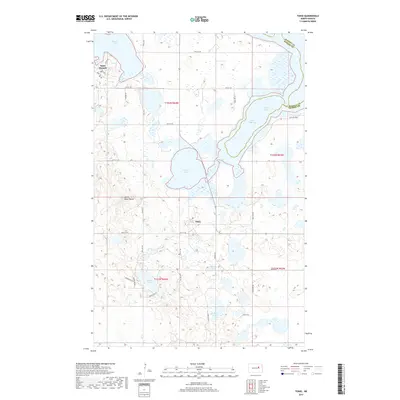
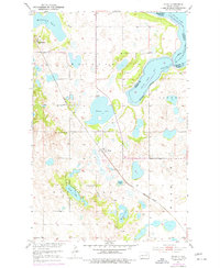 1975 Tokio1977 Print · USGSBenson County's prairie and lakelands are captured in the 1970s, showcasing the intricate shores of Devils Lake and the rail-oriented settlement of Tokio. Genealogists and local historians can locate Wood Lake Ch, Saint Michael, and School No 3 among the region's many lakes and buttes.
 - 1985 Map of Stump Lake
 1985 Stump Lake1985 Print · USGSNorth Dakota's lake country in the mid-eighties shows a landscape shaped by the Burlington Northern rail line and tribal lands. Genealogists and historians can locate family sites near Warwick, Tokio, and the Fort Totten Indian Reservation.2 unique versions available
 - 1994 Map of Tokio, 1995 Print
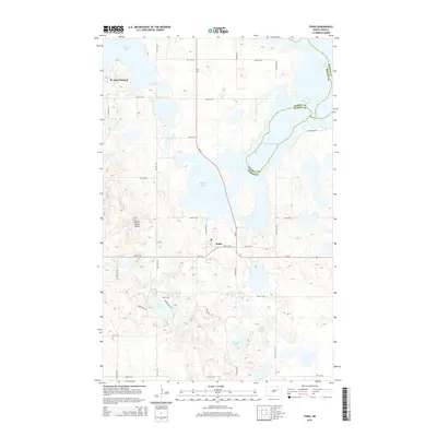
 1994 Tokio1995 Print · USGSThe Sioux Indian Reservation and the waters of Devils Lake define this North Dakota landscape during the mid-nineties. Researchers can locate local landmarks like Tokio Ch, trace the Old Railroad Grade, and identify family sites near Saint Michael.
 - 2011 Map of Tokio, 2011 Print
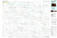
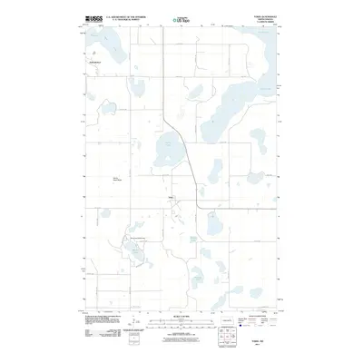 2011 Tokio2011 Print · USGSCovers Tokio, including Wood Lake District, St. Michael District, and other nearby areas
 - 2014 Map of Tokio, 2014 Print
 2014 Tokio2014 Print · USGSCovers Tokio, including Wood Lake District, St. Michael District, and other nearby areas
 - 2017 Map of Tokio, 2017 Print
 2017 Tokio2017 Print · USGSCovers Tokio, including Wood Lake District, St. Michael District, and other nearby areas
 - 2020 Map of Tokio, 2020 Print
 2020 Tokio2020 Print · USGSCovers Tokio, including Wood Lake District, St. Michael District, and other nearby areas
 - 2024 Map of Tokio, 2024 Print
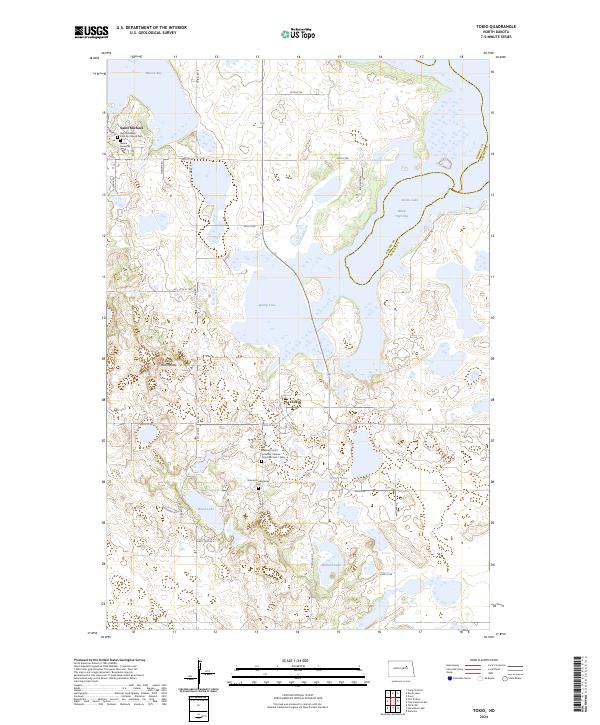 2024 Tokio2024 Print · USGSBenson County is documented here in the early 2020s, showing a landscape defined by prairie wetlands and the rural communities of Saint Michael and Tokio. Genealogists can trace local roots at the Saint Michaels Catholic Church Cem and the Bdecan Presbyterian Cem.
End of results
Showing maps 1-15 of 15
Top cities near Tokio
Frequently asked questions
- What are the different types of historical maps available for Tokio?
- What is the oldest map of Tokio?
- Where can I purchase historical maps of Tokio for my home or office?
- Where can I download high-res historical maps of Tokio?
- Are there historical topographic maps available for Tokio?
- Is there historical aerial imagery available for Tokio?
- Where are historical maps of Tokio sourced from?