1900s (20th Century) Maps of Adams County, Ohio
Explore 45 historic maps of Adams County from the 1900s (20th Century). These maps offer a rare glimpse into what life looked like during the 1900s — showing old roads, neighborhoods, homes, and landmarks that have changed or disappeared over time.
Whether you're researching your family's past, planning a metal detecting trip, or studying how Adams County's landscape evolved across the 1900s, these high-resolution maps are a powerful tool for exploring the history of this region.
- Focus on a specific era: All maps on this page are from the 1900s, giving you a focused view of this time period.
- See what’s changed: Compare century-old streets, trails, and buildings to today's modern landscape using overlays and satellite layers.
- Research with precision: Use these maps for genealogy, historical research, land use analysis, or educational projects.
- View, download, or print: Maps are fully viewable online in high resolution, and can be downloaded or printed for your own records.
Start exploring Adams County's history through authentic maps from the 1900s. This is your window into the past.
Adams County, OH maps
(45)- 1915 Map of Bainbridge
 1915 Bainbridge1915 Print · USGSBefore the modernization of rural Ohio, this 1915 survey captures Highland and Ross counties when one-room schoolhouses and country churches anchored every ridge. Trace family roots at Bainbridge, find the Indian Mound on Paint Creek, or locate Fall Creek Church and Redkey School.2 unique versions available
 - 1916 Map of Peebles, 1962 Print
 1916 Peebles1962 Print · USGSIn the early twentieth century, the rural landscape of Adams County was defined by its winding creeks and a dense network of one-room schoolhouses. Researchers can trace the Norfolk and Western RR corridor through Peebles or find ancestral locations like Marble Furnace and Bacon Flat School.
 - 1917 Map of Bainbridge
 1917 Bainbridge1917 Print · USGSIn the decade before modern highways, this Ohio highland region was a land of ridge-top schools and creek-side mills. Genealogists and historians can locate numerous rural schoolhouses like Walnut Shade School and ancient landmarks including the famous Serpent Mound.4 unique versions available
 - 1917 Map of Hillsboro, 1941 Print
 1917 Hillsboro1941 Print · USGSHighland County during the First World War era was a bustling network of electric rail lines and one-room schoolhouses. Genealogists can locate family landmarks like the Highland County Infirmary or schools such as Kansas College School and Brier College School.2 unique versions available
 - 1918 Map of Peebles, 1941 Print
 1918 Peebles1941 Print · USGSIn the hills of southern Ohio during the Great War era, the landscape is a network of small schoolhouses and creek-side settlements. Genealogists can trace family footprints near Peebles or Locust Grove through dozens of sites like Marble Furnace and Mt Zion School.2 unique versions available
 - 1918 Map of Seaman, 1943 Print
 1918 Seaman1943 Print · USGSAdams and Brown counties appear in the years following the Great War, showing a landscape defined by small hamlets and the steam-era railroads. Researchers can trace family roots through dozens of rural landmarks like the County Infirmary, Eckmansville, and the Harper Ferry School.
 - 1919 Map of Vanceburg, 1938 Print
 1919 Vanceburg1938 Print · USGSThe Ohio River shoreline at the close of the Great War was a landscape of small river towns and remote ridge-top schools. Genealogists can trace family footprints at Stout PO, Sandy Springs, and the Cedar College School in the rugged hills north of the river.2 unique versions available
 - 1929 Map of Springdale
 1929 Springdale1929 Print · USGSThe Ohio River valley and Kentucky's northern hills are captured here in the late twenties, showing a landscape defined by the Chesapeake and Ohio railroad. Genealogists can trace early homesteads and landmarks near Tollesboro, Ruggles Camp, and the many rural sites like Ebenezer Ch.2 unique versions available
 - 1935 Map of Springdale
 1935 Springdale1935 Print · USGSThe Ohio River valley at the height of the mid-1930s reveals a landscape shaped by river commerce and the Chesapeake and Ohio railroad. Researchers can locate numerous vanished country schools like Hamilton School, the infrastructure of Dam 33, and rural centers such as Tollesboro.
 - 1944 Map of Hillsboro
 1944 Hillsboro1944 Print · USGSHighland County is documented here during the mid-forties, showing the vital rail junction at Hillsboro and a dense network of rural schools. Trace ancestral roots through localized landmarks like Brier College Sch, Mowrystown, and Millers Chapel Ch.
 - 1947 Map of Columbus, 1948 Print
 1947 Columbus1948 Print · USGSCentral Ohio in the late 1940s is captured in this survey, showing the post-war transition of its rail hubs and military airfield expansions. Genealogists and historians can trace the paths of the Ohio Canal, the Pennsylvania RR lines, and the Camp Sherman Military Reservation.
 - 1949 Map of Vanceburg, 1960 Print
 1949 Vanceburg1960 Print · USGSThe Ohio River valley and the rugged hills of Lewis County are captured here just after the war. Local historians can trace family roots through numerous country landmarks like Beasley Fork Chapel, Aills Cem, and the County Infirmary.
 - 1949 Map of Buena Vista, 1964 Print
 1949 Buena Vista1964 Print · USGSThe Ohio River borderlands of the late 1940s reveal a landscape of river navigation and forest management. Researchers can trace riverside life at Rome (Stout PO), locate the Twin Creek Lookout Tower, and find rural congregations like Aills Chapel.
 - 1949 Map of Vanceburg, 1964 Print
 1949 Vanceburg1964 Print · USGSVanceburg and the surrounding hollows of Lewis County are captured here just after the war, showing the deep intersection of river, rail, and ridge life. Genealogists can locate family landmarks such as Holly Cem, the Lewis County Infirmary, and Holly Hill Ch.4 unique versions available
 - 1949 Map of Concord, 1965 Print
 1949 Concord1965 Print · USGSThe Ohio River valley in the late 1940s reveals a landscape of river-and-rail industry along the Lewis County border. Trace the vanished stops at Rome Sta and Chalkley Sta, or find rural landmarks like Beasley Fork Chapel and Martin (Queens PO).
 - 1951 Map of Vanceburg
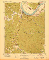 1951 Vanceburg1951 Print · USGSVanceburg and the surrounding Lewis County hills are captured here in the early fifties, showing the river-and-rail economy along the Ohio River. Researchers can trace old family sites and rural infrastructure, from the Lewis County Infirmary to local landmarks like Evans Chapel and the Rock Run Sch.
 - 1951 Map of Buena Vista
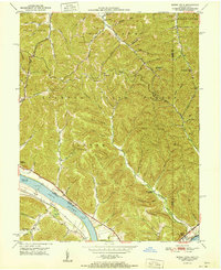 1951 Buena Vista1951 Print · USGSThe Ohio River borderlands at the start of the 1950s show a landscape of deep timbered hollows and river navigation. Researchers can trace rural life through the locations of Dam No 32, the Twin Creek Mission, and the Rome (Stout PO) settlement.
 - 1951 Map of Concord
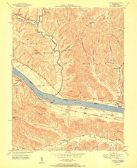 1951 Concord1951 Print · USGSThe riverfront communities of Lewis County and Adams County thrive along the Ohio during the early post-war era. Genealogists and local historians can trace family locations near Concord, identify the Stout Post Office, or find rural landmarks like Beasley Fork Chapel and the Carrs School.2 unique versions available
 - 1952 Map of Maysville East, 1953 Print
 1952 Maysville East1953 Print · USGSThe Ohio River valley near the Mason County line is captured here in the early fifties, showing the vital river-and-rail corridor. Researchers can trace the riverfront development of Maysville or locate landmarks near Sand Hill and the Chesapeake and Ohio railroad.
 - 1952 Map of Manchester Islands, 1954 Print
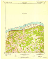 1952 Manchester Islands1954 Print · USGSThe Ohio River shoreline and the timbered heights of Lewis County come alive in this early 1950s survey. Researchers can trace family-named landmarks and rural hubs like Trinity Station, Covedale, and the remote Sulphur Knob Lookout Tower.
 - 1957 Map of Huntington, 1966 Print
 1957 Huntington1966 Print · USGSThe industrial heart of the Ohio River valley is captured here in the mid-sixties, showing the growth of Huntington and Ashland. Researchers can trace the extensive rail networks of the Chesapeake and Ohio RR and locate sites like the Chief Cornstalk Hunting Ground.3 unique versions available
 - 1960 Map of Huntington
 1960 Huntington1960 Print · USGSThe tri-state river valley thrived in the late fifties as a hub of heavy industry and Appalachian rail transit. Genealogists and historians can trace the connection between river towns like Ashland and Portsmouth or locate family homesteads near Coleman Ridge.
 - 1961 Map of Columbus
 1961 Columbus1961 Print · USGSCentral and Southern Ohio are captured here in the early sixties, as the region's industrial rail hubs and military bases reached their peak. Genealogists and historians can trace the transition from urban Columbus to rural townships along the Scioto River, locating Lockbourne USAF and old junctions like Washington Court House.
 - 1961 Map of Belfast, 1962 Print
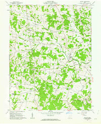 1961 Belfast1962 Print · USGSHighland and Adams counties in the early sixties reveal a landscape of small farming hamlets and numerous family cemeteries. Genealogists and local historians can trace legacy sites like Burnetts Chapel, Old Concord Cem, and the quiet crossroads of Belfast.4 unique versions available
 - 1961 Map of West Union, 1962 Print
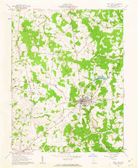 1961 West Union1962 Print · USGSWest Union and the surrounding Adams County hills are captured here in the early sixties, showing a landscape defined by small rural settlements and civic hubs. Researchers can trace local history through sites like the County Fairgrounds, Kirker Cemetery, and Liberty Chapel.3 unique versions available
Showing maps 1-25 of 45
Top cities of Adams County
- West Union historical maps
- Manchester historical maps
- Peebles historical maps
- Winchester historical maps
- Seaman historical maps
- Cherry Fork historical maps
Frequently asked questions
- What are the different types of historical maps available for Adams County?
- What is the oldest map of Adams County?
- Where can I purchase historical maps of Adams County for my home or office?
- Where can I download high-res historical maps of Adams County?
- Are there historical topographic maps available for Adams County?
- Is there historical aerial imagery available for Adams County?
- Where are historical maps of Adams County sourced from?