1960s Maps of Clermont County, Ohio
Explore 18 historic maps of Clermont County from the 1960s. These maps offer a rare glimpse into what life looked like during the 1960s — showing old roads, neighborhoods, homes, and landmarks that have changed or disappeared over time.
Whether you're researching your family's past, planning a metal detecting trip, or studying how Clermont County's landscape evolved across the 1960s, these high-resolution maps are a powerful tool for exploring the history of this region.
- Focus on a specific era: All maps on this page are from the 1960s, giving you a focused view of this time period.
- See what’s changed: Compare century-old streets, trails, and buildings to today's modern landscape using overlays and satellite layers.
- Research with precision: Use these maps for genealogy, historical research, land use analysis, or educational projects.
- View, download, or print: Maps are fully viewable online in high resolution, and can be downloaded or printed for your own records.
Start exploring Clermont County's history through authentic maps from the 1960s. This is your window into the past.
Clermont County, OH maps
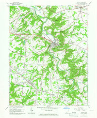
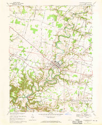
(18)- 1960 Map of Fayetteville, 1962 Print
 1960 Fayetteville1962 Print · USGSBrown County in the early sixties remains a landscape of traditional farming communities and religious institutions. Genealogists can trace family names at Engle Cem or Dunham Cem and explore the grounds of the Ursuline School for Girls.2 unique versions available
 - 1961 Map of Columbus
 1961 Columbus1961 Print · USGSCentral and Southern Ohio are captured here in the early sixties, as the region's industrial rail hubs and military bases reached their peak. Genealogists and historians can trace the transition from urban Columbus to rural townships along the Scioto River, locating Lockbourne USAF and old junctions like Washington Court House.
 - 1961 Map of Blanchester, 1962 Print
 1961 Blanchester1962 Print · USGSClinton County’s railroad heritage is on full display during the early sixties, centered on the bustling junction at Blanchester. Genealogists and local historians can trace family farmsteads along Nauvoo Road and locate historic burial sites like Rehoboth Cem or the IOOF Cem.4 unique versions available
 - 1961 Map of Madeira, 1963 Print
 1961 Madeira1963 Print · USGSThe Little Miami valley was transitioning into a suburban corridor in the early sixties as riverfront industry met growing residential estates. Genealogists can trace family names through Evergreen Cem and United Cem, or locate landmarks like the Sacred Heart Novitiate and Cincinnati Country Day School.5 unique versions available
 - 1961 Map of Withamsville, 1963 Print
 1961 Withamsville1963 Print · USGSGreater Cincinnati was expanding rapidly during the early sixties, as suburban estates began to fill the heights above the river. Researchers can trace the development of Withamsville and Melbourne, find local landmarks like St Gregory Seminary, and locate the old Drive-in Theater.3 unique versions available
 - 1962 Map of Columbus
 1962 Columbus1962 Print · USGSCentral Ohio during the early sixties reveals a transition from the industrial corridors of Columbus to the forested ridges of the south. Genealogists and historians can trace the rail networks of the Baltimore & Ohio RR and find local landmarks like Washington Court House and Camp Sherman Military Reservation.
 - 1964 Map of Louisville
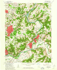
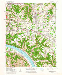
 1964 Louisville1964 Print · USGSThe Ohio River valley and Kentucky Bluegrass are captured in the mid-1960s, showing a region balanced between industrial growth and its agrarian roots. Genealogists and historians can trace the development of county seats like Shelbyville and Paris, or locate established institutions such as Georgetown College and Bernheim Forest.
 - 1965 Map of Batavia, 1967 Print
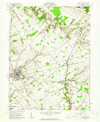
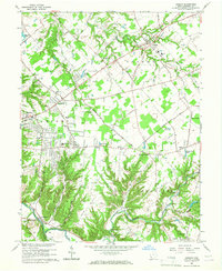
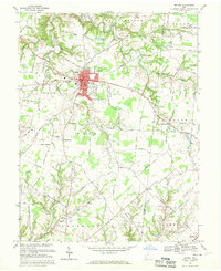
 1965 Batavia1967 Print · USGSClermont County in the mid-sixties shows the transition from rural townships to growing commuter hubs along the Norfolk and Western Railway. You can trace family history at the IOOF Cem or locate vanished landmarks like the Sky Hill Airport and the local Drive-in Theater.5 unique versions available
 - 1965 Map of Goshen, 1967 Print
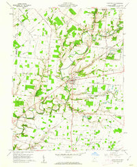
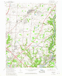
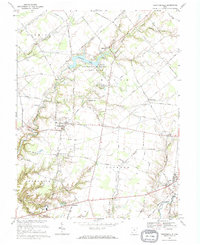
 1965 Goshen1967 Print · USGSClermont County in the mid-1960s reveals a mix of old township crossroads and emerging suburban centers. Genealogists and historians can trace family sites at Graceland Memorial Gardens, the rural Perintown rail stop, and the historic Mt Zion Cem.3 unique versions available
 - 1965 Map of Mason, 1968 Print
 1965 Mason1968 Print · USGSWarren and Hamilton counties are shown in the mid-sixties as the suburban corridor north of Cincinnati began to accelerate. Researchers can trace the massive U S Reservation Voice of America site, the old crossroads at Sixteen Mile Stand, and landmarks like the Radio Tower (WLW).4 unique versions available
 - 1967 Map of Columbus, 1969 Print
 1967 Columbus1969 Print · USGSCentral Ohio during the late sixties serves as a vital corridor of rail and aviation, from the industrial streets of Springfield to the hangar lines of Lockbourne Air Force Base. Genealogists and researchers can trace the growth of towns like Circleville and London or locate rural landmarks such as St Paul church and the London Correctional Institution.2 unique versions available
 - 1968 Map of Laurel, 1970 Print
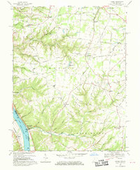 1968 Laurel1970 Print · USGSClermont County's riverfront and upland townships are captured here in the late sixties, showing a landscape defined by its deep runs and rural hubs. Researchers can trace historic family names and sites such as the Crane Schoolhouse, Point Pleasant, and the Laurel Cem.2 unique versions available
 - 1968 Map of Felicity, 1970 Print
 1968 Felicity1970 Print · USGSThe Ohio River valley and the rural uplands of Clermont and Bracken counties are captured here in the late sixties. Trace the riverside rail lines of the Chesapeake and Ohio or locate historic landmarks like Boude Ferry, Utopia, and Mt Zion Ch.2 unique versions available
 - 1968 Map of Bethel, 1970 Print
 1968 Bethel1970 Print · USGSClermont County agriculture and village life are captured here in the late sixties, centered on the bustling hub of Bethel. Local historians can trace the foundations of rural communities like Wiggonsville and Yankeetown or locate family plots at Rose Hill Cem and Brooks Cem.4 unique versions available
 - 1968 Map of Pleasant Plain, 1970 Print
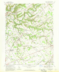 1968 Pleasant Plain1970 Print · USGSWarren County at the end of the sixties reveals a landscape of established rail lines and winding river valleys. Genealogists and local historians can trace family ties through numerous rural burial sites like West Mary Cemetery and Spurling Cemetery or locate the historic Harlan Butlerville School.
 - 1968 Map of Newtonsville, 1970 Print
 1968 Newtonsville1970 Print · USGSThis Clermont County landscape during the late sixties highlights the rural character of southwestern Ohio before significant suburban expansion. Researchers can trace family roots at Shiloh Ch or explore the early layout of Stonelick Lake State Park and Newtonsville.
 - 1968 Map of Williamsburg, 1970 Print
 1968 Williamsburg1970 Print · USGSClermont County and the village of Williamsburg are captured here in the late sixties as new highway corridors began to reshape the rural landscape. Researchers can trace family roots at Williamsburg Cem or locate legacy sites like Hennings Mill and Maple Grove Ch.4 unique versions available
 - 1968 Map of Moscow, 1971 Print
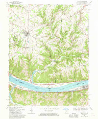
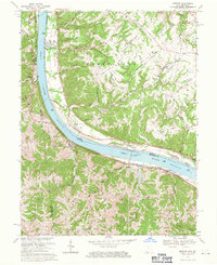 1968 Moscow1971 Print · USGSLife along the riverfront takes center stage in the late sixties as navigation and rail transport define this stretch of the Ohio valley. Researchers can trace family history through riverside towns and rural landmarks like Moscow Cem, the Chesapeake + Ohio railroad, and McKendree Cem Ch.2 unique versions available
End of results
Showing maps 1-18 of 18
Top cities of Clermont County
Frequently asked questions
- What are the different types of historical maps available for Clermont County?
- What is the oldest map of Clermont County?
- Where can I purchase historical maps of Clermont County for my home or office?
- Where can I download high-res historical maps of Clermont County?
- Are there historical topographic maps available for Clermont County?
- Is there historical aerial imagery available for Clermont County?
- Where are historical maps of Clermont County sourced from?