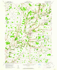
1960 Map of Fayetteville
USGS Topo · Published 1962About this map
The East Fork Little Miami River and its numerous tributaries, including Sycamore Creek and Solomon Run, define the rolling topography of this corner of the Virginia Military District. In the early 1960s, Fayetteville serves as a local hub, situated near the intersection of several primary routes and an Old Railroad Grade that speaks to the area's older transportation history. To the northeast, the presence of the Ursuline School For Girls and the Ursuline Cem at Saint Martin reflects the regional importance of religious and educational institutions. Small farming communities and family-named landmarks are scattered throughout, from the Engle Cem to the settlement of Vera Cruz. The eastern edge is characterized by the expansive Indian Creek Wildlife Area, where Indian Creek and Barker Run drain towards the Little Miami system.
Find a feature on this map
81 named features on this map. Tap any name to fly to it.
Don’t see what you’re looking for? This feature index may not catch every label — zoom into the map to look around manually.
Map Details
Editions of this 1960 Fayetteville Map
2 editions found
Other maps of this area

1907 · Blanchester
USGS Topo · 1:62,500

1914 · Batavia
USGS Topo · 1:48,000

1914 · Morrow
USGS Topo · 1:62,500

1916 · Batavia
USGS Topo · 1:62,500

1916 · Morrow
USGS Topo · 1:62,500

1917 · Sardinia
USGS Topo · 1:62,500

1944 · Sardinia
USGS Topo · 1:62,500

1947 · Columbus
USGS Topo · 1:250,000

1953 · Newtonsville
USGS Topo · 1:24,000
1953 · Williamsburg
USGS Topo · 1:24,000