
1953 Map of Newtonsville
USGS Topo · Published 1955About this map
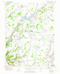
Newtonsville serves as the central hub of this Clermont County landscape, where the agricultural uplands of Goshen and Wayne townships meet the carved valleys of Stonelick Creek. The 1953 survey captures the area just after the establishment of the Stonelick Lake State Reserve, showing the newly formed Stonelick Lake and the surrounding woodlands of Woodland Park. A network of rural hamlets including Edenton, Modest, and Lerado are connected by established pikes and roads like Woodville Road and Pleasant Plain Road. Small family cemeteries such as Plainview Cem and Hartman Cem, along with the Stonelick Ch, mark the long-standing community centers. To the south, the terrain becomes increasingly dissected as tributaries like Brushy Fork and Rocky Run flow toward the East Fork Little Miami River.
Find a feature on this map
39 named features on this map. Tap any name to fly to it.
Don’t see what you’re looking for? This feature index may not catch every label — zoom into the map to look around manually.
Map Details
Editions of this 1953 Newtonsville Map
2 editions found
Other maps of this area

1907 · Blanchester
USGS Topo · 1:62,500

1914 · Batavia
USGS Topo · 1:48,000

1914 · Morrow
USGS Topo · 1:62,500

1916 · Batavia
USGS Topo · 1:62,500

1916 · Morrow
USGS Topo · 1:62,500

1917 · Sardinia
USGS Topo · 1:62,500

1944 · Sardinia
USGS Topo · 1:62,500

1947 · Columbus
USGS Topo · 1:250,000

1953 · Goshen
USGS Topo · 1:24,000
1953 · Batavia
USGS Topo · 1:24,000