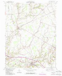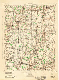
1944 Map of Sardinia
USGS Topo · Published 1944About this map
Ursuline Convent stands as a prominent landmark near Saint Martin in this mid-century survey of the Brown Highland region. The landscape is defined by a dense network of small rural schools, including Forest Grove Sch, Columbia Sch, and Honolulu Sch, reflecting the community-centric development of Brown and Highland counties before the era of school consolidation. The Norfolk and Western railway cuts through the southern portion of the sheet, providing a vital transport link for agricultural towns like Sardinia, Mount Orab, and Mowrystown.
Find a feature on this map
129 named features on this map. Tap any name to fly to it.
Don’t see what you’re looking for? This feature index may not catch every label — zoom into the map to look around manually.
Map Details
Editions of this 1944 Sardinia Map
This is the sole edition of this map. No revisions or reprints were ever made.
Historical Maps of Mount Orab Through Time
8 maps found