
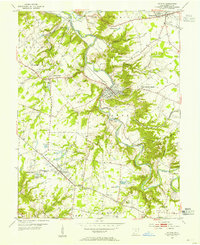
1953 Map of Goshen
USGS Topo · Published 1955About this map
The northern reaches of Clermont County in the early 1950s were defined by a collection of farming hamlets and small crossroads settlements like Goshen, Springvale, and Mt Repose. The landscape is etched by the intricate drainage systems of O'Bannon Creek and the East Fork Little Miami River, where the deep valleys of Stonelick Creek and Lick Fork contrast with the level uplands of Miami and Goshen townships. The local road network, including Deerfield Road and Woodville Pike, connects these rural communities to specialized landmarks like the Covered Bridge near St Philomena Ch and the Fairground at Owensville. For genealogists, the map is particularly valuable for locating family-named cemeteries such as Mt Zion Cem, Olive Cem, and Rapps Cem that anchor these historical neighborhoods. Transport and infrastructure are represented by the Norfolk and Western rail line skirting the southwestern edge through Perintown.
Find a feature on this map
47 named features on this map. Tap any name to fly to it.
Don’t see what you’re looking for? This feature index may not catch every label — zoom into the map to look around manually.
Map Details
Editions of this 1953 Goshen Map
This is the sole edition of this map. No revisions or reprints were ever made.
Other maps of this area

1898 · East Cincinnati
USGS Topo · 1:62,500

1904 · Mason
USGS Topo · 1:62,500

1906 · Mason
USGS Topo · 1:62,500

1914 · East Cincinnati
USGS Topo · 1:62,500

1914 · Batavia
USGS Topo · 1:48,000

1914 · Morrow
USGS Topo · 1:62,500

1916 · Batavia
USGS Topo · 1:62,500

1916 · Morrow
USGS Topo · 1:62,500

1953 · Withamsville
USGS Topo · 1:24,000
1953 · Batavia
USGS Topo · 1:24,000
Featured Places
- Stonelick Township, OH
- Mulberry, OH
- Owensville, Stonelick Township
- Miami Township, OH
- Union Township, OH