Old Maps of Venice, Sandusky for Academic Research
Study the evolution of Venice with 12 high-resolution historic maps. Whether you're teaching, researching, or modeling changes in land use, these maps provide essential visual documentation of urban, environmental, and geographic change.
- Analyze long-term change: Track patterns in development, transportation, and natural features.
- Ideal for environmental or urban studies: Support academic projects with primary historical map data.
- Use in the classroom or lab: Educators and researchers rely on these maps to bring historical context to life.
These maps are a powerful tool for teaching, research, and visualizing how Venice has changed over the decades.
Venice, Sandusky maps
(12)- 1901 Map of Bellevue, 1958 Print
 1901 Bellevue1958 Print · USGSAcross the marshy lowlands and limestone springs of Erie and Sandusky counties at the turn of the century, a massive railroad network dominates the landscape. Genealogists can trace family footprints in Clyde and Bellevue or locate vanished rail stops at Thames and Parkertown.
 - 1903 Map of Bellevue
 1903 Bellevue1903 Print · USGSNear the dawn of the twentieth century, the junction of Erie and Sandusky counties was a bustling corridor of rail and water transport. Genealogists and historians can trace the early footprints of Bellevue and Clyde, or find specific local landmarks like the Blue Hole and the Connecticut Western Reserve Boundary Line.5 unique versions available
 - 1956 Map of Toledo, 1968 Print
 1956 Toledo1968 Print · USGSNorthwest Ohio and the Lake Erie shoreline are shown in detail during the late fifties, showcasing a landscape of heavy industry, railroads, and island communities. Genealogists and historians can trace rail networks like the Chesapeake & Ohio RR or locate landmarks such as the Erie Proving Ground and Kelleys Island.4 unique versions available
 - 1959 Map of Castalia, 1965 Print
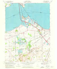
 1959 Castalia1965 Print · USGSCoastal Erie County and the Sandusky Bay shoreline are captured here in the late fifties as rail lines and industrial quarries defined the local economy. Genealogists and researchers can locate the Trinity Ch, trace the Pennsylvania Railroad, or find the Blue Hole and Township Sch.
 - 1961 Map of Toledo
 1961 Toledo1961 Print · USGSThe western basin of Lake Erie and the industrial heart of Northern Ohio are captured here during the post-war era. Researchers can trace historical rail lines like the New York Central or locate landmarks like the Erie Ordnance Depot and Pelee Island.
 - 1969 Map of Castalia, 1971 Print
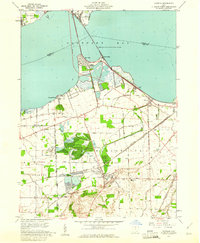
 1969 Castalia1971 Print · USGSCoastal Erie County and the southern shores of Sandusky Bay come into focus in the late sixties, showcasing a landscape defined by water and industry. Genealogists and local historians can trace the foundations of Venice and Castalia, or locate the Oak Lawn Cem and Bogart Sch.2 unique versions available
 - 1986 Map of Lorain
 1986 Lorain1986 Print · USGSThe Lake Erie shoreline and North Central Ohio interior are shown in detail during the mid-eighties, from the industrial docks of Lorain to the peninsulas of Sandusky. Researchers can trace historic transport routes like the Baltimore and Ohio Railroad or locate significant landmarks like Oberlin College and Cedar Point.2 unique versions available
 - 2010 Map of Castalia, 2010 Print
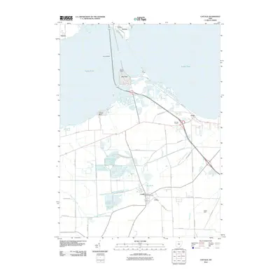 2010 Castalia2010 Print · USGSCovers Venice, including Sandusky, Danbury, and other nearby areas
 - 2013 Map of Castalia, 2013 Print
 2013 Castalia2013 Print · USGSCovers Venice, including Sandusky, Danbury, and other nearby areas
 - 2016 Map of Castalia, 2016 Print
 2016 Castalia2016 Print · USGSCovers Venice, including Sandusky, Danbury, and other nearby areas
 - 2019 Map of Castalia, 2019 Print
 2019 Castalia2019 Print · USGSCovers Venice, including Sandusky, Danbury, and other nearby areas
 - 2023 Map of Castalia, 2023 Print
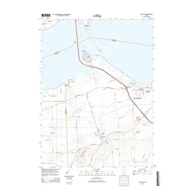
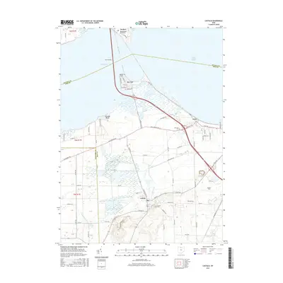
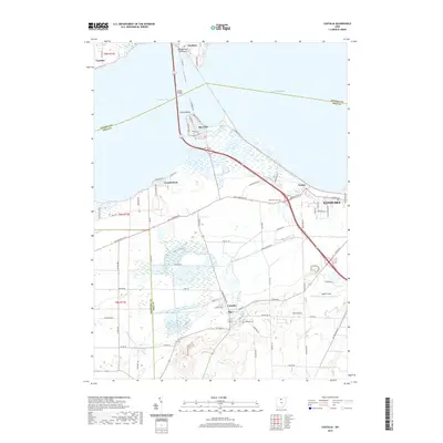
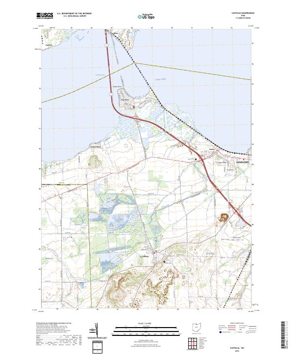 2023 Castalia2023 Print · USGSThe Erie County shoreline near Castalia and Sandusky is shown in this recent survey of the bay. Researchers can trace local lineage through Castalia Cem, explore the residential layout of Bay View, or locate the historic path of Old Railroad Rd.
End of results
Showing maps 1-12 of 12
Top cities near Venice
- Sandusky historical maps
- Norwalk historical maps
- Clyde historical maps
- Port Clinton historical maps
- Danbury historical maps
- Bellevue historical maps
See more
Frequently asked questions
- What are the different types of historical maps available for Venice?
- What is the oldest map of Venice?
- Where can I purchase historical maps of Venice for my home or office?
- Where can I download high-res historical maps of Venice?
- Are there historical topographic maps available for Venice?
- Is there historical aerial imagery available for Venice?
- Where are historical maps of Venice sourced from?